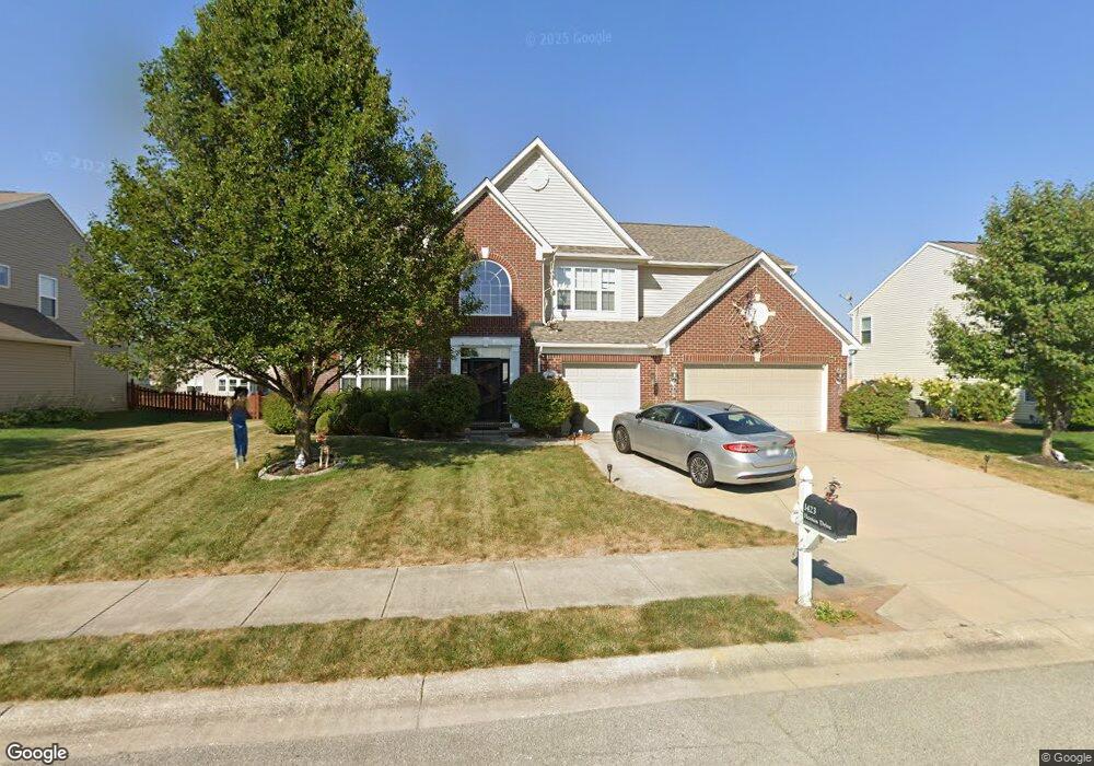
1423 Hession Dr Brownsburg, IN 46112
Estimated Value: $455,000 - $614,000
5
Beds
3
Baths
4,015
Sq Ft
$127/Sq Ft
Est. Value
About This Home
This home is located at 1423 Hession Dr, Brownsburg, IN 46112 and is currently estimated at $509,499, approximately $126 per square foot. 1423 Hession Dr is a home with nearby schools including Brown Elementary School, Brownsburg West Middle School, and Brownsburg High School.
Ownership History
Date
Name
Owned For
Owner Type
Purchase Details
Closed on
Feb 8, 2022
Sold by
Ross Brandon F
Bought by
Ross Brandon F
Current Estimated Value
Purchase Details
Closed on
Aug 6, 2010
Sold by
Rh Of Indiana Lp
Bought by
Ross Brandon F and Ross Kimberly R
Home Financials for this Owner
Home Financials are based on the most recent Mortgage that was taken out on this home.
Original Mortgage
$230,565
Interest Rate
4.75%
Mortgage Type
FHA
Create a Home Valuation Report for This Property
The Home Valuation Report is an in-depth analysis detailing your home's value as well as a comparison with similar homes in the area
Home Values in the Area
Average Home Value in this Area
Purchase History
| Date | Buyer | Sale Price | Title Company |
|---|---|---|---|
| Ross Brandon F | -- | Rosenberg Pllc | |
| Ross Brandon F | -- | None Available |
Source: Public Records
Mortgage History
| Date | Status | Borrower | Loan Amount |
|---|---|---|---|
| Previous Owner | Ross Brandon F | $230,565 |
Source: Public Records
Tax History Compared to Growth
Tax History
| Year | Tax Paid | Tax Assessment Tax Assessment Total Assessment is a certain percentage of the fair market value that is determined by local assessors to be the total taxable value of land and additions on the property. | Land | Improvement |
|---|---|---|---|---|
| 2024 | $4,302 | $430,200 | $60,500 | $369,700 |
| 2023 | $3,950 | $395,000 | $55,000 | $340,000 |
| 2022 | $3,670 | $367,000 | $55,000 | $312,000 |
| 2021 | $3,331 | $333,100 | $55,000 | $278,100 |
| 2020 | $2,931 | $293,100 | $55,000 | $238,100 |
| 2019 | $2,827 | $282,700 | $52,400 | $230,300 |
| 2018 | $2,765 | $276,500 | $52,400 | $224,100 |
| 2017 | $2,622 | $262,200 | $50,400 | $211,800 |
| 2016 | $2,540 | $254,000 | $50,400 | $203,600 |
| 2014 | $2,412 | $241,200 | $47,500 | $193,700 |
Source: Public Records
Map
Nearby Homes
- 805 Wild Lake Cir
- 821 Harvest Lake Dr
- 1303 Gable Lake Dr
- 961 Pine Ridge Way
- 1113 River Ridge Dr
- 6863 Black Cherry Terrace
- 6905 Black Willow Ln
- 6929 Hornbeam Cir
- 1280 Summer Ridge Ln
- 1284 Summer Ridge Ln
- 1327 Blue Ridge Ln
- 7158 Sugar Maple Ln
- 7166 Rhapsody Way
- 7089 Symphony Dr
- 9873 Blue Ridge Way
- 725 Hawthorne Ln
- 543 N Odell St
- 609 Roberta Ct
- 1208 Brittany Cir Unit A
- Wexford Plan at Forest Hill
- 1419 Hession Dr
- 1427 Hession Dr
- 814 Bristle Lake Dr
- 1420 Hession Dr
- 1415 Hession Dr
- 818 Bristle Lake Dr
- 1431 Hession Dr
- 810 Bristle Lake Dr
- 824 Settlers Walk
- 822 Bristle Lake Dr
- 1424 Hession Dr
- 814 Settlers Walk
- 806 Bristle Lake Dr
- 834 Settlers Walk
- 1435 Hession Dr
- 826 Bristle Lake Dr
- 1428 Hession Dr
- 804 Settlers Walk
- 802 Bristle Lake Dr
- 1439 Hession Dr