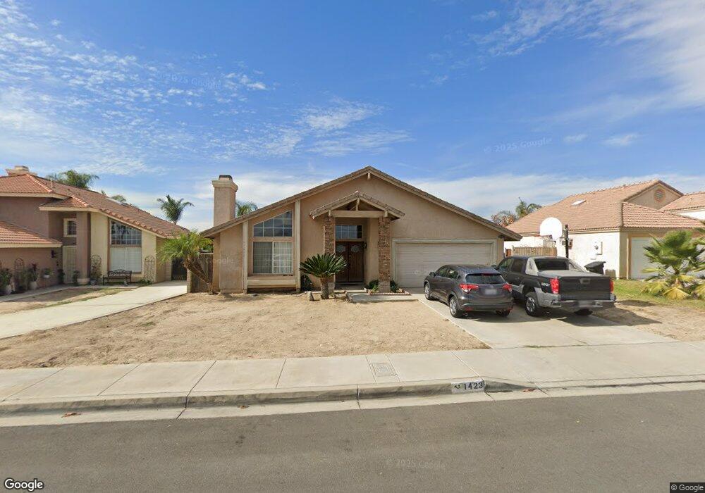
1423 John Juarez Way Colton, CA 92324
Estimated Value: $561,181 - $608,000
4
Beds
2
Baths
1,721
Sq Ft
$336/Sq Ft
Est. Value
About This Home
This home is located at 1423 John Juarez Way, Colton, CA 92324 and is currently estimated at $578,045, approximately $335 per square foot. 1423 John Juarez Way is a home located in San Bernardino County with nearby schools including Ernest Garcia Elementary School, William G. Jehue Middle School, and Rialto High School.
Ownership History
Date
Name
Owned For
Owner Type
Purchase Details
Closed on
Sep 9, 1997
Sold by
Colton Valencia Builders Ii Ltd
Bought by
James Lawrence D and James Rosalyn F
Current Estimated Value
Home Financials for this Owner
Home Financials are based on the most recent Mortgage that was taken out on this home.
Original Mortgage
$144,056
Interest Rate
7.16%
Mortgage Type
FHA
Create a Home Valuation Report for This Property
The Home Valuation Report is an in-depth analysis detailing your home's value as well as a comparison with similar homes in the area
Home Values in the Area
Average Home Value in this Area
Purchase History
| Date | Buyer | Sale Price | Title Company |
|---|---|---|---|
| James Lawrence D | $147,000 | First American Title Ins Co |
Source: Public Records
Mortgage History
| Date | Status | Borrower | Loan Amount |
|---|---|---|---|
| Previous Owner | James Lawrence D | $144,056 | |
| Closed | James Lawrence D | $6,000 |
Source: Public Records
Tax History
| Year | Tax Paid | Tax Assessment Tax Assessment Total Assessment is a certain percentage of the fair market value that is determined by local assessors to be the total taxable value of land and additions on the property. | Land | Improvement |
|---|---|---|---|---|
| 2025 | $3,075 | $234,367 | $58,602 | $175,765 |
| 2024 | $2,966 | $229,772 | $57,453 | $172,319 |
| 2023 | $3,140 | $225,266 | $56,326 | $168,940 |
| 2022 | $2,923 | $220,849 | $55,222 | $165,627 |
| 2021 | $2,897 | $216,518 | $54,139 | $162,379 |
| 2020 | $2,908 | $214,298 | $53,584 | $160,714 |
| 2019 | $2,839 | $210,096 | $52,533 | $157,563 |
| 2018 | $2,737 | $205,977 | $51,503 | $154,474 |
| 2017 | $2,727 | $201,938 | $50,493 | $151,445 |
| 2016 | $3,408 | $197,978 | $49,503 | $148,475 |
| 2015 | $3,412 | $195,004 | $48,759 | $146,245 |
| 2014 | $3,350 | $191,184 | $47,804 | $143,380 |
Source: Public Records
Map
Nearby Homes
- 1065 Stevenson St Unit A & B
- 711 N Meridian Ave
- 895 Orange St
- 1075 Leslie Ct
- 1210 Tejon Ave
- 1150 Express Cir
- 1261 N Rancho Ave
- 881 S Lamarr St
- 3004 Cardamon St
- 941 W F St
- 773 W C St
- 2250 W Mill St Unit 19
- 2250 W Mill St Unit 68
- 2250 W Mill #70 St
- 1734 Kippy Dr
- 1844 Alston Ave
- 805 Valencia Dr
- 1972 De Anza Dr
- 315 S Dallas Ave
- 825 S Acacia Ave
- 1445 John Juarez Way
- 1401 John Juarez Way
- 1200 Porfirio Elias Way
- 1467 John Juarez Way
- 1201 Porfirio Elias Way
- 1207 William Mcgrath St
- 1219 William Mcgrath St
- 1224 Porfirio Elias Way
- 1223 William Mcgrath St
- 1489 William Mcgrath St
- 1225 Porfirio Elias Way
- 1489 John Juarez Way
- 1235 William Mcgrath St
- 1264 Porfirio Elias Way
- 1247 Porfirio Elias Way
- 1247 William Mcgrath St
- 1206 William Mcgrath St
- 1218 William Mcgrath St
- 1268 Porfirio Elias Way
- 1268 Porfirio Elias Way