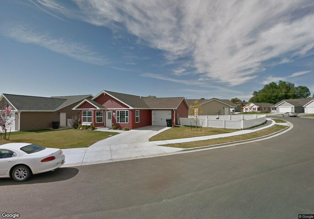
1423 Watson Peak Rd Billings, MT 59105
Billings Heights NeighborhoodEstimated Value: $331,000 - $345,000
3
Beds
2
Baths
1,349
Sq Ft
$250/Sq Ft
Est. Value
About This Home
This home is located at 1423 Watson Peak Rd, Billings, MT 59105 and is currently estimated at $337,063, approximately $249 per square foot. 1423 Watson Peak Rd is a home located in Yellowstone County with nearby schools including Bench School, Medicine Crow Middle School, and Skyview High School.
Ownership History
Date
Name
Owned For
Owner Type
Purchase Details
Closed on
Oct 30, 2017
Sold by
Massey Lyssa R and Niles Lyssa R
Bought by
Niles Lyssa R
Current Estimated Value
Home Financials for this Owner
Home Financials are based on the most recent Mortgage that was taken out on this home.
Original Mortgage
$158,400
Outstanding Balance
$132,661
Interest Rate
3.83%
Mortgage Type
New Conventional
Estimated Equity
$204,402
Purchase Details
Closed on
May 1, 2014
Sold by
Twin Oaks Corp
Bought by
Massey Lyssa R
Home Financials for this Owner
Home Financials are based on the most recent Mortgage that was taken out on this home.
Original Mortgage
$28,935
Interest Rate
4.28%
Mortgage Type
Credit Line Revolving
Create a Home Valuation Report for This Property
The Home Valuation Report is an in-depth analysis detailing your home's value as well as a comparison with similar homes in the area
Home Values in the Area
Average Home Value in this Area
Purchase History
| Date | Buyer | Sale Price | Title Company |
|---|---|---|---|
| Niles Lyssa R | -- | First Montana Title | |
| Massey Lyssa R | -- | None Available |
Source: Public Records
Mortgage History
| Date | Status | Borrower | Loan Amount |
|---|---|---|---|
| Open | Niles Lyssa R | $158,400 | |
| Closed | Massey Lyssa R | $28,935 |
Source: Public Records
Tax History Compared to Growth
Tax History
| Year | Tax Paid | Tax Assessment Tax Assessment Total Assessment is a certain percentage of the fair market value that is determined by local assessors to be the total taxable value of land and additions on the property. | Land | Improvement |
|---|---|---|---|---|
| 2025 | $2,970 | $322,700 | $59,246 | $263,454 |
| 2024 | $2,970 | $289,000 | $56,374 | $232,626 |
| 2023 | $2,959 | $289,000 | $56,374 | $232,626 |
| 2022 | $2,030 | $215,000 | $0 | $0 |
| 2021 | $2,412 | $215,000 | $0 | $0 |
| 2020 | $2,448 | $204,200 | $0 | $0 |
| 2019 | $2,344 | $204,200 | $0 | $0 |
| 2018 | $2,252 | $191,800 | $0 | $0 |
| 2017 | $1,775 | $191,800 | $0 | $0 |
| 2016 | $2,018 | $178,400 | $0 | $0 |
| 2015 | $1,976 | $178,400 | $0 | $0 |
| 2014 | $1,921 | $92,273 | $0 | $0 |
Source: Public Records
Map
Nearby Homes
- 1410 Twin Oaks Dr
- 1422 Watson Peak Rd
- 1443 Twin Oaks Dr
- TBD Saint Andrews Dr
- 211 Stillwater Ln
- 228 Nash Ln
- 130 132 Stillwater Ln
- 218 Reda Ln Unit 4
- 218 Reda Ln Unit 3
- 277 Westchester Square S
- lot 12 Southern Sky Estates
- 69 Nugget Place
- 1725 Broadview Dr
- 225 Windsor Cir N
- 210 Covert Ln
- 1717 Sylvan Ln
- 104 Stillwater Ln
- 1029 Nutter Blvd
- 1322 Babcock Cir
- 424 Wicks Ln
- 1427 Watson Peak Rd
- 1419 Watson Peak Rd
- 1429 Watson Peak Rd
- 1434 Shaw Ln
- 1428 Watson Peak Rd
- 1415 Watson Peak Rd
- 1426 Watson Peak Rd
- 1431 Watson Peak Rd
- 1432 Watson Peak Rd
- 1424 Watson Peak Rd
- 1411 Watson Peak Rd
- 1437 Shaw Ln
- 1437 Shaw Ln
- 1436 Shaw Ln
- 1433 Watson Peak Rd
- 1422 Watson Peak Rd
- 1409 Watson Peak Rd
- 1409 Watson Peak Rd
- 1407 Watson Peak Rd
- 1436 Watson Peak Rd