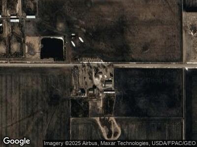
1424 240th St Lytton, IA 50561
Estimated Value: $367,000 - $492,000
3
Beds
2
Baths
3,199
Sq Ft
$135/Sq Ft
Est. Value
About This Home
This home is located at 1424 240th St, Lytton, IA 50561 and is currently estimated at $433,420, approximately $135 per square foot. 1424 240th St is a home located in Calhoun County with nearby schools including South Central Calhoun Elementary School, South Central Calhoun High School, and South Central Calhoun Middle School.
Ownership History
Date
Name
Owned For
Owner Type
Purchase Details
Closed on
Dec 1, 2022
Sold by
Pearson Ricky and Pearson Cheryl
Bought by
Albright Land Holding Llc
Current Estimated Value
Purchase Details
Closed on
Sep 22, 2022
Sold by
Nekonchuk Ruth and Nekonchuk Mark
Bought by
Albright Inc
Purchase Details
Closed on
Apr 12, 2022
Sold by
Albright James I
Bought by
Albright J Alan
Create a Home Valuation Report for This Property
The Home Valuation Report is an in-depth analysis detailing your home's value as well as a comparison with similar homes in the area
Home Values in the Area
Average Home Value in this Area
Purchase History
| Date | Buyer | Sale Price | Title Company |
|---|---|---|---|
| Albright Land Holding Llc | -- | -- | |
| Albright Inc | $681,000 | -- | |
| Albright Land Holdings Llc | $280,000 | -- | |
| Albright J Alan | $1,000 | Schwarzkopf Robert A |
Source: Public Records
Mortgage History
| Date | Status | Borrower | Loan Amount |
|---|---|---|---|
| Previous Owner | Albright James Alan | $114,100 | |
| Previous Owner | Albright J Alan | $375,000 |
Source: Public Records
Tax History Compared to Growth
Tax History
| Year | Tax Paid | Tax Assessment Tax Assessment Total Assessment is a certain percentage of the fair market value that is determined by local assessors to be the total taxable value of land and additions on the property. | Land | Improvement |
|---|---|---|---|---|
| 2024 | $3,438 | $305,130 | $54,510 | $250,620 |
| 2023 | $3,206 | $305,130 | $54,510 | $250,620 |
| 2022 | $2,944 | $230,870 | $40,180 | $190,690 |
| 2021 | $2,894 | $213,280 | $40,180 | $173,100 |
| 2020 | $2,844 | $205,510 | $38,420 | $167,090 |
| 2019 | $2,668 | $206,620 | $55,660 | $150,960 |
| 2018 | $2,686 | $206,620 | $55,660 | $150,960 |
| 2017 | $2,686 | $206,620 | $55,660 | $150,960 |
| 2016 | $2,338 | $198,820 | $0 | $0 |
| 2015 | $2,338 | $189,930 | $0 | $0 |
| 2014 | $2,018 | $189,930 | $0 | $0 |
Source: Public Records
Map
Nearby Homes
- 3409 240th St
- 2685 290th St
- 1035 190th St
- 2017 270th St
- 606 Park Ave
- 3070 230th St
- 212 S State St
- 211 S 5th St
- 223 S 12th St
- 1103 Robbins St
- 224 S 12th St
- 810711200007 Rolf Avenue and Highway 20
- 918 S 16th St
- 7080 Twin Lakes Rd
- 7467 Twin Lakes Rd
- 5851 Sandy Point Rd
- 429 Austin St
- 609 S Cayuga St
- 424 8th St
- 729 8th St
