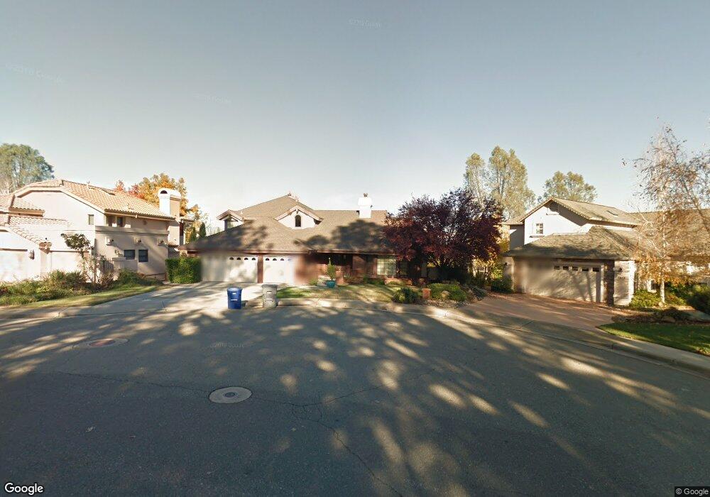
1424 Saint Andrews Dr Redding, CA 96003
Gold Hills NeighborhoodEstimated Value: $589,409 - $657,000
3
Beds
3
Baths
2,837
Sq Ft
$219/Sq Ft
Est. Value
About This Home
This home is located at 1424 Saint Andrews Dr, Redding, CA 96003 and is currently estimated at $620,602, approximately $218 per square foot. 1424 Saint Andrews Dr is a home located in Shasta County with nearby schools including Columbia Elementary School, Mountain View Middle School, and Foothill High School.
Ownership History
Date
Name
Owned For
Owner Type
Purchase Details
Closed on
Apr 7, 2021
Sold by
Crandell Stuart L and Crandell Megan L
Bought by
Crandell Stuart L and Crandell Megan L
Current Estimated Value
Purchase Details
Closed on
Nov 17, 2014
Sold by
Arthur David L and Arthur Elaine M
Bought by
Crandell Stuart L and Crandell Megan L
Home Financials for this Owner
Home Financials are based on the most recent Mortgage that was taken out on this home.
Original Mortgage
$277,777
Outstanding Balance
$89,484
Interest Rate
2.87%
Mortgage Type
FHA
Estimated Equity
$531,118
Purchase Details
Closed on
Nov 15, 1999
Sold by
Schoradt Steven F and Howard Mary
Bought by
Arthur David L and Arthur Elaine M
Home Financials for this Owner
Home Financials are based on the most recent Mortgage that was taken out on this home.
Original Mortgage
$208,000
Interest Rate
7.5%
Create a Home Valuation Report for This Property
The Home Valuation Report is an in-depth analysis detailing your home's value as well as a comparison with similar homes in the area
Home Values in the Area
Average Home Value in this Area
Purchase History
| Date | Buyer | Sale Price | Title Company |
|---|---|---|---|
| Crandell Stuart L | -- | None Available | |
| Crandell Stuart L | $400,000 | Fidelity National Title Co | |
| Arthur David L | $260,000 | First American Title Co |
Source: Public Records
Mortgage History
| Date | Status | Borrower | Loan Amount |
|---|---|---|---|
| Open | Crandell Stuart L | $277,777 | |
| Previous Owner | Arthur David L | $208,000 |
Source: Public Records
Tax History
| Year | Tax Paid | Tax Assessment Tax Assessment Total Assessment is a certain percentage of the fair market value that is determined by local assessors to be the total taxable value of land and additions on the property. | Land | Improvement |
|---|---|---|---|---|
| 2025 | $5,370 | $480,728 | $114,168 | $366,560 |
| 2024 | $5,388 | $471,303 | $111,930 | $359,373 |
| 2023 | $5,388 | $462,063 | $109,736 | $352,327 |
| 2022 | $5,192 | $453,004 | $107,585 | $345,419 |
| 2021 | $5,171 | $444,123 | $105,476 | $338,647 |
| 2020 | $5,134 | $439,570 | $104,395 | $335,175 |
| 2019 | $5,017 | $430,952 | $102,349 | $328,603 |
| 2018 | $5,044 | $422,503 | $100,343 | $322,160 |
| 2017 | $5,101 | $414,220 | $98,376 | $315,844 |
| 2016 | $4,784 | $406,099 | $96,448 | $309,651 |
| 2015 | $4,710 | $400,000 | $95,000 | $305,000 |
| 2014 | $3,829 | $325,977 | $81,492 | $244,485 |
Source: Public Records
Map
Nearby Homes
- 1672 Saint Andrews Dr
- 6260 Carmel Dr
- 1779 Player Ct
- 6040 Constitution Way
- 1546 Gold Hills Dr
- 11632 Ridgewood Rd
- 5890 Shadow Glen Dr
- 5808 Constitution Way
- 19340 Carnegie Ct
- 19324 Hollow Ln
- 2132 Hope Ln
- 948 & 950 Hawley
- 19011 Freda Ln
- 1102 Hope Ln
- 5513 Diamond Ridge Dr
- 1050 Hillsdale Ct
- 19219 Nike Ct
- 6014 Mid Drive Trail
- 662 Ansley Ct
- 19424 Posey Ln
- 1436 St Andrews Dr
- 1436 Saint Andrews Dr
- 1412 Saint Andrews Dr
- 1448 Saint Andrews Dr Unit (Gold Hills)
- 1448 Saint Andrews Dr
- 1400 Saint Andrews Dr
- 1460 Saint Andrews Dr
- 19112 Robledo Way
- 1472 St Andrews Dr
- 1472 Saint Andrews Dr
- 19084 Robledo Way Unit 1
- 19084 Robledo Way
- 6151 Turnberry Ct Unit 1
- 6151 Turnberry Ct
- 19050 Hollow Ln
- 1484 St Andrews Dr
- 1484 Saint Andrews Dr
- 6177 Turnberry Ct
- 19098 Robledo Way
- 6129 Turnberry Ct
Your Personal Tour Guide
Ask me questions while you tour the home.