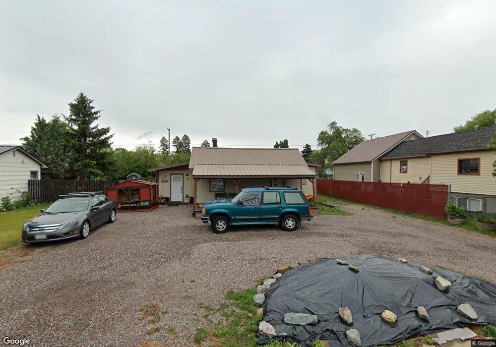
1425 6th Ave W Kalispell, MT 59901
Estimated Value: $386,000 - $416,000
3
Beds
2
Baths
1,448
Sq Ft
$276/Sq Ft
Est. Value
About This Home
This home is located at 1425 6th Ave W, Kalispell, MT 59901 and is currently estimated at $399,787, approximately $276 per square foot. 1425 6th Ave W is a home located in Flathead County with nearby schools including Lillian Peterson School, Kalispell Middle School, and Flathead High School.
Ownership History
Date
Name
Owned For
Owner Type
Purchase Details
Closed on
Oct 23, 2009
Sold by
Butterfield Matthew P and Butterfield Sheila R
Bought by
Porter Bryan E and Porter Heather
Current Estimated Value
Home Financials for this Owner
Home Financials are based on the most recent Mortgage that was taken out on this home.
Original Mortgage
$138,775
Outstanding Balance
$90,479
Interest Rate
5.05%
Mortgage Type
New Conventional
Estimated Equity
$309,308
Create a Home Valuation Report for This Property
The Home Valuation Report is an in-depth analysis detailing your home's value as well as a comparison with similar homes in the area
Purchase History
| Date | Buyer | Sale Price | Title Company |
|---|---|---|---|
| Porter Bryan E | -- | Insured Titles |
Source: Public Records
Mortgage History
| Date | Status | Borrower | Loan Amount |
|---|---|---|---|
| Open | Porter Bryan E | $138,775 |
Source: Public Records
Tax History
| Year | Tax Paid | Tax Assessment Tax Assessment Total Assessment is a certain percentage of the fair market value that is determined by local assessors to be the total taxable value of land and additions on the property. | Land | Improvement |
|---|---|---|---|---|
| 2025 | $1,886 | $392,200 | $0 | $0 |
| 2024 | $2,977 | $382,300 | $0 | $0 |
| 2023 | $3,507 | $382,300 | $0 | $0 |
| 2022 | $2,766 | $215,700 | $0 | $0 |
| 2021 | $2,321 | $215,700 | $0 | $0 |
| 2020 | $2,722 | $201,800 | $0 | $0 |
| 2019 | $2,723 | $201,800 | $0 | $0 |
| 2018 | $2,164 | $144,300 | $0 | $0 |
| 2017 | $2,166 | $144,300 | $0 | $0 |
| 2016 | $1,923 | $139,600 | $0 | $0 |
| 2015 | $1,917 | $139,600 | $0 | $0 |
| 2014 | $1,867 | $82,256 | $0 | $0 |
Source: Public Records
Map
Nearby Homes
- 1418 6th Ave W
- 1313 7th Ave W
- 1517 5th Ave W
- 1308 7th Ave W
- 1483 & 1485 Western Dr
- NHN 11th St W
- 209 12th St W
- 135 Rimrock Ct
- 836 6th Ave W
- 865 9th St W
- 1971 Bluestone Dr
- 819 9th Ave W
- 824 8th St W
- 1906 Bluestone Dr
- 1227 1st Ave E
- 1312 2nd Ave E
- 1996/1998 Greatview
- 446 7th Ave W
- 514 9th Ave W
- 2035 Teal Dr
Your Personal Tour Guide
Ask me questions while you tour the home.