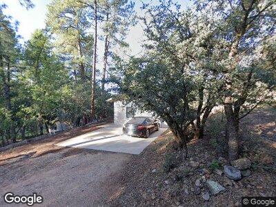
1426 Walden Rd Prescott, AZ 86303
Estimated Value: $421,481 - $612,000
--
Bed
--
Bath
1,908
Sq Ft
$257/Sq Ft
Est. Value
About This Home
This home is located at 1426 Walden Rd, Prescott, AZ 86303 and is currently estimated at $490,120, approximately $256 per square foot. 1426 Walden Rd is a home located in Yavapai County with nearby schools including Lincoln Elementary School, Granite Mountain Middle School, and Prescott Mile High Middle School.
Ownership History
Date
Name
Owned For
Owner Type
Purchase Details
Closed on
Jun 21, 2022
Sold by
Colgrove Michael L
Bought by
Michael Colgrove Living Trust
Current Estimated Value
Purchase Details
Closed on
Apr 12, 1996
Sold by
Matley Connie A
Bought by
Colgrove Michael L
Home Financials for this Owner
Home Financials are based on the most recent Mortgage that was taken out on this home.
Original Mortgage
$151,950
Interest Rate
7.97%
Mortgage Type
VA
Create a Home Valuation Report for This Property
The Home Valuation Report is an in-depth analysis detailing your home's value as well as a comparison with similar homes in the area
Home Values in the Area
Average Home Value in this Area
Purchase History
| Date | Buyer | Sale Price | Title Company |
|---|---|---|---|
| Michael Colgrove Living Trust | -- | Grand Canyon Planning Associat | |
| Colgrove Michael L | $157,000 | Westitle Agency |
Source: Public Records
Mortgage History
| Date | Status | Borrower | Loan Amount |
|---|---|---|---|
| Previous Owner | Colgrove Michael L | $151,950 |
Source: Public Records
Tax History Compared to Growth
Tax History
| Year | Tax Paid | Tax Assessment Tax Assessment Total Assessment is a certain percentage of the fair market value that is determined by local assessors to be the total taxable value of land and additions on the property. | Land | Improvement |
|---|---|---|---|---|
| 2026 | $1,642 | $43,679 | -- | -- |
| 2024 | $1,607 | $41,895 | -- | -- |
| 2023 | $1,607 | $36,677 | $6,210 | $30,467 |
| 2022 | $1,581 | $30,022 | $5,175 | $24,847 |
| 2021 | $1,672 | $30,024 | $4,707 | $25,317 |
| 2020 | $1,676 | $0 | $0 | $0 |
| 2019 | $1,659 | $0 | $0 | $0 |
| 2018 | $1,594 | $0 | $0 | $0 |
| 2017 | $1,529 | $0 | $0 | $0 |
| 2016 | $1,530 | $0 | $0 | $0 |
| 2015 | $1,477 | $0 | $0 | $0 |
| 2014 | $1,480 | $0 | $0 | $0 |
Source: Public Records
Map
Nearby Homes
- 1420 White Spar Rd
- 1434 Haisley Ct Unit 27
- 1432 Haisley Ct Unit 26
- 280 Cinnabar Ct
- 1940 Coyote Rd
- 1900 Coyote Rd
- 1520 White Spar Rd Unit B6
- 1520 White Spar Rd Unit B1
- 1520 White Spar Rd Unit M28
- 1520 White Spar Rd Unit M7
- 1291 Tanglewood Rd
- 760 Cielo Cir
- 1640 Roadrunner S
- 1520 White Spar Rd Fv2 Rd
- 1645 Kaibab Loop
- 1255 Solar Heights Dr Unit 8
- 1330 Solar Heights Dr
- 1400 Escalante Dr Unit 9
- 1400 Escalante Dr
- 255 Golden Eagle Dr
- 1426 Walden Rd
- 1434 Walden Rd
- 1445 White Spar Rd
- 1425 Walden Rd
- 1420 Walden Rd
- 1441 Walden Rd
- 1450 Walden Rd
- 1429 Walden Rd
- 1418 Walden Rd
- 1455 Walden Rd
- 0 Walden Rd
- 1412 Walden Rd
- 1416 Walden Rd
- 1460 Walden Rd
- 465 Banning Creek Rd
- 475 Banning Creek Rd
- 475 Banning Creek Rd Unit 9
- 485 Banning Creek Rd
- 445 Banning Creek Rd
- 219 Banning Creek Rd