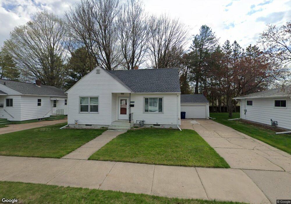
1427 Lenard St Wausau, WI 54401
Northwest NeighborhoodEstimated Value: $172,000 - $201,000
4
Beds
1
Bath
--
Sq Ft
7,841
Sq Ft Lot
About This Home
This home is located at 1427 Lenard St, Wausau, WI 54401 and is currently estimated at $187,718. 1427 Lenard St is a home located in Marathon County with nearby schools including Thomas Jefferson Elementary School, John Muir Middle School, and West High School.
Ownership History
Date
Name
Owned For
Owner Type
Purchase Details
Closed on
Aug 28, 2020
Sold by
Ryon Michael J and Ryon Jean A
Bought by
Goetsch Jamie L
Current Estimated Value
Purchase Details
Closed on
Aug 28, 2007
Sold by
Goetsch Jamie L
Bought by
Ryon Michael J and Ryon Jean A
Purchase Details
Closed on
May 16, 2007
Sold by
Andersen Tara R
Bought by
Goetsch Jamie L
Home Financials for this Owner
Home Financials are based on the most recent Mortgage that was taken out on this home.
Original Mortgage
$83,500
Interest Rate
6.21%
Mortgage Type
Unknown
Create a Home Valuation Report for This Property
The Home Valuation Report is an in-depth analysis detailing your home's value as well as a comparison with similar homes in the area
Home Values in the Area
Average Home Value in this Area
Purchase History
| Date | Buyer | Sale Price | Title Company |
|---|---|---|---|
| Goetsch Jamie L | $56,300 | None Available | |
| Ryon Michael J | -- | Valley Title Inc | |
| Goetsch Jamie L | $83,500 | Valley Title Inc |
Source: Public Records
Mortgage History
| Date | Status | Borrower | Loan Amount |
|---|---|---|---|
| Previous Owner | Goetsch Jamie L | $83,500 |
Source: Public Records
Tax History Compared to Growth
Tax History
| Year | Tax Paid | Tax Assessment Tax Assessment Total Assessment is a certain percentage of the fair market value that is determined by local assessors to be the total taxable value of land and additions on the property. | Land | Improvement |
|---|---|---|---|---|
| 2024 | $2,916 | $165,100 | $23,100 | $142,000 |
| 2023 | $2,175 | $99,500 | $19,800 | $79,700 |
| 2022 | $2,209 | $99,500 | $19,800 | $79,700 |
| 2021 | $2,118 | $99,500 | $19,800 | $79,700 |
| 2020 | $2,248 | $99,500 | $19,800 | $79,700 |
| 2019 | $1,988 | $84,500 | $14,400 | $70,100 |
| 2018 | $2,169 | $84,500 | $14,400 | $70,100 |
| 2017 | $1,959 | $84,500 | $14,400 | $70,100 |
| 2016 | $1,894 | $84,500 | $14,400 | $70,100 |
| 2015 | $2,086 | $84,500 | $14,400 | $70,100 |
| 2014 | $2,184 | $92,700 | $19,800 | $72,900 |
Source: Public Records
Map
Nearby Homes
- 1537 Lenard St
- 1618 E Bos Creek Dr
- 1509 N 3rd Ave
- 102 E Strowbridge St
- 1718 Mortenson Dr
- 108 W Strowbridge St
- 1311 N 4th Ave
- 423 E Campus Dr
- 817 Becher Dr
- 817 N 2nd Ave
- 602 Nina Ave
- 2404 N 6th St
- 2705 N 7th St
- 620 Spring St
- 3109 N 7th St
- 1508 Merrill Ave Unit 311
- 1508 Merrill Ave Unit 213
- 907 N 9th Ave
- 518 Lincoln Ave
- 2410 N 8th St
- 1433 Lenard St
- 1425 Lenard St
- 1439 Lenard St
- 1436 E Cherry St
- 1426 E Cherry St
- 1440 E Cherry St
- 1424 E Cherry St
- 1428 Lenard St
- 1424 Lenard St
- 1432 Lenard St
- 1443 Lenard St
- 1413 Lenard St
- 1420 E Cherry St
- 1444 E Cherry St
- 1418 Lenard St
- 1436 Lenard St
- 1416 E Cherry St
- 1440 Lenard St
- 1447 Lenard St
- 1411 Lenard St