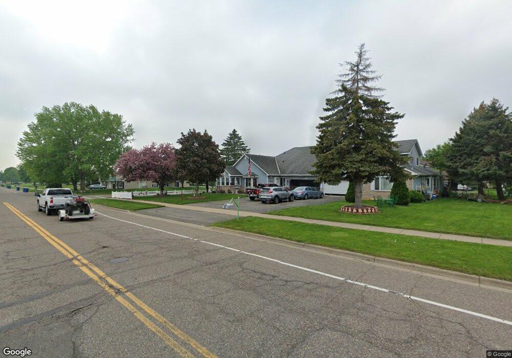
14273 Hayes Rd Saint Paul, MN 55124
Alimagnet NeighborhoodEstimated Value: $298,344 - $330,000
3
Beds
2
Baths
1,284
Sq Ft
$245/Sq Ft
Est. Value
About This Home
This home is located at 14273 Hayes Rd, Saint Paul, MN 55124 and is currently estimated at $315,086, approximately $245 per square foot. 14273 Hayes Rd is a home located in Dakota County with nearby schools including Westview Elementary School, Valley Middle School, and Apple Valley Senior High School.
Ownership History
Date
Name
Owned For
Owner Type
Purchase Details
Closed on
Nov 10, 2011
Sold by
Gould Dennie J and Gould Magdalene C
Bought by
Bartone Duane and Bartone Vicki
Current Estimated Value
Home Financials for this Owner
Home Financials are based on the most recent Mortgage that was taken out on this home.
Original Mortgage
$147,155
Outstanding Balance
$100,636
Interest Rate
4.08%
Mortgage Type
New Conventional
Estimated Equity
$214,450
Create a Home Valuation Report for This Property
The Home Valuation Report is an in-depth analysis detailing your home's value as well as a comparison with similar homes in the area
Home Values in the Area
Average Home Value in this Area
Purchase History
| Date | Buyer | Sale Price | Title Company |
|---|---|---|---|
| Bartone Duane | $154,900 | Home Title |
Source: Public Records
Mortgage History
| Date | Status | Borrower | Loan Amount |
|---|---|---|---|
| Open | Bartone Duane | $147,155 |
Source: Public Records
Tax History Compared to Growth
Tax History
| Year | Tax Paid | Tax Assessment Tax Assessment Total Assessment is a certain percentage of the fair market value that is determined by local assessors to be the total taxable value of land and additions on the property. | Land | Improvement |
|---|---|---|---|---|
| 2024 | $2,962 | $273,200 | $43,600 | $229,600 |
| 2023 | $2,962 | $270,300 | $42,700 | $227,600 |
| 2022 | $2,650 | $266,600 | $42,600 | $224,000 |
| 2021 | $2,338 | $238,900 | $37,000 | $201,900 |
| 2020 | $2,290 | $209,400 | $35,200 | $174,200 |
| 2019 | $2,053 | $200,000 | $33,600 | $166,400 |
| 2018 | $1,986 | $189,800 | $31,100 | $158,700 |
| 2017 | $1,937 | $177,500 | $28,800 | $148,700 |
| 2016 | $1,865 | $166,200 | $27,400 | $138,800 |
| 2015 | $1,646 | $136,615 | $23,040 | $113,575 |
| 2014 | -- | $120,810 | $20,663 | $100,147 |
| 2013 | -- | $104,896 | $17,939 | $86,957 |
Source: Public Records
Map
Nearby Homes
- 14208 Heritage Ln
- 14132 Heywood Path
- 13902 Herald Way
- 13910 Herald Ct
- 13780 Hanover Way
- 441 Walnut Ln
- 8681 144th Street Ct
- 14115 Pennock Ave Unit 301
- 14115 Pennock Ave Unit 303
- 13761 Hollybrook Cir
- 14786 Hallmark Dr
- 14242 Glencove Trail
- 13751 Hollybrook Cir
- 7662 142nd St W
- 13731 Hollybrook Cir
- 13727 Hollybrook Cir
- The Magnolia Plan at Eagle Pointe - Townhomes
- The Sophia Plan at Eagle Pointe - Townhomes
- The Amelia Plan at Eagle Pointe - Townhomes
- The Nolan Plan at Eagle Pointe - Townhomes
- 14271 Hayes Rd
- 8271 143rd St W
- 8273 143rd St W
- 14255 Hayes Rd Unit 4
- 14249 Hayes Rd
- 14253 Hayes Rd Unit 3
- 14251 Hayes Rd Unit 1
- 14266 Hemlock Ct N
- 14250 14250 Hemlock-Court-n
- 14246 Hemlock Ct N Unit 2
- 14248 Hemlock Ct N Unit 3
- 14252 Hemlock Ct N
- 14250 Hemlock Ct N
- 14223 Hayes Rd
- 14353 Hayes Rd
- 8274 142nd St W
- 8298 142nd St W Unit 8298
- 8302 142nd St W Unit 302
- 8300 142nd St W Unit 8300
- 8296 142nd St W Unit 8296