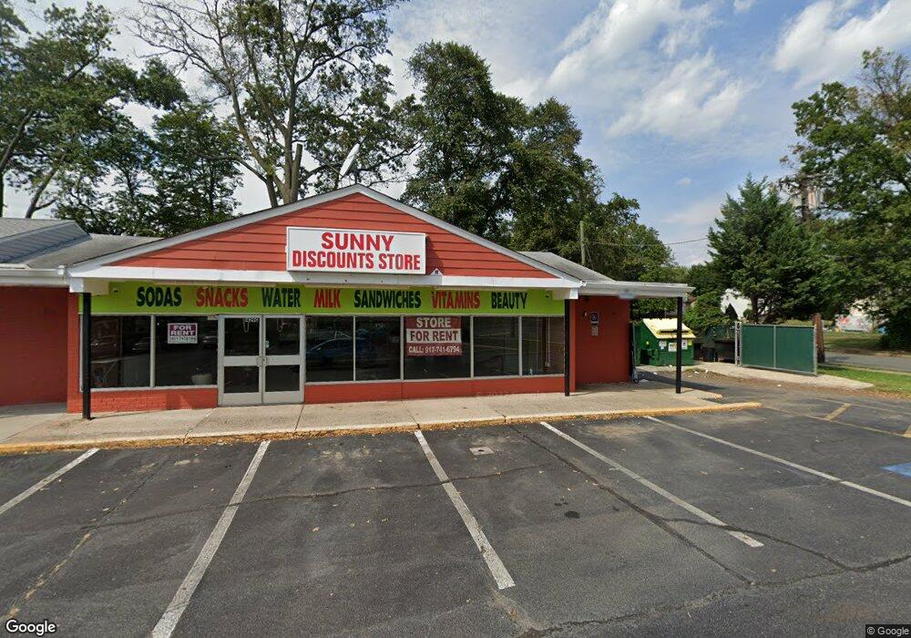
1429 Parkside Ave Unit B Ewing, NJ 08638
Braeburn Heights NeighborhoodEstimated Value: $2,374,062
--
Bed
--
Bath
6,890
Sq Ft
$345/Sq Ft
Est. Value
About This Home
This home is located at 1429 Parkside Ave Unit B, Ewing, NJ 08638 and is currently estimated at $2,374,062, approximately $344 per square foot. 1429 Parkside Ave Unit B is a home located in Mercer County with nearby schools including Ewing High School, Paul Robeson Charter School For The Humanities, and Trenton Stem-To-Civics Charter School.
Ownership History
Date
Name
Owned For
Owner Type
Purchase Details
Closed on
Feb 19, 2014
Sold by
Fev Plaza 1427 Llc
Bought by
Platinum Plaza Llc
Current Estimated Value
Purchase Details
Closed on
Feb 29, 2008
Sold by
Mottram Traci
Bought by
Fev Plaza 1427 Llc
Purchase Details
Closed on
Jun 8, 2007
Sold by
Frost Philip M and Sherman Sheryl Sherman
Bought by
Mottram Traci and Sherman Craig
Home Financials for this Owner
Home Financials are based on the most recent Mortgage that was taken out on this home.
Interest Rate
6.53%
Create a Home Valuation Report for This Property
The Home Valuation Report is an in-depth analysis detailing your home's value as well as a comparison with similar homes in the area
Home Values in the Area
Average Home Value in this Area
Purchase History
| Date | Buyer | Sale Price | Title Company |
|---|---|---|---|
| Platinum Plaza Llc | $1,200,000 | Old Republic Natl Title Ins | |
| Fev Plaza 1427 Llc | $1,175,000 | -- | |
| Mottram Traci | -- | -- |
Source: Public Records
Mortgage History
| Date | Status | Borrower | Loan Amount |
|---|---|---|---|
| Previous Owner | Mottram Traci | -- |
Source: Public Records
Tax History Compared to Growth
Tax History
| Year | Tax Paid | Tax Assessment Tax Assessment Total Assessment is a certain percentage of the fair market value that is determined by local assessors to be the total taxable value of land and additions on the property. | Land | Improvement |
|---|---|---|---|---|
| 2025 | $38,347 | $975,000 | $180,000 | $795,000 |
| 2024 | $36,046 | $975,000 | $180,000 | $795,000 |
| 2023 | $36,046 | $975,000 | $180,000 | $795,000 |
| 2022 | $37,261 | $1,035,900 | $180,000 | $855,900 |
| 2021 | $36,350 | $1,035,900 | $180,000 | $855,900 |
| 2020 | $35,832 | $1,035,900 | $180,000 | $855,900 |
| 2019 | $34,899 | $1,035,900 | $180,000 | $855,900 |
| 2018 | $34,449 | $652,200 | $162,000 | $490,200 |
| 2017 | $35,251 | $652,200 | $162,000 | $490,200 |
| 2016 | $34,775 | $652,200 | $162,000 | $490,200 |
| 2015 | $34,312 | $652,200 | $162,000 | $490,200 |
| 2014 | $34,221 | $652,200 | $162,000 | $490,200 |
Source: Public Records
Map
Nearby Homes
- 66 Pennwood Dr
- 17 Hillman Ave
- 91 Groveland Ave
- 50 Hillman Ave
- 50 Groveland Ave
- 46 Rosedale Ave
- 9 Auburn Ave
- 14 Chesney Ave
- 77 Woodland Ave
- 1635 Ninth St
- 37 Hazelhurst Ave
- 6 New Hillcrest Ave
- 107 Hawthorne Ave
- 1583 Pennington Rd
- 7 Pershing Ave
- 644 Concord Cir
- 1637 Pennington Rd
- 4 Bittersweet Rd
- 1625 6th St
- 2305 Columbia Ave
- 1429 Parkside Ave
- 60 Pennwood Dr
- 1427 Parkside Ave Unit B
- 64 Pennwood Dr
- 58 Pennwood Dr
- 68 Pennwood Dr
- 11 Hillman Ave
- 1 Ives Ave
- 70 Pennwood Dr
- 56 Pennwood Dr
- 65 Pennwood Dr
- 67 Pennwood Dr
- 72 Pennwood Dr
- 54 Pennwood Dr
- 15 Hillman Ave
- 45 Pennwood Dr
- 74 Pennwood Dr
- 5 Ives Ave
- 12 Hillman Ave
- 52 Pennwood Dr