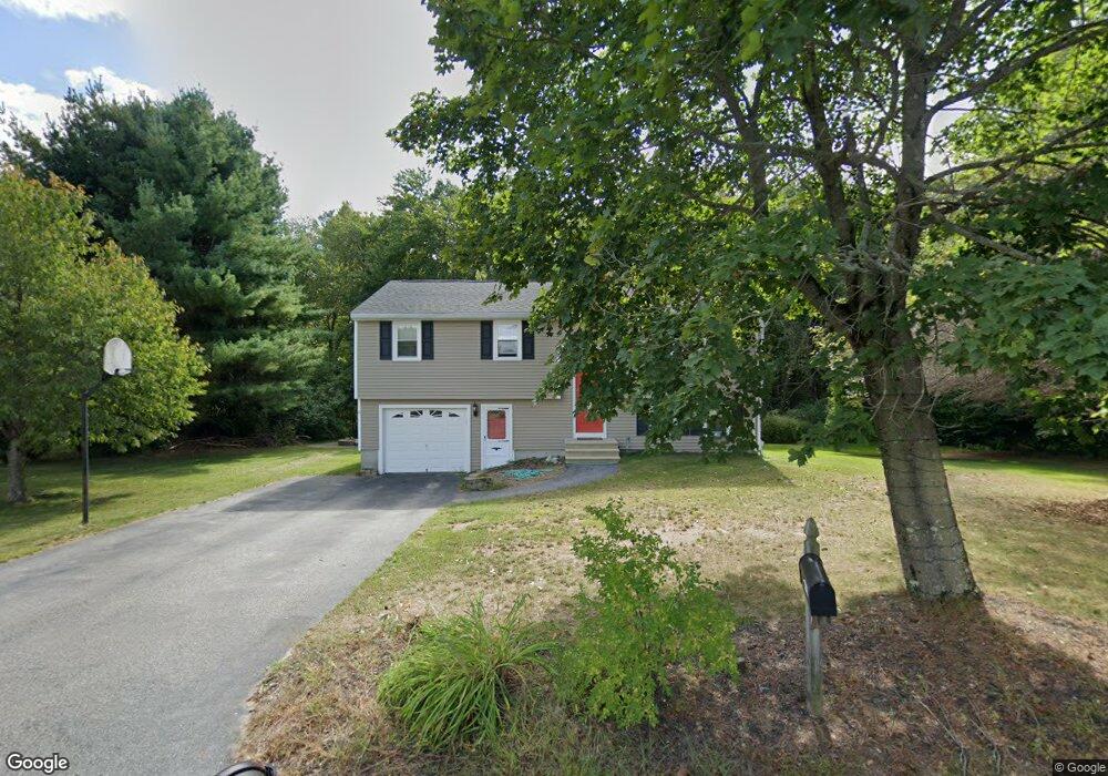
143 Bridle Path Ln Methuen, MA 01844
The West End NeighborhoodEstimated Value: $619,244 - $636,000
3
Beds
2
Baths
1,818
Sq Ft
$346/Sq Ft
Est. Value
About This Home
This home is located at 143 Bridle Path Ln, Methuen, MA 01844 and is currently estimated at $628,811, approximately $345 per square foot. 143 Bridle Path Ln is a home located in Essex County with nearby schools including Marsh Grammar School, Methuen High School, and Fellowship Christian Academy.
Ownership History
Date
Name
Owned For
Owner Type
Purchase Details
Closed on
Jun 7, 2025
Sold by
Rock Peter M and Rock Amanda
Bought by
Rock Peter M
Current Estimated Value
Purchase Details
Closed on
Sep 1, 2017
Sold by
Rock Peter M
Bought by
Rock Peter M and Rock Amanda M
Purchase Details
Closed on
Dec 1, 2008
Sold by
Colon Kathryn
Bought by
Rock Peter M
Home Financials for this Owner
Home Financials are based on the most recent Mortgage that was taken out on this home.
Original Mortgage
$148,500
Interest Rate
6.47%
Mortgage Type
Purchase Money Mortgage
Purchase Details
Closed on
Nov 21, 2008
Sold by
Rock Joyce A Est and Mallen
Bought by
Rock Peter M and Colon Kathryn
Home Financials for this Owner
Home Financials are based on the most recent Mortgage that was taken out on this home.
Original Mortgage
$148,500
Interest Rate
6.47%
Mortgage Type
Purchase Money Mortgage
Create a Home Valuation Report for This Property
The Home Valuation Report is an in-depth analysis detailing your home's value as well as a comparison with similar homes in the area
Home Values in the Area
Average Home Value in this Area
Purchase History
| Date | Buyer | Sale Price | Title Company |
|---|---|---|---|
| Rock Peter M | -- | -- | |
| Rock Peter M | -- | -- | |
| Rock Peter M | -- | -- | |
| Rock Peter M | -- | -- | |
| Rock Peter M | $142,500 | -- | |
| Rock Peter M | $142,500 | -- | |
| Rock Peter M | -- | -- | |
| Rock Peter M | -- | -- |
Source: Public Records
Mortgage History
| Date | Status | Borrower | Loan Amount |
|---|---|---|---|
| Previous Owner | Rock Peter M | $148,500 | |
| Previous Owner | Rock Peter M | $83,000 |
Source: Public Records
Tax History
| Year | Tax Paid | Tax Assessment Tax Assessment Total Assessment is a certain percentage of the fair market value that is determined by local assessors to be the total taxable value of land and additions on the property. | Land | Improvement |
|---|---|---|---|---|
| 2025 | $5,780 | $546,300 | $258,700 | $287,600 |
| 2024 | $5,782 | $532,400 | $235,200 | $297,200 |
| 2023 | $5,470 | $467,500 | $210,000 | $257,500 |
| 2022 | $5,131 | $393,200 | $168,000 | $225,200 |
| 2021 | $4,862 | $368,600 | $159,600 | $209,000 |
| 2020 | $4,824 | $358,900 | $159,600 | $199,300 |
| 2019 | $4,742 | $334,200 | $151,200 | $183,000 |
| 2018 | $4,578 | $320,800 | $151,200 | $169,600 |
| 2017 | $4,407 | $300,800 | $151,200 | $149,600 |
| 2016 | $4,356 | $294,100 | $151,200 | $142,900 |
| 2015 | -- | $290,800 | $151,200 | $139,600 |
Source: Public Records
Map
Nearby Homes
- 58 Campus Rd
- 344B Hampshire Rd
- 146 Hampshire Rd
- 20 Pinehurst Ave
- 37 Lexington Ave
- 219 Pelham St
- 65 Ormonde Rd
- 35 Canobieola Rd
- 42 Perley St
- 534 Forest St
- 25 Newbury Rd
- 6 Newbury Rd
- 6 Newbury Rd Unit M18 B12-16 L7
- 16 Carmel Rd Unit M18 B12-16 L2
- 8 Carmel Rd
- 18 Stone Castle Dr Unit 76
- 50 Haigh Ave
- 37 Brady Ave
- 37 Summer Hill Rd
- 21 Hampshire Rd Unit 111
- 139 Bridle Path Ln
- 147 Bridle Path Ln
- 74 Bridle Path Ln
- 138 Bridle Path Ln
- 135 Bridle Path Ln
- 142 Bridle Path Ln
- 134 Bridle Path Ln
- 70 Bridle Path Ln
- 78 Bridle Path Ln
- 130 Bridle Path Ln
- 59 Bridle Path Ln
- 66 Bridle Path Ln
- 55 Bridle Path Ln
- 55 Bridle Path Ln
- 126 Bridle Path Ln
- 51 Bridle Path Ln
- 63 Bridle Path Ln
- 82 Bridle Path Ln
- 47 Bridle Path Ln
- 122 Bridle Path Ln
Your Personal Tour Guide
Ask me questions while you tour the home.