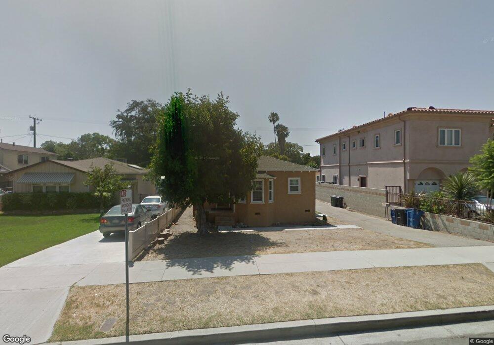
143 N Sparks St Burbank, CA 91506
Chandler Park NeighborhoodEstimated Value: $1,355,000 - $1,492,000
5
Beds
2
Baths
2,234
Sq Ft
$642/Sq Ft
Est. Value
About This Home
This home is located at 143 N Sparks St, Burbank, CA 91506 and is currently estimated at $1,433,470, approximately $641 per square foot. 143 N Sparks St is a home located in Los Angeles County with nearby schools including Walt Disney Elementary School, Dolores Huerta Middle School, and John Burroughs High School.
Ownership History
Date
Name
Owned For
Owner Type
Purchase Details
Closed on
Jun 29, 2000
Sold by
Lona Lojo Kolankanni
Bought by
Nayagam Siluvai
Current Estimated Value
Purchase Details
Closed on
Apr 14, 2000
Sold by
Ghrist Timothy S and Ghrist Antoinette R
Bought by
Nayagam Siluvai
Home Financials for this Owner
Home Financials are based on the most recent Mortgage that was taken out on this home.
Original Mortgage
$256,500
Interest Rate
8.67%
Create a Home Valuation Report for This Property
The Home Valuation Report is an in-depth analysis detailing your home's value as well as a comparison with similar homes in the area
Home Values in the Area
Average Home Value in this Area
Purchase History
| Date | Buyer | Sale Price | Title Company |
|---|---|---|---|
| Nayagam Siluvai | -- | Southland Title | |
| Nayagam Siluvai | $285,000 | Southland Title |
Source: Public Records
Mortgage History
| Date | Status | Borrower | Loan Amount |
|---|---|---|---|
| Previous Owner | Nayagam Siluvai | $256,500 |
Source: Public Records
Tax History Compared to Growth
Tax History
| Year | Tax Paid | Tax Assessment Tax Assessment Total Assessment is a certain percentage of the fair market value that is determined by local assessors to be the total taxable value of land and additions on the property. | Land | Improvement |
|---|---|---|---|---|
| 2025 | $4,950 | $435,043 | $251,629 | $183,414 |
| 2024 | $4,950 | $426,514 | $246,696 | $179,818 |
| 2023 | $4,898 | $418,152 | $241,859 | $176,293 |
| 2022 | $4,681 | $409,954 | $237,117 | $172,837 |
| 2021 | $4,651 | $401,917 | $232,468 | $169,449 |
| 2020 | $4,599 | $397,797 | $230,085 | $167,712 |
| 2019 | $4,467 | $389,998 | $225,574 | $164,424 |
| 2018 | $4,326 | $382,351 | $221,151 | $161,200 |
| 2016 | $4,088 | $367,506 | $212,564 | $154,942 |
| 2015 | $4,006 | $361,987 | $209,372 | $152,615 |
| 2014 | $4,004 | $354,897 | $205,271 | $149,626 |
Source: Public Records
Map
Nearby Homes
- 233 N Sparks St
- 1713 1715 W Victory
- 430 N Parish Place
- 340 N Mariposa St
- 114 S Lamer St
- 500 N Lamer St
- 532 N Reese Place
- 125 N Keystone St
- 924 W Clark Ave
- 311 N Lomita St
- 2016 W Oak St
- 435 S Mariposa St
- 405 N Brighton St
- 325 N Glenwood Place
- 272 W Tujunga Ave
- 525 S Shelton St Unit 102
- 525 S Shelton St Unit 205
- 238 S Lincoln St
- 452 N Lomita St
- 510 N Shelton St Unit 2
- 147 N Sparks St
- 139 N Sparks St
- 151 N Sparks St
- 135 N Sparks St
- 242 N Reese Place
- 246 N Reese Place
- 238 N Reese Place
- 131 N Sparks St
- 201 N Sparks St
- 250 N Reese Place
- 234 N Reese Place
- 142 N Sparks St
- 146 N Sparks St
- 138 N Sparks St
- 127 N Sparks St
- 230 N Reese Place
- 256 N Reese Place
- 134 N Sparks St
- 150 N Sparks St
- 209 N Sparks St