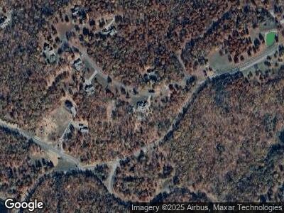
143 Tunnie Point Dunlap, TN 37327
Cagle-Fredonia NeighborhoodEstimated Value: $634,000 - $965,000
--
Bed
3
Baths
3,972
Sq Ft
$198/Sq Ft
Est. Value
About This Home
This home is located at 143 Tunnie Point, Dunlap, TN 37327 and is currently estimated at $786,727, approximately $198 per square foot. 143 Tunnie Point is a home located in Sequatchie County with nearby schools including Griffith Elementary School, Sequatchie County Middle School, and Sequatchie County High School.
Ownership History
Date
Name
Owned For
Owner Type
Purchase Details
Closed on
Aug 19, 2010
Sold by
James L Wagner Land Co
Bought by
Fuller Michael Wilson Co
Current Estimated Value
Purchase Details
Closed on
Sep 19, 2007
Sold by
James L Wagner Land Co Llc
Bought by
Wilson Fuller Michael
Purchase Details
Closed on
Jan 31, 2006
Bought by
James L Wagner Land Comp Llc
Purchase Details
Closed on
Jan 20, 1995
Bought by
Lofty Wn and Lofty Spangler David C James E
Create a Home Valuation Report for This Property
The Home Valuation Report is an in-depth analysis detailing your home's value as well as a comparison with similar homes in the area
Home Values in the Area
Average Home Value in this Area
Purchase History
| Date | Buyer | Sale Price | Title Company |
|---|---|---|---|
| Fuller Michael Wilson Co | $75,000 | -- | |
| Wilson Fuller Michael | $98,500 | -- | |
| James L Wagner Land Comp Llc | $2,265,800 | -- | |
| Lofty Wn | $187,000 | -- |
Source: Public Records
Tax History Compared to Growth
Tax History
| Year | Tax Paid | Tax Assessment Tax Assessment Total Assessment is a certain percentage of the fair market value that is determined by local assessors to be the total taxable value of land and additions on the property. | Land | Improvement |
|---|---|---|---|---|
| 2024 | $3,485 | $189,750 | $16,500 | $173,250 |
| 2023 | $3,485 | $189,750 | $16,500 | $173,250 |
| 2022 | $2,465 | $100,950 | $11,800 | $89,150 |
| 2021 | $2,465 | $100,950 | $11,800 | $89,150 |
| 2020 | $2,465 | $100,950 | $11,800 | $89,150 |
| 2019 | $2,424 | $99,275 | $11,800 | $87,475 |
| 2018 | $2,424 | $99,275 | $11,800 | $87,475 |
| 2017 | $2,424 | $99,275 | $11,800 | $87,475 |
| 2016 | $2,854 | $111,125 | $25,400 | $85,725 |
| 2015 | $2,854 | $111,125 | $25,400 | $85,725 |
| 2014 | $2,924 | $113,850 | $25,400 | $88,450 |
Source: Public Records
Map
Nearby Homes
- 1844 Hobbstown Rd
- 00 Hobbstown Rd
- 217 Daydream Dr
- 217 A Daydream Dr
- 68 Bluff View Dr
- 0 Roaring Creek Rd Unit 1512433
- 0 Roaring Creek Rd Unit 1512039
- 0 Roaring Creek Rd Unit 1512037
- 0 Roaring Creek Rd Unit 1512032
- 0 Roaring Creek Rd Unit 1512031
- 0 Roaring Creek Rd Unit 1503916
- 0 Turkey Trail
- 28 Autumn Way
- 57 Deer Point Dr
- 42 Deer Point Dr
- 0 Mountain Top Trail Unit RTC2796879
- 38 Quail Trail
- 0 Periwinkle Way Unit 1512246
- 46 No Name Dr
- 89 No Name Dr
- 143 Tunnie Point
- 0 Tunnie Point Unit 1328368
- 0 Tunnie Point Unit 1317876
- 0 Tunnie Point Unit 1346433
- 0 Tunnie Point Unit 1278851
- 0 Tunnie Point Unit RTC2747198
- 0 Tunnie Point Unit RTC2728671
- 0 Tunnie Point Unit RTC2728608
- 0 Tunnie Point Unit RTC2718602
- Lot 221 Tunnie Point
- 0 Tunnie Point Unit 229 1328368
- 0 Tunnie Point Unit 234 1317876
- 0 Tunnie Point Unit 1278163
- 0 Tunnie Point Unit 234 1346433
- 0 Tunnie Point Unit Lot 229 1354423
- 0 Tunnie Point Unit 1354423
- 0 Tunnie Point Unit RTC2350919
- 0 Tunnie Point Unit 234 1278851
- 0 Tunnie Point
- 234 Tunnie Point
