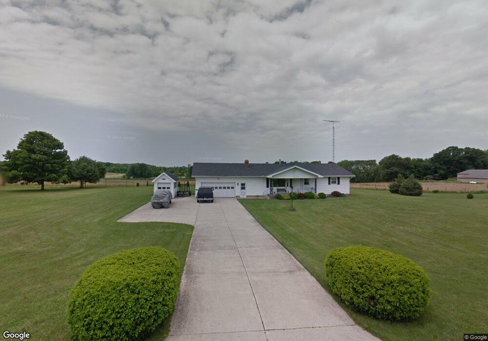
14301 County Road 155 Kenton, OH 43326
Estimated Value: $288,812 - $373,000
3
Beds
2
Baths
1,904
Sq Ft
$173/Sq Ft
Est. Value
About This Home
This home is located at 14301 County Road 155, Kenton, OH 43326 and is currently estimated at $329,703, approximately $173 per square foot. 14301 County Road 155 is a home located in Hardin County with nearby schools including Kenton Elementary School, Kenton Middle School, and Kenton High School.
Ownership History
Date
Name
Owned For
Owner Type
Purchase Details
Closed on
Jul 8, 2016
Sold by
Vanvanschoik Bonnie Van and Foreman Connie
Bought by
Payne Randall R and Payne Lindsay A
Current Estimated Value
Home Financials for this Owner
Home Financials are based on the most recent Mortgage that was taken out on this home.
Original Mortgage
$139,803
Outstanding Balance
$112,213
Interest Rate
3.75%
Mortgage Type
FHA
Estimated Equity
$217,490
Purchase Details
Closed on
Mar 3, 2016
Bought by
Connie Foreman
Create a Home Valuation Report for This Property
The Home Valuation Report is an in-depth analysis detailing your home's value as well as a comparison with similar homes in the area
Home Values in the Area
Average Home Value in this Area
Purchase History
| Date | Buyer | Sale Price | Title Company |
|---|---|---|---|
| Payne Randall R | $119,900 | None Available | |
| Connie Foreman | -- | -- |
Source: Public Records
Mortgage History
| Date | Status | Borrower | Loan Amount |
|---|---|---|---|
| Open | Payne Randall R | $139,803 |
Source: Public Records
Tax History Compared to Growth
Tax History
| Year | Tax Paid | Tax Assessment Tax Assessment Total Assessment is a certain percentage of the fair market value that is determined by local assessors to be the total taxable value of land and additions on the property. | Land | Improvement |
|---|---|---|---|---|
| 2024 | $2,729 | $64,620 | $5,250 | $59,370 |
| 2023 | $2,729 | $64,620 | $5,250 | $59,370 |
| 2022 | $1,963 | $43,270 | $4,410 | $38,860 |
| 2021 | $1,967 | $43,270 | $4,410 | $38,860 |
| 2020 | $1,700 | $43,270 | $4,410 | $38,860 |
| 2019 | $1,385 | $36,660 | $4,200 | $32,460 |
| 2018 | $1,389 | $36,660 | $4,200 | $32,460 |
| 2017 | $1,287 | $36,660 | $4,200 | $32,460 |
| 2016 | $1,205 | $33,890 | $3,680 | $30,210 |
| 2015 | $1,174 | $33,890 | $3,680 | $30,210 |
| 2014 | $899 | $33,890 | $3,680 | $30,210 |
| 2013 | $869 | $31,930 | $3,680 | $28,250 |
Source: Public Records
Map
Nearby Homes
- 13450 State Route 292
- 320 Letson Ave
- 727 S Detroit St
- 414 Robinson Ave
- 639 S Main St
- 726 Tracy St
- 508 Decatur St
- 510 Decatur St
- 920 Cooper St
- 702 W Franklin St Unit 702 1/2
- 121 S High St
- 723 W Lima St Unit 66
- 723 W Lima St Unit 1
- 0 Ohio 309
- 530 E Franklin St
- 115 Scioto St
- 513 E Franklin St
- 219 W Carrol St
- 424 W Carrol St
- 39 Grape St
- 14335 County Road 155
- 14265 Cr
- 14265 County Rd
- 14302 Cr
- 14302 County Road 155
- 14338 County Road 155
- 14260 Cr
- 14260 County Road 155
- 14367 County Road 155
- 14367 County Rd
- 14221 County Road 155
- 14390 County Road 155
- 14458 County Rd
- 14458 County Road 155
- 14126 County Road 155
- 14467 County Road 155
- 14494 County Road 155
- 14125 County Road 155