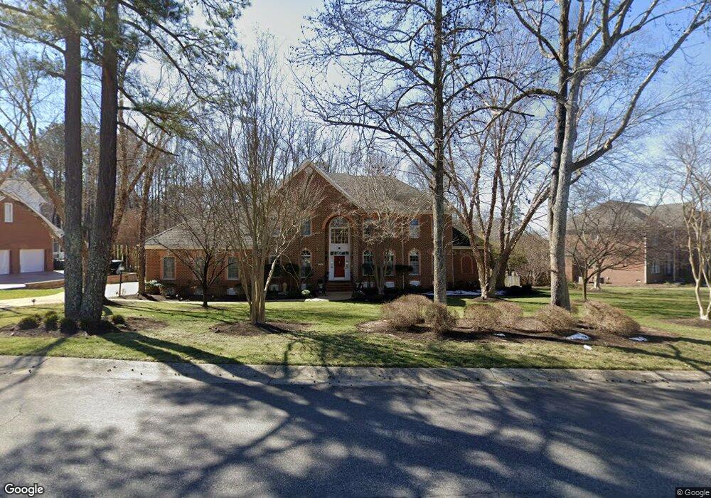
14319 Lander Rd Midlothian, VA 23113
Westchester NeighborhoodEstimated Value: $1,289,000 - $1,448,000
5
Beds
7
Baths
5,186
Sq Ft
$258/Sq Ft
Est. Value
About This Home
This home is located at 14319 Lander Rd, Midlothian, VA 23113 and is currently estimated at $1,335,972, approximately $257 per square foot. 14319 Lander Rd is a home located in Chesterfield County with nearby schools including Bettie Weaver Elementary School, Midlothian Middle School, and Midlothian High School.
Ownership History
Date
Name
Owned For
Owner Type
Purchase Details
Closed on
Jul 7, 2006
Sold by
Corporate Reloc Svcvs
Bought by
Morreale Thomas
Current Estimated Value
Home Financials for this Owner
Home Financials are based on the most recent Mortgage that was taken out on this home.
Original Mortgage
$795,000
Outstanding Balance
$470,668
Interest Rate
6.6%
Mortgage Type
New Conventional
Estimated Equity
$865,304
Purchase Details
Closed on
Jan 29, 2002
Bought by
Conner Stephen M and Conner Madlen R
Home Financials for this Owner
Home Financials are based on the most recent Mortgage that was taken out on this home.
Original Mortgage
$105,000
Interest Rate
7.08%
Mortgage Type
New Conventional
Purchase Details
Closed on
Oct 19, 2001
Sold by
Hodges David C Inc
Bought by
Connor Stephen M and Connor Madlen R
Create a Home Valuation Report for This Property
The Home Valuation Report is an in-depth analysis detailing your home's value as well as a comparison with similar homes in the area
Home Values in the Area
Average Home Value in this Area
Purchase History
| Date | Buyer | Sale Price | Title Company |
|---|---|---|---|
| Morreale Thomas | $885,000 | -- | |
| Conner Stephen M | -- | -- | |
| Connor Stephen M | -- | -- |
Source: Public Records
Mortgage History
| Date | Status | Borrower | Loan Amount |
|---|---|---|---|
| Open | Morreale Thomas | $795,000 | |
| Previous Owner | Connor Stephen M | $105,000 |
Source: Public Records
Tax History
| Year | Tax Paid | Tax Assessment Tax Assessment Total Assessment is a certain percentage of the fair market value that is determined by local assessors to be the total taxable value of land and additions on the property. | Land | Improvement |
|---|---|---|---|---|
| 2025 | $10,082 | $1,130,000 | $170,000 | $960,000 |
| 2024 | $10,082 | $1,144,400 | $149,000 | $995,400 |
| 2023 | $8,871 | $974,800 | $144,000 | $830,800 |
| 2022 | $8,504 | $924,400 | $134,000 | $790,400 |
| 2021 | $7,327 | $764,300 | $132,000 | $632,300 |
| 2020 | $7,767 | $817,600 | $132,000 | $685,600 |
| 2019 | $7,439 | $783,100 | $130,000 | $653,100 |
| 2018 | $7,439 | $783,100 | $130,000 | $653,100 |
| 2017 | $7,518 | $783,100 | $130,000 | $653,100 |
| 2016 | $7,518 | $783,100 | $130,000 | $653,100 |
| 2015 | $7,543 | $783,100 | $130,000 | $653,100 |
| 2014 | $7,139 | $741,000 | $118,000 | $623,000 |
Source: Public Records
Map
Nearby Homes
- 14335 Lander Rd
- 2213 Founders Bridge Rd
- 16151 Founders Bridge Terrace
- 2121 Christendom Dr
- 536 Totten Dr
- 16021 Aspect Way
- 16025 Aspect Way
- 16029 Aspect Way
- 16033 Aspect Way
- 16037 Aspect Way
- 16041 Aspect Way
- 2911 Vistapoint Rd
- 16104 Esteem Way
- 16108 Esteem Way
- 16108 Esteem Way Unit AA 54
- 16112 Esteem Way Unit AA 53
- 16112 Esteem Way
- 16120 Esteem Way
- 16116 Esteem Way
- 533 Creekwillow Dr
- 14307 Lander Rd
- 14318 Lander Rd
- 2907 Aylesford Dr
- 14301 Lander Rd
- 14324 Lander Rd
- 14312 Lander Rd
- 2500 Lander Ct
- 14306 Lander Rd
- 2901 Aylesford Dr
- 14330 Lander Rd
- 14300 Lander Rd
- 14336 Lander Rd
- 2501 Lander Ct
- 14213 Lander Rd
- 2507 Lander Ct
- 14212 Lander Rd
- 14342 Lander Rd
- 2825 Aylesford Dr
- 16013 Pine Vale Place
- 16007 Pine Vale Place
Your Personal Tour Guide
Ask me questions while you tour the home.