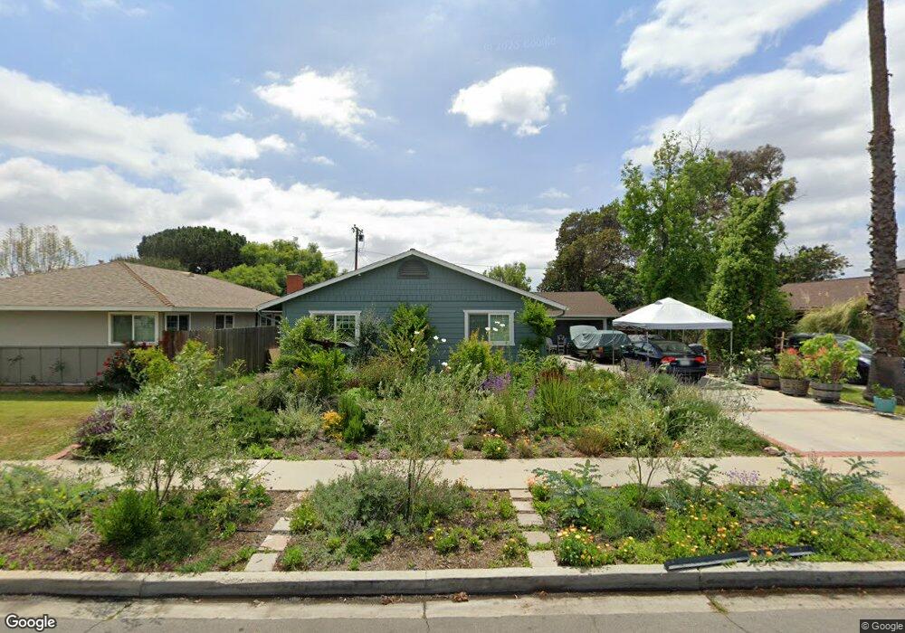
1432 Cameo Dr Tustin, CA 92780
Estimated Value: $1,232,056 - $1,454,000
3
Beds
2
Baths
1,590
Sq Ft
$841/Sq Ft
Est. Value
About This Home
This home is located at 1432 Cameo Dr, Tustin, CA 92780 and is currently estimated at $1,336,764, approximately $840 per square foot. 1432 Cameo Dr is a home located in Orange County with nearby schools including Barbara Benson Elementary School, C. E. Utt Middle School, and Tustin High School.
Ownership History
Date
Name
Owned For
Owner Type
Purchase Details
Closed on
Jul 9, 2008
Sold by
Arms Melissa M
Bought by
Campeau Dwayne Andrew and Leys Campeau Brooke Allison
Current Estimated Value
Home Financials for this Owner
Home Financials are based on the most recent Mortgage that was taken out on this home.
Original Mortgage
$362,500
Outstanding Balance
$233,028
Interest Rate
6%
Mortgage Type
Purchase Money Mortgage
Estimated Equity
$1,103,736
Purchase Details
Closed on
May 17, 2005
Sold by
Mallard Bernard C
Bought by
Mallard Bernard C and Arms Melissa M
Create a Home Valuation Report for This Property
The Home Valuation Report is an in-depth analysis detailing your home's value as well as a comparison with similar homes in the area
Home Values in the Area
Average Home Value in this Area
Purchase History
| Date | Buyer | Sale Price | Title Company |
|---|---|---|---|
| Campeau Dwayne Andrew | $487,500 | Multiple | |
| Mallard Bernard C | -- | -- |
Source: Public Records
Mortgage History
| Date | Status | Borrower | Loan Amount |
|---|---|---|---|
| Open | Campeau Dwayne Andrew | $362,500 |
Source: Public Records
Tax History Compared to Growth
Tax History
| Year | Tax Paid | Tax Assessment Tax Assessment Total Assessment is a certain percentage of the fair market value that is determined by local assessors to be the total taxable value of land and additions on the property. | Land | Improvement |
|---|---|---|---|---|
| 2025 | $7,005 | $627,778 | $509,217 | $118,561 |
| 2024 | $7,005 | $615,469 | $499,232 | $116,237 |
| 2023 | $6,834 | $603,401 | $489,443 | $113,958 |
| 2022 | $6,730 | $591,570 | $479,846 | $111,724 |
| 2021 | $6,594 | $579,971 | $470,437 | $109,534 |
| 2020 | $6,559 | $574,025 | $465,614 | $108,411 |
| 2019 | $6,398 | $562,770 | $456,484 | $106,286 |
| 2018 | $6,293 | $551,736 | $447,534 | $104,202 |
| 2017 | $6,183 | $540,918 | $438,759 | $102,159 |
| 2016 | $6,072 | $530,312 | $430,156 | $100,156 |
| 2015 | $6,127 | $522,347 | $423,695 | $98,652 |
| 2014 | $5,969 | $512,115 | $415,395 | $96,720 |
Source: Public Records
Map
Nearby Homes
- 1642 Tiffany Place
- 12472 Woodlawn Ave
- 1161 Packers Cir Unit 102
- 1111 Packers Cir Unit 25
- 1311 La Colina Dr
- 1431 Mauna Loa Rd
- 12441 La Bella Dr
- 1125 E 1st St
- 12361 Charloma Dr
- 1621 Bryan Ave
- 13511 Epping Way
- 12605 Prescott Ave
- 1301 Landfair Cir
- 2141 Palermo
- 2226 Mccharles Dr
- 12800 Stevens Dr
- 12261 Browning Ave
- 13631 Fielding Dr
- 14732 Candeda Place
- 12138 Skyline Dr
- 1442 Cameo Dr
- 1422 Cameo Dr
- 1431 Kenneth Dr
- 1462 Cameo Dr
- 1412 Cameo Dr
- 1421 Kenneth Dr
- 1451 Kenneth Dr
- 1411 Kenneth Dr
- 1441 Cameo Dr
- 1421 Cameo Dr
- 1461 Kenneth Dr
- 1392 Cameo Dr
- 12851 Red Hill Ave
- 1478 Cambridge
- 1461 Cameo Dr
- 1411 Cameo Dr
- 1401 Kenneth Dr
- 1471 Kenneth Dr
- 12831 Red Hill Ave
- 12822 Keith Place