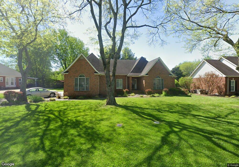
1434 Wall St Murfreesboro, TN 37130
Estimated Value: $494,000 - $639,000
--
Bed
4
Baths
2,982
Sq Ft
$185/Sq Ft
Est. Value
About This Home
This home is located at 1434 Wall St, Murfreesboro, TN 37130 and is currently estimated at $550,572, approximately $184 per square foot. 1434 Wall St is a home located in Rutherford County with nearby schools including Black Fox Elementary School, Whitworth-Buchanan Middle School, and Riverdale High School.
Ownership History
Date
Name
Owned For
Owner Type
Purchase Details
Closed on
Apr 30, 2018
Sold by
Humphrey Pamela H
Bought by
Humphrey Justin
Current Estimated Value
Home Financials for this Owner
Home Financials are based on the most recent Mortgage that was taken out on this home.
Original Mortgage
$205,190
Interest Rate
4.4%
Mortgage Type
New Conventional
Create a Home Valuation Report for This Property
The Home Valuation Report is an in-depth analysis detailing your home's value as well as a comparison with similar homes in the area
Home Values in the Area
Average Home Value in this Area
Purchase History
| Date | Buyer | Sale Price | Title Company |
|---|---|---|---|
| Humphrey Justin | -- | None Available |
Source: Public Records
Mortgage History
| Date | Status | Borrower | Loan Amount |
|---|---|---|---|
| Closed | Humphrey Justin | $205,190 |
Source: Public Records
Tax History Compared to Growth
Tax History
| Year | Tax Paid | Tax Assessment Tax Assessment Total Assessment is a certain percentage of the fair market value that is determined by local assessors to be the total taxable value of land and additions on the property. | Land | Improvement |
|---|---|---|---|---|
| 2025 | $3,211 | $113,525 | $15,000 | $98,525 |
| 2024 | $3,211 | $113,525 | $15,000 | $98,525 |
| 2023 | $2,130 | $113,525 | $15,000 | $98,525 |
| 2022 | $1,835 | $113,525 | $15,000 | $98,525 |
| 2021 | $1,771 | $79,775 | $15,000 | $64,775 |
| 2020 | $1,771 | $79,775 | $15,000 | $64,775 |
| 2019 | $1,771 | $79,775 | $15,000 | $64,775 |
| 2018 | $2,432 | $79,775 | $0 | $0 |
| 2017 | $2,428 | $62,475 | $0 | $0 |
| 2016 | $2,428 | $62,475 | $0 | $0 |
| 2015 | $2,428 | $62,475 | $0 | $0 |
| 2014 | $1,554 | $62,475 | $0 | $0 |
| 2013 | -- | $58,225 | $0 | $0 |
Source: Public Records
Map
Nearby Homes
- 1919 Chartwell Ct
- 1519 Kensington Dr
- 1810 Brighton Dr
- 1811 Cascade Ct
- 1951 Russell Ct
- 1729 Twelve Oaks Ln
- 1518 Cameron Ct
- 2209 Seahunter Ct
- 2010 Bartway Dr Unit 2012
- 2208 Viking Ct
- 1834 Greerson Ct
- 1806 Greerson Dr
- 1819 Greerson Dr
- 2010 S Rutherford Blvd
- 2002 Obrien Dr
- 1919 Bradyville Pike
- 2237 Pathfinder Dr
- 2426 Turtle Trace
- 2260 Viking Ct
- 1602 Cypress Dr
- 1430 Wall St
- 1438 Wall St
- 1532 Canterbury Ln
- 1426 Wall St
- 1439 Wall St
- 1431 Wall St
- 1435 Wall St
- 1442 Wall St
- 1427 Wall St
- 1443 Wall St
- 1422 Wall St
- 1536 Canterbury Ln
- 1536 Canterbury Ln Unit 138
- 1423 Wall St
- 1510 Canterbury Ln
- 1506 Canterbury Ln
- 1418 Wall St
- 1915 Chartwell Ct
- 1531 Canterbury Ln
- 1527 Canterbury Ln