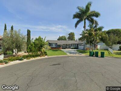
14355 Harp Ct Tustin, CA 92780
Estimated Value: $1,256,000 - $1,340,000
3
Beds
2
Baths
1,610
Sq Ft
$805/Sq Ft
Est. Value
About This Home
This home is located at 14355 Harp Ct, Tustin, CA 92780 and is currently estimated at $1,295,984, approximately $804 per square foot. 14355 Harp Ct is a home located in Orange County with nearby schools including Guin Foss Elementary School, Columbus Tustin Middle School, and Foothill High School.
Ownership History
Date
Name
Owned For
Owner Type
Purchase Details
Closed on
Feb 14, 2008
Sold by
Papp Emerita and Papp Emy
Bought by
Papp Emerita and The Emerita Papp Separate Property Trust
Current Estimated Value
Purchase Details
Closed on
Oct 16, 2002
Sold by
Beloso Emerita T
Bought by
Beloso Emerita T
Purchase Details
Closed on
Nov 5, 1999
Sold by
Papp Gilbert and Beloso Emerita T
Bought by
Papp Gilbert
Purchase Details
Closed on
Jul 1, 1999
Sold by
Anne Truofreh Mary
Bought by
Papp Gilbert and Belose Emerita T
Create a Home Valuation Report for This Property
The Home Valuation Report is an in-depth analysis detailing your home's value as well as a comparison with similar homes in the area
Home Values in the Area
Average Home Value in this Area
Purchase History
| Date | Buyer | Sale Price | Title Company |
|---|---|---|---|
| Papp Emerita | -- | None Available | |
| Beloso Emerita T | -- | -- | |
| Papp Gilbert | -- | -- | |
| Papp Gilbert | $305,000 | First Southwestern Title Ins |
Source: Public Records
Tax History Compared to Growth
Tax History
| Year | Tax Paid | Tax Assessment Tax Assessment Total Assessment is a certain percentage of the fair market value that is determined by local assessors to be the total taxable value of land and additions on the property. | Land | Improvement |
|---|---|---|---|---|
| 2024 | $1,818 | $128,218 | $34,720 | $93,498 |
| 2023 | $1,760 | $125,704 | $34,039 | $91,665 |
| 2022 | $1,719 | $123,240 | $33,372 | $89,868 |
| 2021 | $1,687 | $120,824 | $32,718 | $88,106 |
| 2020 | $1,676 | $119,586 | $32,383 | $87,203 |
| 2019 | $1,643 | $117,242 | $31,748 | $85,494 |
| 2018 | $1,618 | $114,944 | $31,126 | $83,818 |
| 2017 | $1,591 | $112,691 | $30,516 | $82,175 |
| 2016 | $1,565 | $110,482 | $29,918 | $80,564 |
| 2015 | $1,657 | $108,823 | $29,469 | $79,354 |
| 2014 | $1,619 | $106,692 | $28,892 | $77,800 |
Source: Public Records
Map
Nearby Homes
- 18632 Warren Ave
- 12700 Newport Ave Unit 36
- 12720 Newport Ave Unit 17
- 14691 Leon Place
- 18011 Theodora Dr
- 12842 Elizabeth Way
- 13772 Sanderstead Rd
- 1111 Packers Cir Unit 27
- 1292 Tiffany Place
- 17771 Orange Tree Ln
- 1121 Packers Cir Unit 57
- 1361 Kenneth Dr
- 12351 Woodlawn Ave
- 1121 E 1st St
- 1107 E 1st St
- 123 Jessup Way
- 12432 Rebecca Ln
- 1461 Garland Ave
- 1551 Rainbow Dr
- 13602 Prospect Ave
- 14355 Harp Ct
- 14361 Harp Ct
- 14362 Harp Ct
- 14351 Ehlen Way
- 14362 Brenan Way
- 14356 Brenan Way
- 14381 Harp Ct
- 14382 Harp Ct
- 14371 Ehlen Way
- 14382 Brenan Way
- 14346 Ehlen Way
- 14345 Brenan Way
- 18452 Manning Dr
- 18442 Manning Dr
- 14351 Brenan Way
- 14352 Ehlen Way
- 14371 Brenan Way
- 18472 Manning Dr
- 18422 Manning Dr
- 14372 Ehlen Way