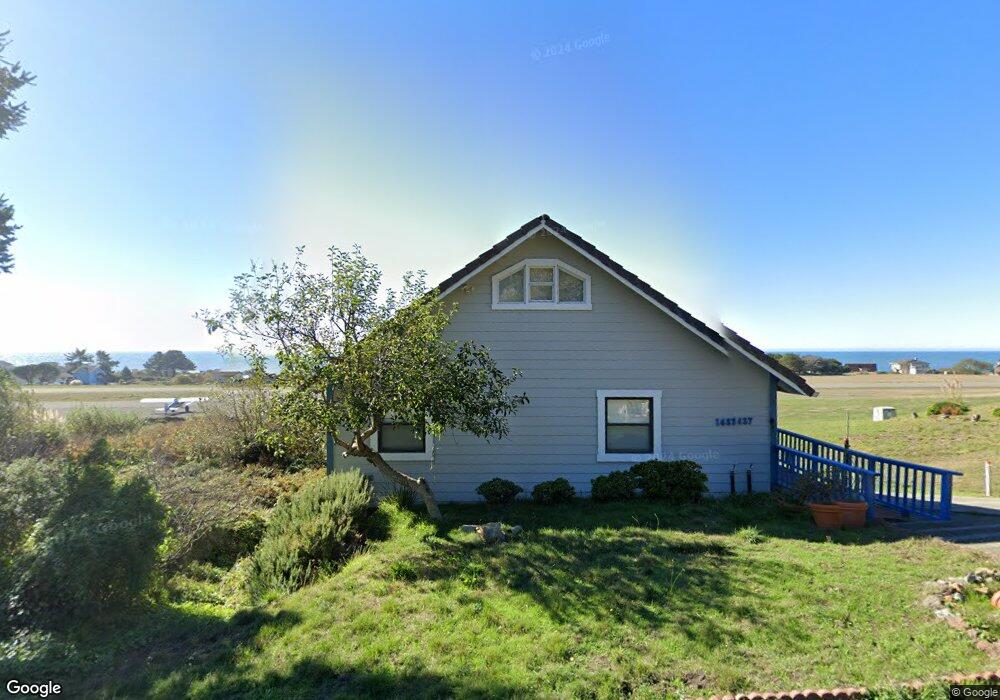
1437 Upper Pacific Dr Whitethorn, CA 95589
Estimated Value: $326,760 - $739,000
Studio
--
Bath
--
Sq Ft
4,574
Sq Ft Lot
About This Home
This home is located at 1437 Upper Pacific Dr, Whitethorn, CA 95589 and is currently estimated at $464,690. 1437 Upper Pacific Dr is a home located in Humboldt County.
Ownership History
Date
Name
Owned For
Owner Type
Purchase Details
Closed on
Nov 6, 2002
Sold by
Galicia Benjamin and Galicia Mercedes C
Bought by
Galicia Benjamin and Galicia Mercedes C
Current Estimated Value
Purchase Details
Closed on
Dec 26, 2001
Sold by
Mobley Stephen
Bought by
Galicia Benjamin and Galicia Mercedes C
Purchase Details
Closed on
Aug 16, 2001
Sold by
Mobley Dianne
Bought by
Mobley Stephen E
Purchase Details
Closed on
Jan 13, 1999
Sold by
Kansfield Donald F
Bought by
Mobley Steve
Create a Home Valuation Report for This Property
The Home Valuation Report is an in-depth analysis detailing your home's value as well as a comparison with similar homes in the area
Home Values in the Area
Average Home Value in this Area
Purchase History
| Date | Buyer | Sale Price | Title Company |
|---|---|---|---|
| Galicia Benjamin | -- | -- | |
| Galicia Benjamin | $160,000 | Fidelity National Title Co | |
| Mobley Stephen E | -- | -- | |
| Mobley Steve | -- | Fidelity National Title Co |
Source: Public Records
Tax History
| Year | Tax Paid | Tax Assessment Tax Assessment Total Assessment is a certain percentage of the fair market value that is determined by local assessors to be the total taxable value of land and additions on the property. | Land | Improvement |
|---|---|---|---|---|
| 2025 | $2,908 | $245,732 | $44,305 | $201,427 |
| 2024 | $2,908 | $240,915 | $43,437 | $197,478 |
| 2023 | $2,919 | $236,192 | $42,586 | $193,606 |
| 2022 | $2,877 | $231,561 | $41,751 | $189,810 |
| 2021 | $2,777 | $227,022 | $40,933 | $186,089 |
| 2020 | $2,793 | $224,695 | $40,514 | $184,181 |
| 2019 | $2,729 | $220,290 | $39,720 | $180,570 |
| 2018 | $2,686 | $215,972 | $38,942 | $177,030 |
| 2017 | $2,540 | $211,738 | $38,179 | $173,559 |
| 2016 | $2,526 | $207,587 | $37,431 | $170,156 |
| 2015 | $2,514 | $204,470 | $36,869 | $167,601 |
| 2014 | $2,432 | $200,465 | $36,147 | $164,318 |
Source: Public Records
Map
Nearby Homes
- 36 Bambi Dr
- 16 Bambi Dr
- 82 Fawn Dr
- 90 Fawn Dr
- 1325&1335 Upper Pacific Dr
- 75 Neptune Rd
- 126 Neptune Dr
- 23 Steelhead Ct
- 794 & 806 Lower Pacific Dr
- 112 Seafoam Rd
- 142 Oceanview Rd
- 22 Spruce Ct
- 454 Lower Pacific Dr
- 806 Lower Pacific Dr
- 58 Lower Pacific Dr
- 680 Lower Pacific Dr
- 60 Spruce Rd
- 8 Buckhorn Ct
- 155 Seafoam Rd
- 1630 Upper Pacific Dr
- 1409 Upper Pacific Dr
- 1432 Upper Pacific Dr
- 1454 Upper Pacific Dr
- 1412 1422 Upper Pacific Dr
- 1464 Upper Pacific Dr
- 1387 Upper Pacific Dr
- 76 Bambi Dr
- 1397 Upper Pacific Dr
- 1484 Upper Pacific Dr
- 46 Bambi Dr
- 1390 Upper Pacific Dr
- 1390 Upper Pacific Dr
- 98 Bambi Dr
- 56 Bambi Dr
- 1390 Upper Pacific Dr
- 108 Bambi Dr
- 1375 Upper Pacific Dr
- 118 Bambi Dr
- 16 Bambi Rd
- 130 Bambi Dr
Your Personal Tour Guide
Ask me questions while you tour the home.