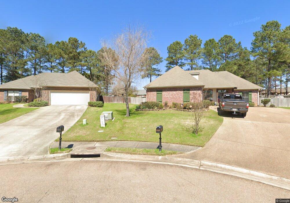
144 Mason Cove Madison, MS 39110
Estimated Value: $285,000 - $314,000
3
Beds
2
Baths
1,606
Sq Ft
$187/Sq Ft
Est. Value
About This Home
This home is located at 144 Mason Cove, Madison, MS 39110 and is currently estimated at $300,806, approximately $187 per square foot. 144 Mason Cove is a home located in Madison County with nearby schools including Mannsdale Elementary School, Germantown Middle School, and Germantown High School.
Ownership History
Date
Name
Owned For
Owner Type
Purchase Details
Closed on
Sep 19, 2025
Sold by
Gibert Rachel Lea
Bought by
Gibert Nicholas Charles
Current Estimated Value
Purchase Details
Closed on
May 30, 2018
Sold by
Flora Land & Timber Llc
Bought by
Elkins William C and Elkins Audra D
Purchase Details
Closed on
Mar 2, 2018
Sold by
Delariva Lucas R
Bought by
Elkins William
Purchase Details
Closed on
Aug 30, 2013
Sold by
Smith John Burns
Bought by
Delariva Lucas R
Home Financials for this Owner
Home Financials are based on the most recent Mortgage that was taken out on this home.
Original Mortgage
$187,908
Interest Rate
4.31%
Mortgage Type
New Conventional
Purchase Details
Closed on
Apr 9, 2007
Sold by
Gideon & Shoemaker Llc
Bought by
Thomas Builders Inc
Create a Home Valuation Report for This Property
The Home Valuation Report is an in-depth analysis detailing your home's value as well as a comparison with similar homes in the area
Home Values in the Area
Average Home Value in this Area
Purchase History
| Date | Buyer | Sale Price | Title Company |
|---|---|---|---|
| Gibert Nicholas Charles | -- | None Listed On Document | |
| Elkins William C | -- | -- | |
| Elkins William | -- | -- | |
| Delariva Lucas R | -- | None Available | |
| Thomas Builders Inc | -- | None Available |
Source: Public Records
Mortgage History
| Date | Status | Borrower | Loan Amount |
|---|---|---|---|
| Previous Owner | Delariva Lucas R | $187,908 |
Source: Public Records
Tax History Compared to Growth
Tax History
| Year | Tax Paid | Tax Assessment Tax Assessment Total Assessment is a certain percentage of the fair market value that is determined by local assessors to be the total taxable value of land and additions on the property. | Land | Improvement |
|---|---|---|---|---|
| 2024 | $1,409 | $16,643 | $0 | $0 |
| 2023 | $1,409 | $16,643 | $0 | $0 |
| 2022 | $1,409 | $16,643 | $0 | $0 |
| 2021 | $1,315 | $16,042 | $0 | $0 |
| 2020 | $1,315 | $16,042 | $0 | $0 |
| 2019 | $1,614 | $16,031 | $0 | $0 |
| 2018 | $1,314 | $16,031 | $0 | $0 |
| 2017 | $1,290 | $15,791 | $0 | $0 |
| 2016 | $1,290 | $15,791 | $0 | $0 |
| 2015 | $1,227 | $15,791 | $0 | $0 |
| 2014 | $1,227 | $15,791 | $0 | $0 |
Source: Public Records
Map
Nearby Homes
- 100 Memory Ln
- 101 Blackberry Patch
- 102 Blackberry Patch
- 125 Memory Ln
- 120 Saddlebrook Cove
- 103 Elm Ct
- 124 Ashbrooke Blvd
- 487 Crossvine Place
- 103 Maple Grove
- 157 Cotton Wood Dr
- 251 Westlake Cir
- 104 Westlake Cir
- 156 Cotton Wood Dr
- 302 Lois Ct
- 304 Lois Ct
- 110 Buckeye Dr
- 308 Lois Ct
- 177 Fieldstone Ln
- 366 Wellstone Place
- 370 Wellstone Place