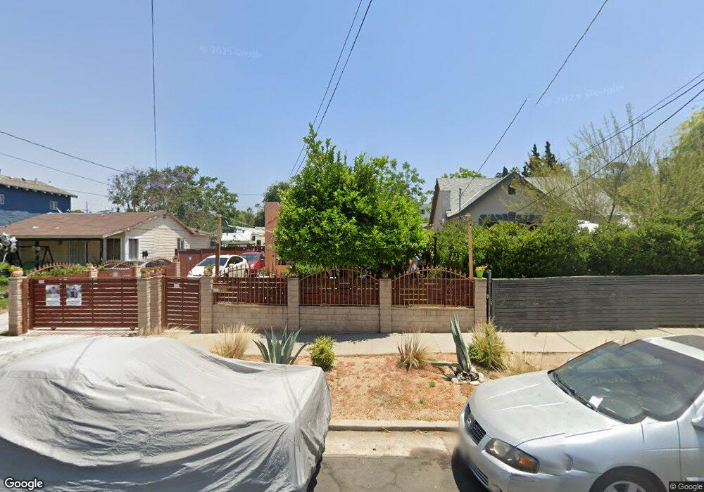
1442 N Avenue 47 Los Angeles, CA 90042
Estimated Value: $964,000 - $1,144,000
2
Beds
2
Baths
1,215
Sq Ft
$877/Sq Ft
Est. Value
About This Home
This home is located at 1442 N Avenue 47, Los Angeles, CA 90042 and is currently estimated at $1,064,984, approximately $876 per square foot. 1442 N Avenue 47 is a home located in Los Angeles County with nearby schools including Toland Way Elementary School, Benjamin Franklin High School, and Eagle Rock High School.
Ownership History
Date
Name
Owned For
Owner Type
Purchase Details
Closed on
Nov 1, 1994
Sold by
Gomez Rafael Cortes and Gomez Rafael Cortez
Bought by
Anguiano Luis Fernando
Current Estimated Value
Purchase Details
Closed on
Dec 1, 1993
Sold by
Glendale Federal Bank Fsb
Bought by
Anguiano Luis Fernando
Home Financials for this Owner
Home Financials are based on the most recent Mortgage that was taken out on this home.
Original Mortgage
$76,000
Interest Rate
7.16%
Mortgage Type
Seller Take Back
Create a Home Valuation Report for This Property
The Home Valuation Report is an in-depth analysis detailing your home's value as well as a comparison with similar homes in the area
Home Values in the Area
Average Home Value in this Area
Purchase History
| Date | Buyer | Sale Price | Title Company |
|---|---|---|---|
| Anguiano Luis Fernando | -- | First American Title | |
| Anguiano Luis Fernando | $80,000 | American Coast Title | |
| Anguiano Luis Fernando | -- | American Coast Title | |
| Gomez Rafael Cortez | -- | American Coast Title |
Source: Public Records
Mortgage History
| Date | Status | Borrower | Loan Amount |
|---|---|---|---|
| Previous Owner | Anguiano Luis Fernando | $76,000 |
Source: Public Records
Tax History Compared to Growth
Tax History
| Year | Tax Paid | Tax Assessment Tax Assessment Total Assessment is a certain percentage of the fair market value that is determined by local assessors to be the total taxable value of land and additions on the property. | Land | Improvement |
|---|---|---|---|---|
| 2025 | $3,018 | $241,272 | $101,961 | $139,311 |
| 2024 | $3,018 | $236,542 | $99,962 | $136,580 |
| 2023 | $2,962 | $231,904 | $98,002 | $133,902 |
| 2022 | $2,827 | $227,358 | $96,081 | $131,277 |
| 2021 | $2,787 | $222,901 | $94,198 | $128,703 |
| 2019 | $2,704 | $216,292 | $91,405 | $124,887 |
| 2018 | $1,857 | $149,352 | $89,613 | $59,739 |
| 2016 | $1,766 | $143,554 | $86,134 | $57,420 |
| 2015 | $1,741 | $141,399 | $84,841 | $56,558 |
| 2014 | $1,756 | $138,631 | $83,180 | $55,451 |
Source: Public Records
Map
Nearby Homes
- 1336 Armadale Ave
- 4666 York Blvd
- 4654 Toland Way
- 4780 Hub St
- 4854 Buchanan St
- 4824 Toland Way
- 4500 Mont Eagle Place
- 4925 Buchanan St
- 1607 Campus Rd
- 1113 N Avenue 50
- 4312 Division St
- 1017 Dexter St
- 1048 Dexter St
- 1037 N Avenue 50
- 4263 Barryknoll Dr
- 925 927 El Paso Dr
- 1087 Oneonta Dr
- 1553 Verbena Way
- 1070 N Oban Dr
- 5055 Hub St
- 1444 N Avenue 47
- 1440 N Avenue 47
- 1436 N Avenue 47
- 4712 Lincoln Ave
- 1452 N Avenue 47
- 4714 Lincoln Ave
- 1456 N Avenue 47
- 1426 N Avenue 47
- 4720 Lincoln Ave
- 1422 N Avenue 47
- 1460 N Avenue 47
- 1460 N Ave 47
- 1361 Armadale Ave
- 1464 N Avenue 47
- 4684 Lincoln Ave
- 1445 N Avenue 47
- 4717 Lincoln Ave
- 1429 1/2 N Avenue 47
- 1365 Armadale Ave
- 1351 Armadale Ave