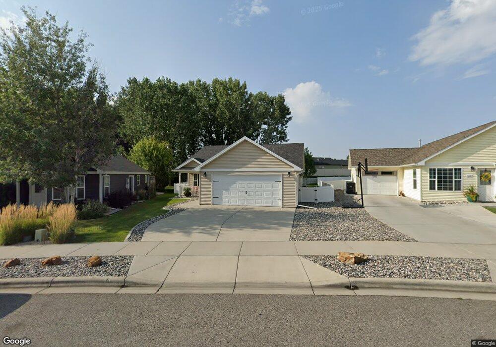
1443 Watson Peak Rd Billings, MT 59105
Billings Heights NeighborhoodEstimated Value: $333,000 - $346,000
3
Beds
2
Baths
1,368
Sq Ft
$249/Sq Ft
Est. Value
About This Home
This home is located at 1443 Watson Peak Rd, Billings, MT 59105 and is currently estimated at $341,267, approximately $249 per square foot. 1443 Watson Peak Rd is a home with nearby schools including Bench School, Medicine Crow Middle School, and Skyview High School.
Ownership History
Date
Name
Owned For
Owner Type
Purchase Details
Closed on
Aug 31, 2016
Sold by
Boston Blake A and Boston Lynda R
Bought by
Ekberg Mary S
Current Estimated Value
Purchase Details
Closed on
Aug 22, 2014
Sold by
Martin Amy L
Bought by
Boston Blake A and Wile Lynda R
Home Financials for this Owner
Home Financials are based on the most recent Mortgage that was taken out on this home.
Original Mortgage
$190,387
Interest Rate
5.5%
Mortgage Type
FHA
Purchase Details
Closed on
Jun 20, 2012
Sold by
Twin Oaks Corporation
Bought by
Martin Amy L
Home Financials for this Owner
Home Financials are based on the most recent Mortgage that was taken out on this home.
Original Mortgage
$177,128
Interest Rate
3.77%
Mortgage Type
VA
Create a Home Valuation Report for This Property
The Home Valuation Report is an in-depth analysis detailing your home's value as well as a comparison with similar homes in the area
Home Values in the Area
Average Home Value in this Area
Purchase History
| Date | Buyer | Sale Price | Title Company |
|---|---|---|---|
| Ekberg Mary S | -- | Stewart Title | |
| Boston Blake A | -- | Amercian Title & Escrow | |
| Martin Amy L | -- | None Available |
Source: Public Records
Mortgage History
| Date | Status | Borrower | Loan Amount |
|---|---|---|---|
| Previous Owner | Boston Blake A | $190,387 | |
| Previous Owner | Martin Amy L | $177,128 |
Source: Public Records
Tax History Compared to Growth
Tax History
| Year | Tax Paid | Tax Assessment Tax Assessment Total Assessment is a certain percentage of the fair market value that is determined by local assessors to be the total taxable value of land and additions on the property. | Land | Improvement |
|---|---|---|---|---|
| 2025 | $2,250 | $335,000 | $57,527 | $277,473 |
| 2024 | $2,250 | $300,200 | $55,008 | $245,192 |
| 2023 | $3,038 | $300,200 | $55,008 | $245,192 |
| 2022 | $2,098 | $222,200 | $0 | $0 |
| 2021 | $2,462 | $222,200 | $0 | $0 |
| 2020 | $2,492 | $210,900 | $0 | $0 |
| 2019 | $2,385 | $210,900 | $0 | $0 |
| 2018 | $2,297 | $198,800 | $0 | $0 |
| 2017 | $2,220 | $198,800 | $0 | $0 |
| 2016 | $2,058 | $184,900 | $0 | $0 |
| 2015 | $2,015 | $184,900 | $0 | $0 |
| 2014 | $1,956 | $95,400 | $0 | $0 |
Source: Public Records
Map
Nearby Homes
- 1410 Twin Oaks Dr
- 1422 Watson Peak Rd
- 1443 Twin Oaks Dr
- TBD Saint Andrews Dr
- 228 Nash Ln
- 218 Reda Ln Unit 4
- 218 Reda Ln Unit 3
- 69 Nugget Place
- 225 Windsor Cir N
- 211 Stillwater Ln
- 277 Westchester Square S
- 130 132 Stillwater Ln
- 1029 Nutter Blvd
- 1725 Broadview Dr
- 210 Covert Ln
- 1717 Sylvan Ln
- 104 Stillwater Ln
- 1322 Babcock Cir
- 424 Wicks Ln
- 385 Prospectors Ln
- 1441 Watson Peak Rd
- 1441 Watson Peak Rd
- 1445 Watson Peak Rd
- 1439 Watson Peak Rd
- 1439 Watson Peak Rd
- 1447 Watson Peak Rd
- 1447 Watson Peak Rd
- 1375 Twin Lakes Dr
- 1450 Watson Peak Rd
- 1437 Watson Peak Rd
- 1437 Watson Peak Rd
- 1449 Watson Peak Rd
- 1446 Watson Peak Rd
- 1367 Twin Lakes Dr
- 1367 Twin Lakes Dr
- 1435 Watson Peak Rd
- 1444 Watson Peak Rd
- 1444 Watson Peak Rd
- 1383 Twin Lakes Dr
- 1451 Watson Peak Rd