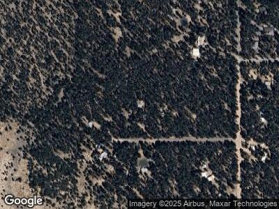
14440 Yoder Ln La Pine, OR 97739
Estimated Value: $404,073 - $666,000
2
Beds
1
Bath
1,140
Sq Ft
$428/Sq Ft
Est. Value
About This Home
This home is located at 14440 Yoder Ln, La Pine, OR 97739 and is currently estimated at $487,518, approximately $427 per square foot. 14440 Yoder Ln is a home located in Deschutes County with nearby schools including La Pine Elementary School, La Pine Middle School, and La Pine Senior High School.
Ownership History
Date
Name
Owned For
Owner Type
Purchase Details
Closed on
Feb 14, 2008
Sold by
Hill James P and Hill Charlene A
Bought by
Bradfeldt Jeff
Current Estimated Value
Home Financials for this Owner
Home Financials are based on the most recent Mortgage that was taken out on this home.
Original Mortgage
$247,920
Interest Rate
5.64%
Mortgage Type
VA
Purchase Details
Closed on
Sep 17, 2004
Sold by
Wendorf Duane D and Wendorf Patricia A
Bought by
Hill James P and Hill Charlene A
Home Financials for this Owner
Home Financials are based on the most recent Mortgage that was taken out on this home.
Original Mortgage
$85,000
Interest Rate
5.94%
Mortgage Type
Seller Take Back
Create a Home Valuation Report for This Property
The Home Valuation Report is an in-depth analysis detailing your home's value as well as a comparison with similar homes in the area
Home Values in the Area
Average Home Value in this Area
Purchase History
| Date | Buyer | Sale Price | Title Company |
|---|---|---|---|
| Bradfeldt Jeff | $240,000 | Western Title & Escrow Co | |
| Hill James P | $85,000 | First Amer Title Ins Co Or |
Source: Public Records
Mortgage History
| Date | Status | Borrower | Loan Amount |
|---|---|---|---|
| Open | Bradfeldt Jeffrey | $414,400 | |
| Closed | Bradfeldt Jeff | $294,098 | |
| Closed | Bradfeldt Jeff | $247,147 | |
| Closed | Bradfeldt Jeff | $251,538 | |
| Closed | Bradfeldt Jeff | $252,996 | |
| Closed | Bradfeldt Jeff | $253,835 | |
| Closed | Bradfeldt Jeff | $247,920 | |
| Previous Owner | Hill James P | $85,000 |
Source: Public Records
Tax History Compared to Growth
Tax History
| Year | Tax Paid | Tax Assessment Tax Assessment Total Assessment is a certain percentage of the fair market value that is determined by local assessors to be the total taxable value of land and additions on the property. | Land | Improvement |
|---|---|---|---|---|
| 2024 | $1,886 | $114,340 | -- | -- |
| 2023 | $1,845 | $111,010 | $0 | $0 |
| 2022 | $1,641 | $104,650 | $0 | $0 |
| 2021 | $1,652 | $101,610 | $0 | $0 |
| 2020 | $1,567 | $101,610 | $0 | $0 |
| 2019 | $1,524 | $98,660 | $0 | $0 |
| 2018 | $1,482 | $95,790 | $0 | $0 |
| 2017 | $1,444 | $93,000 | $0 | $0 |
| 2016 | $1,378 | $90,300 | $0 | $0 |
| 2015 | $1,341 | $87,670 | $0 | $0 |
| 2014 | $1,298 | $85,120 | $0 | $0 |
Source: Public Records
Map
Nearby Homes
- 15011 Yorkie Ln
- 153363 Hackamore Ln
- 2706 Alacano Dr
- 15036 Yorkie Ln
- 153348 Little River Loop
- 153526 Twilla Ct
- 153521 Twilla Ct
- 50732 S Fawn Dr
- 153212 Little River Loop
- 0 Tl 08700 Stirrup Dr Unit 16
- 1870 Iron Wheel Ct
- 0 Stirrup Dr Unit Lot 20 220194510
- 0 Stirrup Dr Unit Lot 17 220194509
- 0 Stirrup Dr Unit Lot 15 220194508
- 0 Stirrup Dr Unit Lot 14 220194507
- 0 Stirrup Dr Unit Lot 13 220194506
- 0 Stirrup Dr Unit Lot 11 220194505
- 0 Stirrup Dr Unit Lot 12 220194504
- 2716 Boone Cir
- 1764 Lariat Ct
