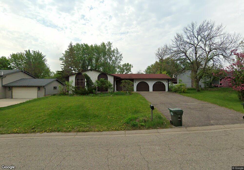
14444 Lower Guthrie Ct Saint Paul, MN 55124
Alimagnet NeighborhoodEstimated Value: $406,131 - $449,000
3
Beds
2
Baths
1,328
Sq Ft
$325/Sq Ft
Est. Value
About This Home
This home is located at 14444 Lower Guthrie Ct, Saint Paul, MN 55124 and is currently estimated at $431,283, approximately $324 per square foot. 14444 Lower Guthrie Ct is a home located in Dakota County with nearby schools including Westview Elementary School, Valley Middle School, and Apple Valley Senior High School.
Ownership History
Date
Name
Owned For
Owner Type
Purchase Details
Closed on
Jul 14, 2016
Sold by
Gottfried Benjamin D and Gottfried Debra M
Bought by
Williams Donald A and Williams Tracy L
Current Estimated Value
Home Financials for this Owner
Home Financials are based on the most recent Mortgage that was taken out on this home.
Original Mortgage
$250,381
Outstanding Balance
$199,362
Interest Rate
3.5%
Mortgage Type
FHA
Estimated Equity
$231,921
Purchase Details
Closed on
May 26, 2009
Sold by
Deutsche Bank National Trust Co
Bought by
Gottfried Benjamin D and Gottfried Debra M
Home Financials for this Owner
Home Financials are based on the most recent Mortgage that was taken out on this home.
Original Mortgage
$138,446
Interest Rate
4.75%
Mortgage Type
FHA
Create a Home Valuation Report for This Property
The Home Valuation Report is an in-depth analysis detailing your home's value as well as a comparison with similar homes in the area
Home Values in the Area
Average Home Value in this Area
Purchase History
| Date | Buyer | Sale Price | Title Company |
|---|---|---|---|
| Williams Donald A | $255,000 | Burnet Title | |
| Gottfried Benjamin D | $141,000 | -- |
Source: Public Records
Mortgage History
| Date | Status | Borrower | Loan Amount |
|---|---|---|---|
| Open | Williams Donald A | $250,381 | |
| Previous Owner | Gottfried Benjamin D | $138,446 |
Source: Public Records
Tax History Compared to Growth
Tax History
| Year | Tax Paid | Tax Assessment Tax Assessment Total Assessment is a certain percentage of the fair market value that is determined by local assessors to be the total taxable value of land and additions on the property. | Land | Improvement |
|---|---|---|---|---|
| 2024 | $3,872 | $346,600 | $91,200 | $255,400 |
| 2023 | $3,872 | $345,700 | $91,400 | $254,300 |
| 2022 | $3,320 | $335,800 | $91,100 | $244,700 |
| 2021 | $3,200 | $292,900 | $79,200 | $213,700 |
| 2020 | $3,212 | $277,500 | $71,300 | $206,200 |
| 2019 | $2,849 | $270,700 | $67,900 | $202,800 |
| 2018 | $2,924 | $253,100 | $64,700 | $188,400 |
| 2017 | $2,787 | $236,400 | $61,600 | $174,800 |
| 2016 | $2,847 | $227,300 | $58,700 | $168,600 |
| 2015 | $2,440 | $212,588 | $53,333 | $159,255 |
| 2014 | -- | $182,613 | $50,157 | $132,456 |
| 2013 | -- | $172,803 | $46,003 | $126,800 |
Source: Public Records
Map
Nearby Homes
- 14242 Glencove Trail
- 7662 142nd St W
- 14115 Pennock Ave Unit 301
- 14115 Pennock Ave Unit 303
- 14786 Hallmark Dr
- 14208 Heritage Ln
- 13780 Hanover Way
- 13902 Herald Way
- 14620 Garrett Ave Unit 310
- 14620 Garrett Ave Unit 104
- 13910 Herald Ct
- 14132 Heywood Path
- 7577 138th St W
- 13868 Glendale Ct
- 441 Walnut Ln
- 834 Fireside Dr
- 13715 Grafton Ct
- 13720 Georgia Dr
- 8681 144th Street Ct
- 14461 Freesia Way
- 14440 Lower Guthrie Ct
- 14448 Lower Guthrie Ct
- 14462 Upper Guthrie Ct
- 14458 Upper Guthrie Ct
- 14436 Lower Guthrie Ct
- 14408 Lower Guthrie Ct
- 14466 Upper Guthrie Ct
- 14404 Lower Guthrie Ct
- 14412 Lower Guthrie Ct
- 14400 Lower Guthrie Ct
- 14461 Guthrie Way
- 14470 Upper Guthrie Ct
- 14416 Lower Guthrie Ct
- 14432 Lower Guthrie Ct
- 14394 Guthrie Ave
- 14459 Guthrie Way
- 14494 Upper Guthrie Ct
- 14498 Upper Guthrie Ct
- 14457 Guthrie Way
- 14490 Upper Guthrie Ct