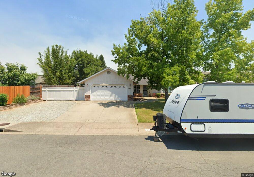
1445 Lavender Way Unit 1 Redding, CA 96003
North Shasta View NeighborhoodEstimated Value: $423,000 - $473,000
4
Beds
2
Baths
1,811
Sq Ft
$243/Sq Ft
Est. Value
About This Home
This home is located at 1445 Lavender Way Unit 1, Redding, CA 96003 and is currently estimated at $439,847, approximately $242 per square foot. 1445 Lavender Way Unit 1 is a home located in Shasta County with nearby schools including Columbia Elementary School, Mountain View Middle School, and Foothill High School.
Ownership History
Date
Name
Owned For
Owner Type
Purchase Details
Closed on
Nov 13, 2020
Sold by
Hart Denise T
Bought by
Hart Denise T and Standley Troy
Current Estimated Value
Home Financials for this Owner
Home Financials are based on the most recent Mortgage that was taken out on this home.
Original Mortgage
$240,000
Outstanding Balance
$213,566
Interest Rate
2.8%
Mortgage Type
New Conventional
Estimated Equity
$226,281
Purchase Details
Closed on
Jan 6, 2017
Sold by
Mcgrath Robert W and Mcgrath Karen
Bought by
Hart Denise T
Home Financials for this Owner
Home Financials are based on the most recent Mortgage that was taken out on this home.
Original Mortgage
$252,000
Interest Rate
4.03%
Mortgage Type
New Conventional
Purchase Details
Closed on
Jan 24, 2006
Sold by
Mcgrath Robert W and Mcgrath Karen
Bought by
Mcgrath Robert W and Mcgrath Karen
Purchase Details
Closed on
Sep 6, 2001
Sold by
Mcgrath Robert William and Mcgrath Karen
Bought by
Mcgrath Robert W and Mcgrath Karen
Home Financials for this Owner
Home Financials are based on the most recent Mortgage that was taken out on this home.
Original Mortgage
$130,000
Interest Rate
7%
Purchase Details
Closed on
Jun 6, 2000
Sold by
Brock Timothy P and Brock Linda F
Bought by
Mcgrath Robert William and Mcgrath Karen
Home Financials for this Owner
Home Financials are based on the most recent Mortgage that was taken out on this home.
Original Mortgage
$117,000
Interest Rate
8.27%
Purchase Details
Closed on
Aug 6, 1997
Sold by
The Lynn Foundation
Bought by
Brock Timothy P and Brock Linda F
Home Financials for this Owner
Home Financials are based on the most recent Mortgage that was taken out on this home.
Original Mortgage
$97,600
Interest Rate
7.57%
Purchase Details
Closed on
Apr 1, 1997
Sold by
Rhodes Daniel M and Rhodes Nancy E
Bought by
The Lynn Foundation
Create a Home Valuation Report for This Property
The Home Valuation Report is an in-depth analysis detailing your home's value as well as a comparison with similar homes in the area
Home Values in the Area
Average Home Value in this Area
Purchase History
| Date | Buyer | Sale Price | Title Company |
|---|---|---|---|
| Hart Denise T | -- | Fidelity National Title | |
| Hart Denise T | $315,000 | Placer Title Company | |
| Mcgrath Robert W | -- | None Available | |
| Mcgrath Robert W | -- | First American Title Co | |
| Mcgrath Robert William | $130,000 | First American Title Co | |
| Brock Timothy P | $122,000 | Chicago Title Co | |
| The Lynn Foundation | $131,129 | Chicago Title |
Source: Public Records
Mortgage History
| Date | Status | Borrower | Loan Amount |
|---|---|---|---|
| Open | Hart Denise T | $240,000 | |
| Previous Owner | Hart Denise T | $252,000 | |
| Previous Owner | Mcgrath Robert W | $130,000 | |
| Previous Owner | Mcgrath Robert William | $117,000 | |
| Previous Owner | Brock Timothy P | $97,600 |
Source: Public Records
Tax History
| Year | Tax Paid | Tax Assessment Tax Assessment Total Assessment is a certain percentage of the fair market value that is determined by local assessors to be the total taxable value of land and additions on the property. | Land | Improvement |
|---|---|---|---|---|
| 2025 | $3,735 | $365,579 | $58,026 | $307,553 |
| 2024 | $3,753 | $358,412 | $56,889 | $301,523 |
| 2023 | $3,753 | $351,385 | $55,774 | $295,611 |
| 2022 | $3,628 | $344,496 | $54,681 | $289,815 |
| 2021 | $3,602 | $337,742 | $53,609 | $284,133 |
| 2020 | $3,574 | $334,280 | $53,060 | $281,220 |
| 2019 | $3,491 | $327,726 | $52,020 | $275,706 |
| 2018 | $3,517 | $321,300 | $51,000 | $270,300 |
| 2017 | $2,134 | $189,323 | $33,102 | $156,221 |
| 2016 | $1,995 | $185,611 | $32,453 | $153,158 |
| 2015 | $1,963 | $182,824 | $31,966 | $150,858 |
| 2014 | $1,913 | $179,243 | $31,340 | $147,903 |
Source: Public Records
Map
Nearby Homes
- 1637 French Lace Ln
- 1090 Gibralter Rd
- 10033 Abernathy Ln
- 965 Willow Brook Ln
- 2385 Shining Star Way
- 10162 Harley Leighton Rd
- 2093 Victor Ave
- 10129 Harley Leighton Rd
- 1939 Cameo Ct
- 1110 Grouse Dr
- 2571 Erin Ln
- 2295 Chelsa Cir
- 550 Armando Ave
- 1285 Lancers Ln
- 2182 Cadjew St
- 547 Casa Buena St
- 1701 E Cypress Ave
- 2912 Squire Ave
- 1088 Burton Dr
- 006 Old Oregon Trail
- 1445 Lavender Way
- 1457 Lavender Way Unit 1
- 1457 Lavender Way
- 2633 Lynaco Ct
- 2603 Lynaco Ct
- 1469 Lavender Way
- 2663 Lynaco Ct
- 1452 Purple Way
- 1464 Purple Way
- 1476 Purple Way
- 1440 Lavender Way
- 1452 Lavender Way
- 2693 Lynaco Ct
- 1481 Lavender Way
- 1426 Lavender Way
- 1464 Lavender Way
- 1412 Lavender Way
- 1488 Purple Way
- 2606 Lynaco Ct
- 2636 Lynaco Ct
Your Personal Tour Guide
Ask me questions while you tour the home.