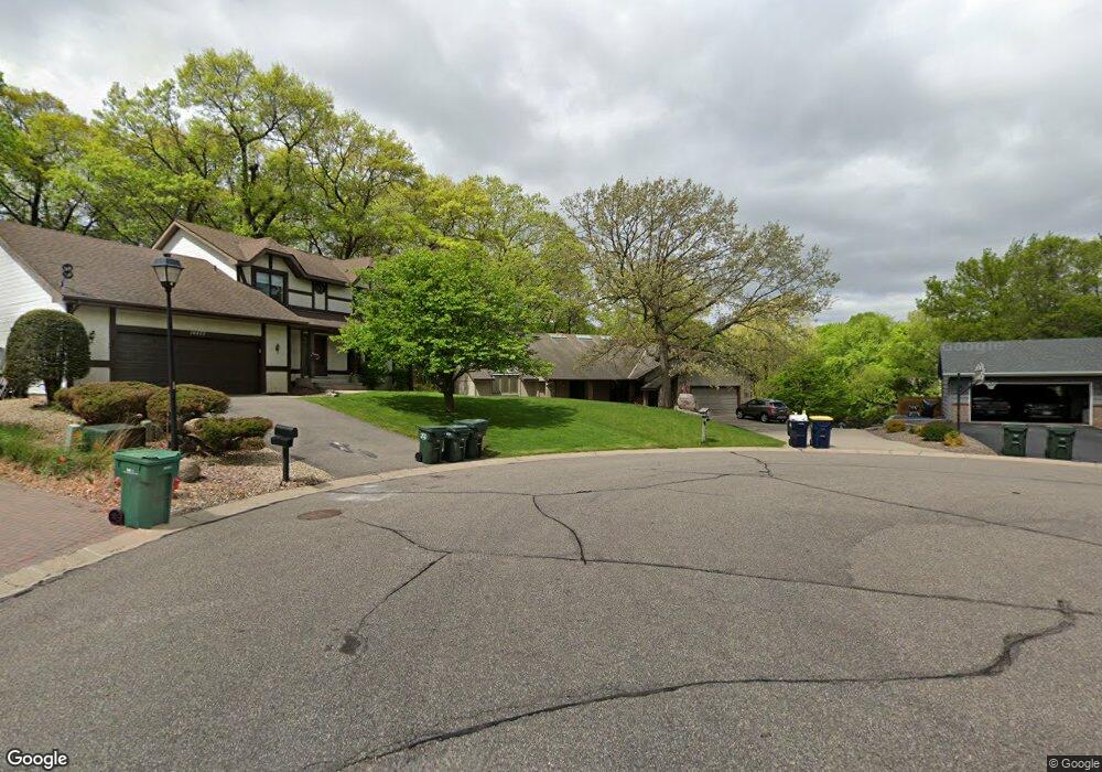
14465 Holland Ct Saint Paul, MN 55124
Alimagnet NeighborhoodEstimated Value: $593,524 - $676,000
3
Beds
3
Baths
3,226
Sq Ft
$197/Sq Ft
Est. Value
About This Home
This home is located at 14465 Holland Ct, Saint Paul, MN 55124 and is currently estimated at $637,131, approximately $197 per square foot. 14465 Holland Ct is a home located in Dakota County with nearby schools including Westview Elementary School, Valley Middle School, and Apple Valley Senior High School.
Ownership History
Date
Name
Owned For
Owner Type
Purchase Details
Closed on
Dec 3, 2010
Sold by
Hoopman James W and Fraser Cynthia S
Bought by
Littlefield Richard R and Littlefield Sherisa D
Current Estimated Value
Purchase Details
Closed on
Jan 25, 2010
Sold by
Hoopman James W and Fraser Cynthia S
Bought by
Littlefield Richard R and Littlefield Sherisa D
Purchase Details
Closed on
Apr 16, 1997
Sold by
Dolan William R and Dolan Karen L
Bought by
Fraser Cynthia and Hoopman James W
Create a Home Valuation Report for This Property
The Home Valuation Report is an in-depth analysis detailing your home's value as well as a comparison with similar homes in the area
Home Values in the Area
Average Home Value in this Area
Purchase History
| Date | Buyer | Sale Price | Title Company |
|---|---|---|---|
| Littlefield Richard R | $349,900 | -- | |
| Littlefield Richard R | $349,900 | -- | |
| Fraser Cynthia | $206,800 | -- |
Source: Public Records
Tax History Compared to Growth
Tax History
| Year | Tax Paid | Tax Assessment Tax Assessment Total Assessment is a certain percentage of the fair market value that is determined by local assessors to be the total taxable value of land and additions on the property. | Land | Improvement |
|---|---|---|---|---|
| 2024 | $6,886 | $597,300 | $151,200 | $446,100 |
| 2023 | $6,886 | $590,500 | $151,500 | $439,000 |
| 2022 | $5,838 | $573,700 | $151,100 | $422,600 |
| 2021 | $5,686 | $501,100 | $131,400 | $369,700 |
| 2020 | $5,712 | $477,500 | $127,800 | $349,700 |
| 2019 | $5,046 | $465,000 | $121,700 | $343,300 |
| 2018 | $4,941 | $428,700 | $115,900 | $312,800 |
| 2017 | $5,026 | $401,800 | $110,400 | $291,400 |
| 2016 | $4,967 | $388,200 | $105,100 | $283,100 |
| 2015 | $4,441 | $376,633 | $95,919 | $280,714 |
| 2014 | -- | $338,374 | $91,516 | $246,858 |
| 2013 | -- | $326,820 | $84,249 | $242,571 |
Source: Public Records
Map
Nearby Homes
- 8681 144th Street Ct
- 441 Walnut Ln
- 14350 Hickory Way
- 14709 White Oak Dr
- 148 Spruce Dr
- 14208 Heritage Ln
- 249 Elm Dr
- 14132 Heywood Path
- 1312 Summit Oaks Dr
- 13761 Hollybrook Cir
- 13751 Hollybrook Cir
- 13910 Herald Ct
- The Magnolia Plan at Eagle Pointe - Townhomes
- The Sophia Plan at Eagle Pointe - Townhomes
- The Amelia Plan at Eagle Pointe - Townhomes
- The Nolan Plan at Eagle Pointe - Townhomes
- 13727 Hollybrook Cir
- 13731 Hollybrook Cir
- 13902 Herald Way
- 14786 Hallmark Dr
- 14453 Holland Ct
- 14477 Holland Ct
- 8720 144th Street Ct
- 8742 144th Street Ct
- 8700 144th Street Ct
- 14429 Holland Ct
- 14488 Holland Ct
- 8660 144th Street Ct
- 8682 144th Street Ct
- 432 Walnut Ln
- 436 Walnut Ln
- 428 Walnut Ln
- 14462 Holland Ct
- 14411 Holland Ct
- 14478 Holland Ct
- 440 Walnut Ln
- 8741 144th Street Ct
- 14446 Holland Ct
- 424 Walnut Ln
- 14428 Holland Ct