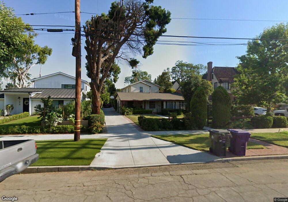
145 E Roosevelt Rd Long Beach, CA 90807
Los Cerritos NeighborhoodEstimated Value: $1,435,000 - $2,156,000
5
Beds
4
Baths
2,566
Sq Ft
$690/Sq Ft
Est. Value
About This Home
This home is located at 145 E Roosevelt Rd, Long Beach, CA 90807 and is currently estimated at $1,770,829, approximately $690 per square foot. 145 E Roosevelt Rd is a home located in Los Angeles County with nearby schools including Los Cerritos Elementary School, Hughes Middle School, and Long Beach Polytechnic High School.
Ownership History
Date
Name
Owned For
Owner Type
Purchase Details
Closed on
Apr 10, 2007
Sold by
Cayot Mark D and Mark D Cayot Irrevocable Trust
Bought by
Cayot Mark D
Current Estimated Value
Purchase Details
Closed on
Oct 19, 2006
Sold by
Cayot Ward S and Ward S Cayot Trust
Bought by
Cayot Mark D and Mark D Cayot Irrevocable Trust
Purchase Details
Closed on
May 17, 1996
Sold by
Cayot Ward S
Bought by
Cayot Ward S and The Ward S Cayo Trust
Create a Home Valuation Report for This Property
The Home Valuation Report is an in-depth analysis detailing your home's value as well as a comparison with similar homes in the area
Home Values in the Area
Average Home Value in this Area
Purchase History
| Date | Buyer | Sale Price | Title Company |
|---|---|---|---|
| Cayot Mark D | -- | None Available | |
| Cayot Mark D | -- | None Available | |
| Cayot Ward S | -- | -- |
Source: Public Records
Tax History
| Year | Tax Paid | Tax Assessment Tax Assessment Total Assessment is a certain percentage of the fair market value that is determined by local assessors to be the total taxable value of land and additions on the property. | Land | Improvement |
|---|---|---|---|---|
| 2025 | $4,813 | $358,972 | $128,403 | $230,569 |
| 2024 | $4,813 | $351,935 | $125,886 | $226,049 |
| 2023 | $4,732 | $345,035 | $123,418 | $221,617 |
| 2022 | $4,454 | $338,271 | $120,999 | $217,272 |
| 2021 | $4,353 | $331,639 | $118,627 | $213,012 |
| 2019 | $4,289 | $321,804 | $115,109 | $206,695 |
| 2018 | $4,111 | $315,495 | $112,852 | $202,643 |
| 2016 | $3,768 | $303,246 | $108,471 | $194,775 |
| 2015 | $3,621 | $298,692 | $106,842 | $191,850 |
| 2014 | $3,602 | $292,842 | $104,750 | $188,092 |
Source: Public Records
Map
Nearby Homes
- 3939 N Virginia Rd Unit 312
- 30 La Linda Dr
- 4202 Locust Ave
- 3813 Cedar Ave
- 3729 N Weston Place
- 3908 Elm Ave
- 421 E Roosevelt Rd
- 3824 Elm Ave
- 4217 Cedar Ave
- 3805 Linden Ave
- 4294 N Country Club Dr
- 3640 Pine Ave
- 3667 Elm Ave
- 3695 Linden Ave Unit 9C
- 3671 Country Club Dr Unit L
- 106 E 36th St
- 627 Avery Place
- 3725 Lime Ave
- 3545 Locust Ave
- 630 W Devon Place
- 165 E Roosevelt Rd
- 135 E Roosevelt Rd Unit A
- 135 E Roosevelt Rd
- 3939 Locust Ave
- 167 E Roosevelt Rd
- 3929 Locust Ave
- 3921 Locust Ave
- 3945 Locust Ave
- 3916 Pine Ave
- 101 E Roosevelt Rd
- 3924 Pine Ave
- 3938 Pine Ave
- 3859 N Weston Place
- 175 E Roosevelt Rd
- 3949 Locust Ave
- 3944 Pine Ave
- 3955 Locust Ave
- 3853 N Weston Place
- 3856 Pine Ave
- 3860 N Weston Place
Your Personal Tour Guide
Ask me questions while you tour the home.