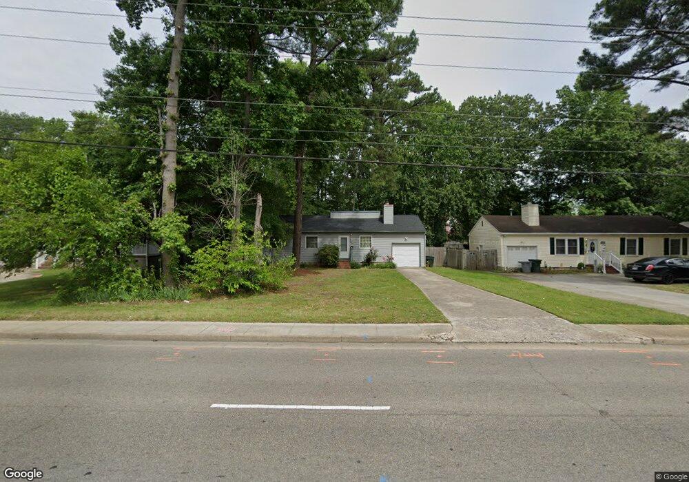
1451 E Pembroke Ave Hampton, VA 23663
Buckroe Beach NeighborhoodEstimated Value: $206,000 - $239,979
3
Beds
1
Bath
1,028
Sq Ft
$217/Sq Ft
Est. Value
About This Home
This home is located at 1451 E Pembroke Ave, Hampton, VA 23663 and is currently estimated at $223,495, approximately $217 per square foot. 1451 E Pembroke Ave is a home located in Hampton City with nearby schools including Capt. John Smith Elementary School, Benjamin Syms Middle School, and Phoebus High School.
Ownership History
Date
Name
Owned For
Owner Type
Purchase Details
Closed on
Jun 14, 2022
Sold by
Rawlings Melinda R
Bought by
Hall Storm Alexandria
Current Estimated Value
Purchase Details
Closed on
Sep 5, 2002
Sold by
Reese Alan D
Bought by
Rumburg Lucas T
Home Financials for this Owner
Home Financials are based on the most recent Mortgage that was taken out on this home.
Original Mortgage
$83,588
Interest Rate
6.39%
Create a Home Valuation Report for This Property
The Home Valuation Report is an in-depth analysis detailing your home's value as well as a comparison with similar homes in the area
Home Values in the Area
Average Home Value in this Area
Purchase History
| Date | Buyer | Sale Price | Title Company |
|---|---|---|---|
| Hall Storm Alexandria | $189,000 | Fidelity National Title | |
| Rumburg Lucas T | $84,900 | -- |
Source: Public Records
Mortgage History
| Date | Status | Borrower | Loan Amount |
|---|---|---|---|
| Previous Owner | Rumburg Lucas T | $83,588 |
Source: Public Records
Tax History
| Year | Tax Paid | Tax Assessment Tax Assessment Total Assessment is a certain percentage of the fair market value that is determined by local assessors to be the total taxable value of land and additions on the property. | Land | Improvement |
|---|---|---|---|---|
| 2025 | $2,524 | $217,500 | $62,700 | $154,800 |
| 2024 | $2,272 | $197,600 | $62,700 | $134,900 |
| 2023 | $2,189 | $188,700 | $57,500 | $131,200 |
| 2022 | $2,066 | $175,100 | $51,800 | $123,300 |
| 2021 | $1,916 | $144,000 | $38,600 | $105,400 |
| 2020 | $1,714 | $138,200 | $38,600 | $99,600 |
| 2019 | $1,714 | $138,200 | $38,600 | $99,600 |
| 2018 | $1,808 | $138,200 | $38,600 | $99,600 |
| 2017 | $1,808 | $0 | $0 | $0 |
| 2016 | $1,808 | $138,200 | $0 | $0 |
| 2015 | $1,808 | $0 | $0 | $0 |
| 2014 | $1,798 | $138,200 | $38,600 | $99,600 |
Source: Public Records
Map
Nearby Homes
- 1504 E Pembroke Ave
- 11 Sherazi Dr
- 208 Woodland Rd
- 64 Ireland St
- 1530 Morgan Dr
- 1314 Saxton Dr
- 304 Woodland Rd
- 816 Old Point Ave
- 168 Woodland Rd
- 15 Gayle St
- 1841 Kensington Dr
- 54 George Ct
- 29 Scotland Rd
- 438 Shelton Rd
- 1814 Somerville Dr
- 6 Langille Ct
- 401 Institute Dr
- 20 Scotland Rd
- 55 Calhoun St
- 51 Calhoun St
- 1453 E Pembroke Ave
- 1443 E Pembroke Ave
- 1445 E Pembroke Ave
- 1455 E Pembroke Ave
- 1424 Antoinette Cir
- 1422 Antoinette Cir
- 1439 E Pembroke Ave
- 1426 Antoinette Cir
- 1457 E Pembroke Ave
- 1420 Antoinette Cir
- 3 Brigham St
- 1427 Antoinette Cir
- 1459 E Pembroke Ave
- 1446 E Pembroke Ave
- 1448 E Pembroke Ave
- 1418 Antoinette Cir
- 1423 Antoinette Cir
- 1444 E Pembroke Ave
- 1435 E Pembroke Ave
- 1421 Antoinette Cir
Your Personal Tour Guide
Ask me questions while you tour the home.