Estimated Value: $1,204,118 - $1,351,000
4
Beds
2
Baths
1,655
Sq Ft
$779/Sq Ft
Est. Value
About This Home
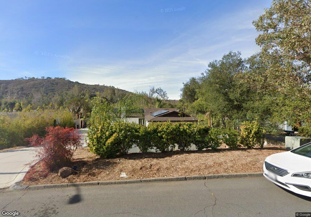
This home is located at 14518 Range Park Rd, Poway, CA 92064 and is currently estimated at $1,290,030, approximately $779 per square foot. 14518 Range Park Rd is a home located in San Diego County with nearby schools including Tierra Bonita Elementary, Twin Peaks Middle, and Poway High.
Ownership History
Date
Name
Owned For
Owner Type
Purchase Details
Closed on
Jul 24, 2018
Sold by
Johnson Carolyn Lee and Johnson Mark Ellis
Bought by
Bourne Phillip and Bourne Melanie
Current Estimated Value
Home Financials for this Owner
Home Financials are based on the most recent Mortgage that was taken out on this home.
Original Mortgage
$433,400
Interest Rate
4.6%
Mortgage Type
New Conventional
Purchase Details
Closed on
Mar 10, 2018
Sold by
Johnson Carolyn Lee and Johnson Mark Ellis
Bought by
Johnson Carolyn Lee and Johnson Mark Ellis
Home Financials for this Owner
Home Financials are based on the most recent Mortgage that was taken out on this home.
Original Mortgage
$505,996
Interest Rate
4.22%
Mortgage Type
New Conventional
Purchase Details
Closed on
Nov 11, 2009
Sold by
Johnson Mark E and Johnson Carolyn L
Bought by
Johnson Carolyn Lee and Johnson Mark Ellis
Create a Home Valuation Report for This Property
The Home Valuation Report is an in-depth analysis detailing your home's value as well as a comparison with similar homes in the area
Home Values in the Area
Average Home Value in this Area
Purchase History
| Date | Buyer | Sale Price | Title Company |
|---|---|---|---|
| Bourne Phillip | $770,000 | Equity Title San Diego | |
| Johnson Carolyn Lee | -- | None Available | |
| Johnson Carolyn Lee | -- | None Available | |
| Johnson Carolyn Lee | -- | None Available |
Source: Public Records
Mortgage History
| Date | Status | Borrower | Loan Amount |
|---|---|---|---|
| Previous Owner | Bourne Phillip | $433,400 | |
| Previous Owner | Johnson Carolyn Lee | $505,996 |
Source: Public Records
Tax History
| Year | Tax Paid | Tax Assessment Tax Assessment Total Assessment is a certain percentage of the fair market value that is determined by local assessors to be the total taxable value of land and additions on the property. | Land | Improvement |
|---|---|---|---|---|
| 2025 | $9,538 | $858,944 | $195,211 | $663,733 |
| 2024 | $9,538 | $842,103 | $191,384 | $650,719 |
| 2023 | $9,337 | $825,592 | $187,632 | $637,960 |
| 2022 | $9,182 | $809,404 | $183,953 | $625,451 |
| 2021 | $9,064 | $793,535 | $180,347 | $613,188 |
| 2020 | $8,942 | $785,399 | $178,498 | $606,901 |
| 2019 | $8,711 | $770,000 | $174,999 | $595,001 |
| 2018 | $1,491 | $132,590 | $30,134 | $102,456 |
| 2017 | $170 | $129,992 | $29,544 | $100,448 |
| 2016 | $1,421 | $127,444 | $28,965 | $98,479 |
| 2015 | $1,400 | $125,530 | $28,530 | $97,000 |
| 2014 | $1,368 | $123,072 | $27,972 | $95,100 |
Source: Public Records
Map
Nearby Homes
- 0 Indian Springs Rd Unit NDP2602071
- 0 Pebble Canyon Dr Unit PTP2505722
- 44 Carlson Ct
- 45 Carlson Ct
- 43 Carlson Ct
- 14840 Crocker Rd
- 13972 Poway Valley Rd
- 14298 Ipava Dr
- 14105 Durhullen Dr
- 14550 Dehia St
- 14922 Derringer Rd
- 14284 Hacienda Ln
- 14963 Huntington Gate Dr Unit 2
- 14546 Highcrest Ct
- 13765 Holly Oak Way
- 13780 Holly Oak Way
- 13435 Frey Ct
- 13428 Standish Dr
- 13419 Sebago Ave
- 14610 Fairburn St
- 14510 Range Park Rd
- 14526 Range Park Rd
- 14502 Range Park Rd
- 14534 Range Park Rd
- 14525 Range Park Rd
- 14502 Indian Springs Rd
- 14454 Range Park Rd
- 14542 Range Park Rd
- 14445 Ortez Place
- 14543 Range Park Place
- 0 Indian Springs Rd Unit 140017607
- 0 Indian Springs Rd
- 23 Indian Springs Rd
- 24 Indian Springs Rd
- lot 24 Indian Springs Rd
- lot 23 Indian Springs Rd
- 14449 Ortez Place
- 14418 Settlers Place
- 14550 Range Park Rd
- 14448 Range Park Rd
Your Personal Tour Guide
Ask me questions while you tour the home.