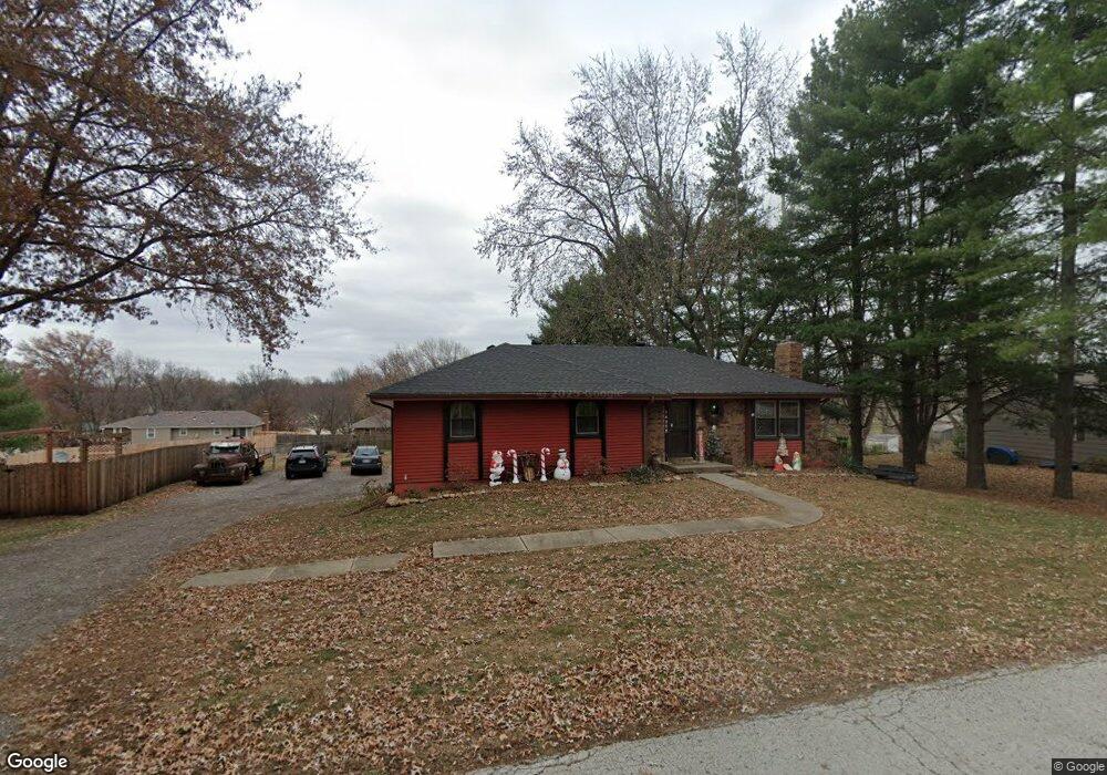
14525 Red Rock Dr Platte City, MO 64079
Estimated Value: $280,000 - $337,000
3
Beds
3
Baths
1,412
Sq Ft
$221/Sq Ft
Est. Value
About This Home
This home is located at 14525 Red Rock Dr, Platte City, MO 64079 and is currently estimated at $311,729, approximately $220 per square foot. 14525 Red Rock Dr is a home located in Platte County with nearby schools including Platte County High School.
Ownership History
Date
Name
Owned For
Owner Type
Purchase Details
Closed on
Feb 15, 2016
Sold by
Canole Stephanie S and Edwards Steven T
Bought by
Edwards Steven
Current Estimated Value
Purchase Details
Closed on
Dec 31, 2010
Sold by
Canole Brian K
Bought by
Canole Stephanie S
Purchase Details
Closed on
Aug 22, 2006
Sold by
Ryan Linda Mae and Ryan Linda M
Bought by
Canole Brian K
Home Financials for this Owner
Home Financials are based on the most recent Mortgage that was taken out on this home.
Original Mortgage
$149,250
Interest Rate
6%
Mortgage Type
USDA
Create a Home Valuation Report for This Property
The Home Valuation Report is an in-depth analysis detailing your home's value as well as a comparison with similar homes in the area
Home Values in the Area
Average Home Value in this Area
Purchase History
| Date | Buyer | Sale Price | Title Company |
|---|---|---|---|
| Edwards Steven | -- | Vision Title Llc | |
| Canole Stephanie S | -- | -- | |
| Canole Brian K | -- | None Available |
Source: Public Records
Mortgage History
| Date | Status | Borrower | Loan Amount |
|---|---|---|---|
| Previous Owner | Canole Brian K | $149,250 |
Source: Public Records
Tax History Compared to Growth
Tax History
| Year | Tax Paid | Tax Assessment Tax Assessment Total Assessment is a certain percentage of the fair market value that is determined by local assessors to be the total taxable value of land and additions on the property. | Land | Improvement |
|---|---|---|---|---|
| 2024 | $2,666 | $40,084 | $7,049 | $33,035 |
| 2023 | $2,666 | $40,084 | $7,049 | $33,035 |
| 2022 | $2,350 | $35,008 | $7,049 | $27,959 |
| 2021 | $2,356 | $35,008 | $7,049 | $27,959 |
| 2020 | $2,109 | $30,974 | $5,501 | $25,473 |
| 2019 | $2,109 | $30,974 | $5,501 | $25,473 |
| 2018 | $1,749 | $25,481 | $3,420 | $22,061 |
| 2017 | $1,740 | $25,481 | $3,420 | $22,061 |
| 2016 | $1,726 | $25,481 | $3,420 | $22,061 |
| 2015 | $1,725 | $25,481 | $3,420 | $22,061 |
| 2013 | $1,581 | $25,481 | $0 | $0 |
Source: Public Records
Map
Nearby Homes
- 14660 Cobblestone Dr
- 12815 NW 145th St
- 24 Timber Creek Dr
- 2705 Mercer Ln
- 2609 Mercer Ln
- 2701 Mercer Ln
- 2709 Mercer Ln
- 2305 Windmill Dr
- 105 Johnson Cir
- 4817 NW 140th St
- Harmony Plan at Windmill Creek
- Hillman Plan at Windmill Creek
- 4812 NW 140th St
- Newcastle Plan at Windmill Creek
- Holcombe Plan at Windmill Creek
- Bellamy Plan at Windmill Creek
- Reagan Plan at Windmill Creek
- Chatham Plan at Windmill Creek
- 2500 Windmill Dr
- 2503 Windmill Cir
- 14545 Red Rock Dr
- 14520 Cobblestone Dr
- 14505 Red Rock Dr
- 14540 Cobblestone Dr
- 14555 Red Rock Dr
- 14524 Red Rock Dr
- 14540 Red Rock Dr
- 14510 Red Rock Dr
- 11875 Flint St
- 11825 Ironstone Cir
- 14560 Red Rock Dr
- 14555 Cobblestone Dr
- 14480 Red Rock Dr
- 11785 Ironstone Cir
- 14475 Red Rock Dr
- 14585 Red Rock Dr
- 14515 Leipard Ln
- 14535 Leipard Ln
- 11790 Ironstone Cir
- 11870 Flint St