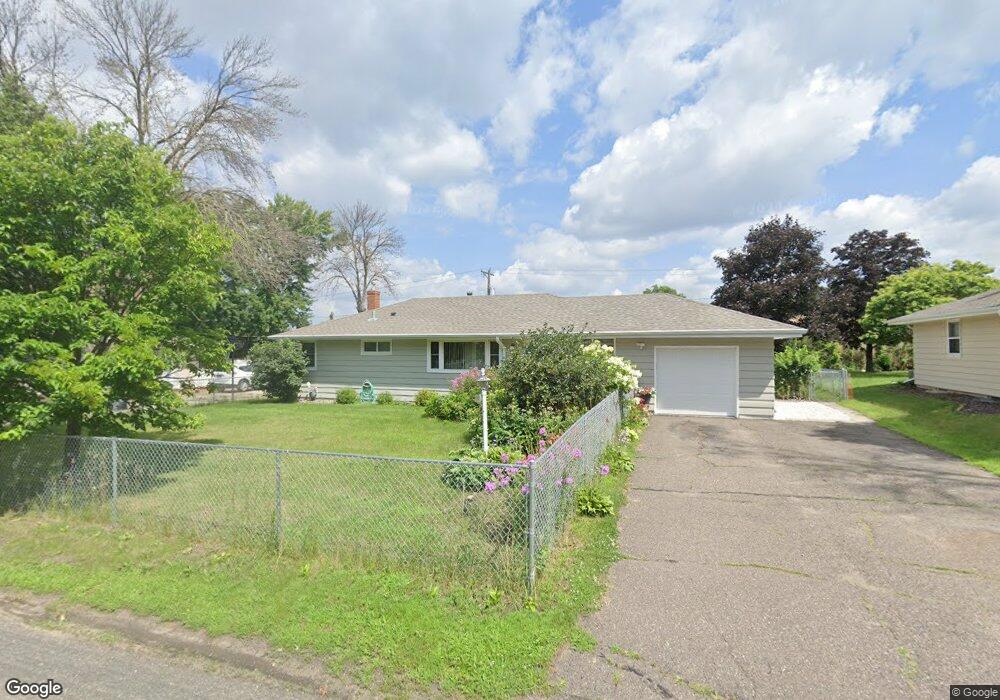
1453 Sherren Ave E Saint Paul, MN 55109
Sherwood Glen NeighborhoodEstimated Value: $283,000 - $322,000
3
Beds
1
Bath
864
Sq Ft
$351/Sq Ft
Est. Value
About This Home
This home is located at 1453 Sherren Ave E, Saint Paul, MN 55109 and is currently estimated at $303,172, approximately $350 per square foot. 1453 Sherren Ave E is a home located in Ramsey County with nearby schools including Weaver Elementary School, John Glenn Middle School, and Presentation Of Mary School.
Ownership History
Date
Name
Owned For
Owner Type
Purchase Details
Closed on
Dec 31, 2015
Sold by
Fannie Mae
Bought by
Vue Blong and Xiong Mee
Current Estimated Value
Home Financials for this Owner
Home Financials are based on the most recent Mortgage that was taken out on this home.
Original Mortgage
$140,650
Outstanding Balance
$111,752
Interest Rate
3.93%
Estimated Equity
$191,420
Purchase Details
Closed on
Jun 16, 2015
Sold by
Ganyaw Patrick S
Bought by
Federal National Mortgage Association
Create a Home Valuation Report for This Property
The Home Valuation Report is an in-depth analysis detailing your home's value as well as a comparison with similar homes in the area
Home Values in the Area
Average Home Value in this Area
Purchase History
| Date | Buyer | Sale Price | Title Company |
|---|---|---|---|
| Vue Blong | -- | First Financial Title Agency | |
| Federal National Mortgage Association | $153,538 | Attorney |
Source: Public Records
Mortgage History
| Date | Status | Borrower | Loan Amount |
|---|---|---|---|
| Open | Vue Blong | $140,650 |
Source: Public Records
Tax History Compared to Growth
Tax History
| Year | Tax Paid | Tax Assessment Tax Assessment Total Assessment is a certain percentage of the fair market value that is determined by local assessors to be the total taxable value of land and additions on the property. | Land | Improvement |
|---|---|---|---|---|
| 2025 | $3,752 | $301,300 | $52,400 | $248,900 |
| 2023 | $3,752 | $274,000 | $52,400 | $221,600 |
| 2022 | $3,218 | $264,400 | $52,400 | $212,000 |
| 2021 | $2,858 | $228,700 | $52,400 | $176,300 |
| 2020 | $2,936 | $210,300 | $52,400 | $157,900 |
| 2019 | $2,474 | $202,300 | $52,400 | $149,900 |
| 2018 | $2,338 | $177,500 | $52,400 | $125,100 |
| 2017 | $1,968 | $165,400 | $52,400 | $113,000 |
| 2016 | $2,152 | $0 | $0 | $0 |
| 2015 | $2,038 | $127,600 | $48,100 | $79,500 |
| 2014 | $1,490 | $0 | $0 | $0 |
Source: Public Records
Map
Nearby Homes
- 1496 Laurie Rd E
- 1509 Sandhurst Ave E
- 2420 Hazelwood St
- 1467 County Road B E
- 1247 Lealand Rd E
- 1666 Laurie Rd E
- 1984 Prosperity Rd
- 1940 Barclay St
- 2554 Bittersweet Ln
- 1018 Sextant Ave
- 1869 Birmingham St
- 1201 Frost Ave
- 1937 Flandrau St
- 1870 Clarence St
- 1854 Barclay St
- 1849 Kennard St
- 2175 German St
- 955 Brooks Ct
- 1995 11th Ave E Unit 2
- 1995 11th Ave E Unit 1
- 1445 Sherren Ave E
- 1461 Sherren Ave E
- 1467 Sherren Ave E
- 1439 Sherren Ave E
- 1452 Sherren Ave E
- 1460 Sherren Ave E
- 1444 Sherren Ave E
- 1466 Sherren Ave E
- 1475 Sherren Ave E
- 2315 Barclay St
- 2305 Barclay St
- 1474 Sherren Ave E
- 1451 Cope Ave E
- 1459 Cope Ave E
- 1443 Cope Ave E
- 1481 Sherren Ave E
- 2297 Barclay St
- 1465 Cope Ave E
- 1480 Sherren Ave E
- 1473 Cope Ave E