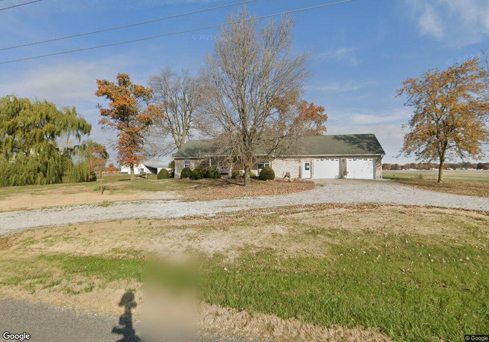
14531 Highline Rd Carlyle, IL 62231
Estimated Value: $178,000 - $398,000
3
Beds
3
Baths
1,600
Sq Ft
$201/Sq Ft
Est. Value
About This Home
This home is located at 14531 Highline Rd, Carlyle, IL 62231 and is currently estimated at $321,321, approximately $200 per square foot. 14531 Highline Rd is a home located in Clinton County with nearby schools including Breese ESD #12, Beckemeyer Elementary School, and Central Community High School.
Ownership History
Date
Name
Owned For
Owner Type
Purchase Details
Closed on
Apr 15, 2021
Sold by
Mccauley Matthew L and Mccauley Kimberly F
Bought by
Haar Neil and Markus Lauren
Current Estimated Value
Home Financials for this Owner
Home Financials are based on the most recent Mortgage that was taken out on this home.
Original Mortgage
$225,000
Outstanding Balance
$203,569
Interest Rate
3.13%
Mortgage Type
New Conventional
Estimated Equity
$117,752
Purchase Details
Closed on
Jun 22, 2012
Sold by
Deiters Scott J and Deiters Ann M
Bought by
Mccauley Matthew L and Mccauley Kimberly F
Home Financials for this Owner
Home Financials are based on the most recent Mortgage that was taken out on this home.
Original Mortgage
$257,254
Interest Rate
3.83%
Mortgage Type
FHA
Create a Home Valuation Report for This Property
The Home Valuation Report is an in-depth analysis detailing your home's value as well as a comparison with similar homes in the area
Home Values in the Area
Average Home Value in this Area
Purchase History
| Date | Buyer | Sale Price | Title Company |
|---|---|---|---|
| Haar Neil | $285,000 | Community Title | |
| Mccauley Matthew L | $262,000 | Highland Community Title Llc |
Source: Public Records
Mortgage History
| Date | Status | Borrower | Loan Amount |
|---|---|---|---|
| Open | Haar Neil | $225,000 | |
| Previous Owner | Mccauley Matthew L | $257,254 |
Source: Public Records
Tax History Compared to Growth
Tax History
| Year | Tax Paid | Tax Assessment Tax Assessment Total Assessment is a certain percentage of the fair market value that is determined by local assessors to be the total taxable value of land and additions on the property. | Land | Improvement |
|---|---|---|---|---|
| 2024 | $5,448 | $95,190 | $16,190 | $79,000 |
| 2023 | $5,448 | $86,540 | $14,720 | $71,820 |
| 2022 | $5,041 | $84,840 | $14,430 | $70,410 |
| 2021 | $4,917 | $83,180 | $14,150 | $69,030 |
| 2020 | $4,929 | $81,550 | $13,870 | $67,680 |
| 2019 | $4,872 | $81,550 | $13,870 | $67,680 |
| 2018 | $0 | $0 | $0 | $0 |
Source: Public Records
Map
Nearby Homes
- 291 Carter St
- 15556 Old State Rd
- 16743 Ashland Ct
- 611 23rd St
- 0 Redwood St
- 1870 Fairfax St
- 1090 18th St
- 951 10th St
- 126 Jefferson Dr
- 15207 Business Highway 127
- 471 Methodist St
- 10675 Buckingham Ct
- 1102 Cherry St
- 290 N Elm St
- 13898 Lincoln Dr
- 923 N 6th St
- 13964 Best One Dr
- 620 S 6th St
- 325 N Walnut St
- 429 S 6th St
- 14655 Highline Rd
- 14829 Highline Rd
- 14332 Highline Rd
- 14338 Highline Rd
- 14836 Highline Rd
- 12241 Bartelso Rd
- 12350 Bartelso Rd
- 12235 Bartelso Rd
- 390 W 5th St
- 890 Dora St
- 12414 Bartelso Rd
- 891 Christiana St
- 470 W 5th St
- 310 W 4th St
- 350 W 4th St
- 850 Elizabeth St
- 430 E 5th St
- 450 W 4th St
- 12256 Scoville
- 12256 Scoville