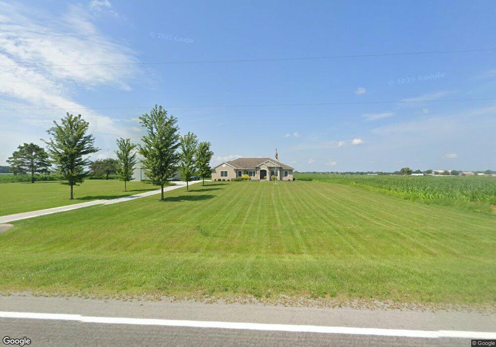
14539 State Route 292 Kenton, OH 43326
Estimated Value: $326,000 - $471,000
4
Beds
3
Baths
2,448
Sq Ft
$159/Sq Ft
Est. Value
About This Home
This home is located at 14539 State Route 292, Kenton, OH 43326 and is currently estimated at $389,749, approximately $159 per square foot. 14539 State Route 292 is a home located in Hardin County with nearby schools including Kenton Elementary School, Kenton Middle School, and Kenton High School.
Ownership History
Date
Name
Owned For
Owner Type
Purchase Details
Closed on
Mar 25, 2009
Sold by
Allen Kerrie
Bought by
Fleece Craig W and Fleece Jennifer R
Current Estimated Value
Purchase Details
Closed on
Nov 29, 1999
Bought by
Kindle Maysa
Purchase Details
Closed on
Mar 12, 1996
Bought by
Fulton Jason W
Purchase Details
Closed on
Mar 20, 1995
Bought by
Dearing Donald E and Dearing Janet
Purchase Details
Closed on
Sep 26, 1991
Create a Home Valuation Report for This Property
The Home Valuation Report is an in-depth analysis detailing your home's value as well as a comparison with similar homes in the area
Home Values in the Area
Average Home Value in this Area
Purchase History
| Date | Buyer | Sale Price | Title Company |
|---|---|---|---|
| Fleece Craig W | $50,000 | None Available | |
| Kindle Maysa | $43,000 | -- | |
| Fulton Jason W | $28,000 | -- | |
| Dearing Donald E | $28,000 | -- | |
| -- | $36,000 | -- |
Source: Public Records
Tax History Compared to Growth
Tax History
| Year | Tax Paid | Tax Assessment Tax Assessment Total Assessment is a certain percentage of the fair market value that is determined by local assessors to be the total taxable value of land and additions on the property. | Land | Improvement |
|---|---|---|---|---|
| 2024 | $4,867 | $115,790 | $7,020 | $108,770 |
| 2023 | $4,867 | $115,790 | $7,020 | $108,770 |
| 2022 | $4,833 | $107,250 | $5,470 | $101,780 |
| 2021 | $4,851 | $107,250 | $5,470 | $101,780 |
| 2020 | $4,190 | $107,250 | $5,470 | $101,780 |
| 2019 | $3,343 | $89,140 | $5,260 | $83,880 |
| 2018 | $3,347 | $89,140 | $5,260 | $83,880 |
| 2017 | $3,286 | $89,140 | $5,260 | $83,880 |
| 2016 | $2,932 | $83,710 | $4,740 | $78,970 |
| 2015 | $2,910 | $83,710 | $4,740 | $78,970 |
| 2014 | $2,921 | $83,710 | $4,740 | $78,970 |
| 2013 | $2,877 | $78,680 | $4,740 | $73,940 |
Source: Public Records
Map
Nearby Homes
- 13450 State Route 292
- 320 Letson Ave
- 727 S Detroit St
- 639 S Main St
- 920 Cooper St
- 414 Robinson Ave
- 510 Decatur St
- 508 Decatur St
- 115 Scioto St
- 530 E Franklin St
- 121 S High St
- 513 E Franklin St
- 39 Grape St
- 79 Broadway St
- 11896 Parklane Dr
- 509 E Carrol St
- 726 Tracy St
- 219 W Carrol St
- 702 W Franklin St Unit 702 1/2
- 215 N Main St
- 14574 State Route 292
- 14440 State Route 292
- 14705 State Route 292
- 14698 State Route 292
- 14789 State Route 292
- 14297 State Route 292
- 14155 State Route 292
- 14931 State Route 292
- 15010 State Route 292
- 14052 State Route 292
- 00 County Road 160
- 13890 State Route 292
- 13929 State Route 292
- 14267 State Route 31
- 15201 State Route 292
- 15201 State Route 292
- 15248 State Route 292
- 14628 State Route 31
- 14073 Sr
- 13770 State Route 292