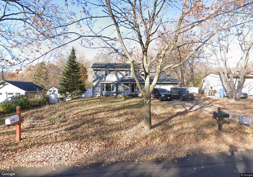
1455 Carrie St Saint Paul, MN 55118
Estimated Value: $446,000 - $479,000
5
Beds
4
Baths
2,752
Sq Ft
$168/Sq Ft
Est. Value
About This Home
This home is located at 1455 Carrie St, Saint Paul, MN 55118 and is currently estimated at $462,418, approximately $168 per square foot. 1455 Carrie St is a home located in Dakota County with nearby schools including Garlough Environmental Magnet, Heritage E-STEM Magnet School, and Two Rivers High School.
Ownership History
Date
Name
Owned For
Owner Type
Purchase Details
Closed on
Dec 12, 2011
Sold by
Deutsche Bank National Trust Company
Bought by
Andrusko Paul and Oconnell Michael R
Current Estimated Value
Purchase Details
Closed on
Nov 27, 2006
Sold by
Zierman Carol J
Bought by
Vang Pakou and Vue Koua
Purchase Details
Closed on
Apr 1, 2003
Sold by
Zierman Carol Jay
Bought by
Menard Penelope J
Purchase Details
Closed on
Dec 5, 2002
Sold by
Shirley James R and Shirley Sandra J
Bought by
Zierman Carol J
Create a Home Valuation Report for This Property
The Home Valuation Report is an in-depth analysis detailing your home's value as well as a comparison with similar homes in the area
Home Values in the Area
Average Home Value in this Area
Purchase History
| Date | Buyer | Sale Price | Title Company |
|---|---|---|---|
| Andrusko Paul | $75,115 | Servicelink | |
| Vang Pakou | $310,000 | -- | |
| Menard Penelope J | $7,250 | -- | |
| Zierman Carol J | $234,500 | -- |
Source: Public Records
Tax History Compared to Growth
Tax History
| Year | Tax Paid | Tax Assessment Tax Assessment Total Assessment is a certain percentage of the fair market value that is determined by local assessors to be the total taxable value of land and additions on the property. | Land | Improvement |
|---|---|---|---|---|
| 2024 | $5,302 | $415,600 | $90,300 | $325,300 |
| 2023 | $5,302 | $427,900 | $95,700 | $332,200 |
| 2022 | $4,290 | $386,500 | $95,300 | $291,200 |
| 2021 | $4,142 | $331,600 | $82,900 | $248,700 |
| 2020 | $4,088 | $318,900 | $78,900 | $240,000 |
| 2019 | $3,761 | $306,700 | $75,200 | $231,500 |
| 2018 | $3,625 | $272,000 | $70,300 | $201,700 |
| 2017 | $3,625 | $273,200 | $66,900 | $206,300 |
| 2016 | $3,418 | $262,600 | $60,900 | $201,700 |
| 2015 | $3,486 | $234,606 | $56,159 | $178,447 |
| 2014 | -- | $231,881 | $52,030 | $179,851 |
| 2013 | -- | $219,455 | $47,618 | $171,837 |
Source: Public Records
Map
Nearby Homes
- 1523 Traverse Ln
- 360 Trenton Ln
- 1532 Trellis Ln
- Bayfield Plan at Thompson Square East
- Capri Plan at Thompson Square East
- 1531 Traverse Ln
- Hayward Plan at Thompson Square East
- Barcelona Plan at Thompson Square East
- Athens II Plan at Thompson Square East
- Athens Plan at Thompson Square East
- 1520 Traverse Ln
- 1522 Traverse Ln
- 1524 Traverse Ln
- 1526 Traverse Ln
- 1530 Trellis Ln
- 1534 Trellis Ln
- 1536 Trellis Ln
- 1538 Trellis Ln
- 1540 Trellis Ln
- 1251 Macarthur Ave
- 1455 Carrie St
- 1447 Carrie St
- 1471 Carrie St
- 1471 Carrie St
- 1456 Carrie St
- 1462 Carrie St
- 1450 Carrie St
- 1450 Carrie St
- 1441 Carrie St
- 1450 Carrie St
- 1468 Carrie St
- 1440 Carrie St
- 1427 Carrie St
- 247 Thompson Ave E
- 245 Thompson Ave E
- 245 245 Thompson Ave E
- 237 Thompson Ave E
- 1428 Carrie St
- 230 230 Thompson-Avenue-e
- 1419 Carrie St