Estimated Value: $788,000 - $870,000
3
Beds
1
Bath
1,240
Sq Ft
$676/Sq Ft
Est. Value
About This Home
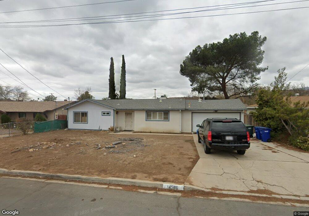
This home is located at 14586 Kennebunk St, Poway, CA 92064 and is currently estimated at $837,993, approximately $675 per square foot. 14586 Kennebunk St is a home located in San Diego County with nearby schools including Garden Road Elementary, Twin Peaks Middle, and Poway High.
Ownership History
Date
Name
Owned For
Owner Type
Purchase Details
Closed on
Aug 21, 2002
Sold by
Soleto Richard Zane and Porter Kerry Lynn
Bought by
Sotelo Richard Zane and Porter Kerry Lynn
Current Estimated Value
Home Financials for this Owner
Home Financials are based on the most recent Mortgage that was taken out on this home.
Original Mortgage
$267,900
Outstanding Balance
$118,092
Interest Rate
7.85%
Estimated Equity
$719,901
Purchase Details
Closed on
Aug 23, 2000
Sold by
Dibernardo William C and Dibernardo Carlene D
Bought by
Sotelo Richard Zane and Porter Kerry Lynn
Home Financials for this Owner
Home Financials are based on the most recent Mortgage that was taken out on this home.
Original Mortgage
$190,185
Interest Rate
7.98%
Mortgage Type
FHA
Purchase Details
Closed on
Jul 29, 1993
Purchase Details
Closed on
Apr 22, 1988
Create a Home Valuation Report for This Property
The Home Valuation Report is an in-depth analysis detailing your home's value as well as a comparison with similar homes in the area
Home Values in the Area
Average Home Value in this Area
Purchase History
| Date | Buyer | Sale Price | Title Company |
|---|---|---|---|
| Sotelo Richard Zane | -- | American Title | |
| Sotelo Richard Zane | $216,000 | Commonwealth Land Title Co | |
| -- | $144,000 | -- | |
| -- | $115,000 | -- |
Source: Public Records
Mortgage History
| Date | Status | Borrower | Loan Amount |
|---|---|---|---|
| Open | Sotelo Richard Zane | $267,900 | |
| Closed | Sotelo Richard Zane | $190,185 |
Source: Public Records
Tax History
| Year | Tax Paid | Tax Assessment Tax Assessment Total Assessment is a certain percentage of the fair market value that is determined by local assessors to be the total taxable value of land and additions on the property. | Land | Improvement |
|---|---|---|---|---|
| 2025 | $3,599 | $325,455 | $165,742 | $159,713 |
| 2024 | $3,599 | $319,075 | $162,493 | $156,582 |
| 2023 | $3,522 | $312,819 | $159,307 | $153,512 |
| 2022 | $3,463 | $306,686 | $156,184 | $150,502 |
| 2021 | $3,417 | $300,673 | $153,122 | $147,551 |
| 2020 | $3,371 | $297,591 | $151,552 | $146,039 |
| 2019 | $3,284 | $291,757 | $148,581 | $143,176 |
| 2018 | $3,192 | $286,037 | $145,668 | $140,369 |
| 2017 | $3,107 | $280,429 | $142,812 | $137,617 |
| 2016 | $3,042 | $274,931 | $140,012 | $134,919 |
| 2015 | $2,997 | $270,802 | $137,909 | $132,893 |
| 2014 | $2,928 | $265,498 | $135,208 | $130,290 |
Source: Public Records
Map
Nearby Homes
- 14525 Kittery St
- 14523 Saco St
- 13001 Standish Dr
- 13209 Neddick Ave
- 14610 Fairburn St
- 13435 Frey Ct
- 13428 Standish Dr
- 12671 Claire Dr
- 13462 Montego Dr
- 14550 Dehia St
- 13746 Paseo Bonita
- 14298 Ipava Dr
- 13643 Melissa Ln
- 000 Carlson Ct 9 Unit 9
- 13908 Hibiscus Ave Unit 40
- 13941 Wisteria Ave
- 15792 Via Santa Pradera
- 13422 Little Dawn Ln
- 13329 Casa Vista St Unit 98
- 12959 Creek Park Dr
- 14580 Kennebunk St
- 14592 Kennebunk St
- 14561 Kittery St
- 14567 Kittery St
- 14574 Kennebunk St
- 14555 Kittery St
- 14575 Kennebunk St
- 14568 Kennebunk St
- 13053 Acton Ave
- 14569 Kennebunk St
- 14562 Kennebunk St
- 13131 Acton Ave
- 13047 Acton Ave
- 14563 Kennebunk St
- 13134 Acton Ave
- 14588 Scarboro St
- 14537 Kittery St
- 14548 Kittery St
- 14582 Scarboro St
- 13041 Acton Ave
Your Personal Tour Guide
Ask me questions while you tour the home.