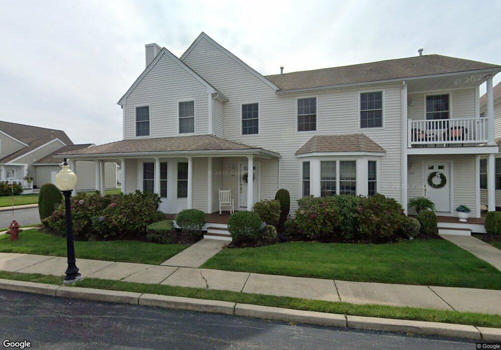
146 Boylston Dr Cranston, RI 02921
Comstock Gardens NeighborhoodEstimated Value: $469,000 - $516,000
2
Beds
3
Baths
1,474
Sq Ft
$334/Sq Ft
Est. Value
About This Home
This home is located at 146 Boylston Dr, Cranston, RI 02921 and is currently estimated at $491,683, approximately $333 per square foot. 146 Boylston Dr is a home located in Providence County with nearby schools including Orchard Farms El. School, Western Hills Middle School, and Cranston High School West.
Ownership History
Date
Name
Owned For
Owner Type
Purchase Details
Closed on
May 30, 2008
Sold by
Npb Llc
Bought by
Damon Carrie
Current Estimated Value
Home Financials for this Owner
Home Financials are based on the most recent Mortgage that was taken out on this home.
Original Mortgage
$237,200
Interest Rate
5.91%
Mortgage Type
Purchase Money Mortgage
Create a Home Valuation Report for This Property
The Home Valuation Report is an in-depth analysis detailing your home's value as well as a comparison with similar homes in the area
Home Values in the Area
Average Home Value in this Area
Purchase History
| Date | Buyer | Sale Price | Title Company |
|---|---|---|---|
| Damon Carrie | $296,000 | -- |
Source: Public Records
Mortgage History
| Date | Status | Borrower | Loan Amount |
|---|---|---|---|
| Open | Damon Carrie | $50,000 | |
| Open | Damon Carrie | $236,800 | |
| Closed | Damon Carrie | $237,200 |
Source: Public Records
Tax History Compared to Growth
Tax History
| Year | Tax Paid | Tax Assessment Tax Assessment Total Assessment is a certain percentage of the fair market value that is determined by local assessors to be the total taxable value of land and additions on the property. | Land | Improvement |
|---|---|---|---|---|
| 2025 | $5,614 | $404,500 | $0 | $404,500 |
| 2024 | $5,505 | $404,500 | $0 | $404,500 |
| 2023 | $5,980 | $316,400 | $0 | $316,400 |
| 2022 | $5,857 | $316,400 | $0 | $316,400 |
| 2021 | $5,695 | $316,400 | $0 | $316,400 |
| 2020 | $5,863 | $282,300 | $0 | $282,300 |
| 2019 | $5,863 | $282,300 | $0 | $282,300 |
| 2018 | $5,728 | $282,300 | $0 | $282,300 |
| 2017 | $5,882 | $256,400 | $0 | $256,400 |
| 2016 | $5,756 | $256,400 | $0 | $256,400 |
| 2015 | $5,756 | $256,400 | $0 | $256,400 |
| 2014 | $6,219 | $272,300 | $0 | $272,300 |
Source: Public Records
Map
Nearby Homes
- 9 Gray Coach E
- 53 Charcalee Dr
- 7 Taylor Rd
- 121 Ashbrook Dr
- 2073 Plainfield Pike
- 11 Raven Cir
- 02 Paula Ln
- 01 Paula Ln
- 20 Doreen Ct
- 2 Mulberry Dr
- 18 Quail Ridge Rd
- 80 Tomahawk Trail
- 26 Scituate Farms Dr
- 12 Beechwood Dr
- 27 Tartaglia St
- 102 Moccasin Trail
- 10 Honey Lou Ct
- 79 Taylor Rd
- 95 Amy Dr
- 105 Amy Dr
- 150 Boylston Dr
- 154 Boylston Dr
- 158 Boylston Dr
- 142 Boylston Dr
- 162 Boylston Dr
- 153 Cheshire Dr
- 138 Boylston Dr
- 166 Boylston Dr
- 145 Boylston Dr
- 180 Boylston Dr
- 157 Cheshire Dr
- 170 Boylston Dr
- 170 Boylston Dr Unit 170
- 39 Ashburton Dr
- 141 Boylston Dr
- 174 Boylston Dr
- 134 Boylston Dr
- 43 Ashburton Dr
- 176 Boylston Dr
- 137 Boylston Dr