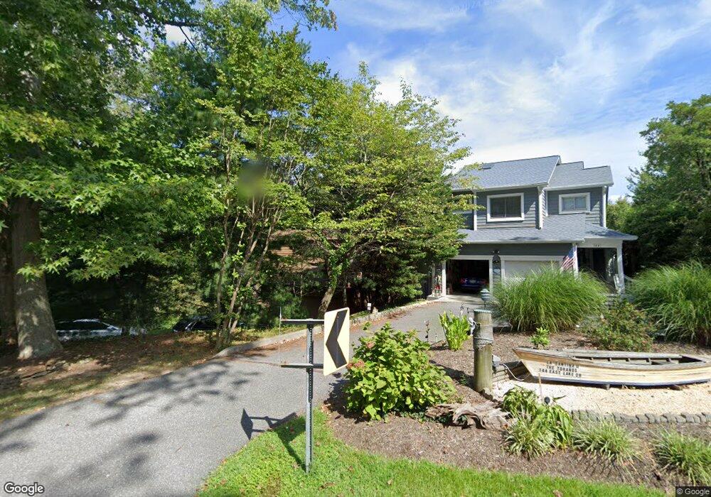
146 E Lake Dr Annapolis, MD 21403
Estimated Value: $2,569,000 - $3,879,000
Studio
4
Baths
2,840
Sq Ft
$1,062/Sq Ft
Est. Value
About This Home
This home is located at 146 E Lake Dr, Annapolis, MD 21403 and is currently estimated at $3,016,175, approximately $1,062 per square foot. 146 E Lake Dr is a home located in Anne Arundel County with nearby schools including Georgetown East Elementary School, Annapolis Middle School, and Annapolis High School.
Ownership History
Date
Name
Owned For
Owner Type
Purchase Details
Closed on
Oct 13, 2025
Sold by
Flynn Kathleen B and Flynn Kathleen C
Bought by
John J Flynn Revocable Trust and Kathleen Byrne Flynn Revocable Trust
Current Estimated Value
Purchase Details
Closed on
Dec 11, 1985
Bought by
Flynn John J and Flynn Kathleen C
Home Financials for this Owner
Home Financials are based on the most recent Mortgage that was taken out on this home.
Original Mortgage
$90,000
Interest Rate
11.5%
Create a Home Valuation Report for This Property
The Home Valuation Report is an in-depth analysis detailing your home's value as well as a comparison with similar homes in the area
Home Values in the Area
Average Home Value in this Area
Purchase History
| Date | Buyer | Sale Price | Title Company |
|---|---|---|---|
| John J Flynn Revocable Trust | -- | None Listed On Document | |
| Flynn John J | $92,000 | -- |
Source: Public Records
Mortgage History
| Date | Status | Borrower | Loan Amount |
|---|---|---|---|
| Previous Owner | Flynn John J | $90,000 |
Source: Public Records
Tax History
| Year | Tax Paid | Tax Assessment Tax Assessment Total Assessment is a certain percentage of the fair market value that is determined by local assessors to be the total taxable value of land and additions on the property. | Land | Improvement |
|---|---|---|---|---|
| 2025 | $12,279 | $2,929,867 | -- | -- |
| 2024 | $12,279 | $2,450,933 | $0 | $0 |
| 2023 | $11,434 | $1,972,000 | $1,451,500 | $520,500 |
| 2022 | $19,405 | $1,856,933 | $0 | $0 |
| 2020 | $9,711 | $1,626,800 | $1,215,700 | $411,100 |
| 2019 | $19,273 | $1,626,800 | $1,215,700 | $411,100 |
| 2018 | $16,496 | $1,626,800 | $1,215,700 | $411,100 |
| 2017 | $9,259 | $1,651,500 | $0 | $0 |
| 2016 | -- | $1,651,500 | $0 | $0 |
| 2015 | -- | $1,651,500 | $0 | $0 |
| 2014 | -- | $1,729,100 | $0 | $0 |
Source: Public Records
Map
Nearby Homes
- 90 E Lake Dr
- 3 Barry Ave
- 48 E Lake Dr
- 45 E Lake Dr
- 113 Bay Dr
- 1327 Bay Ave
- 1202 Chrisland Ct
- 3233 Chrisland Dr
- 3300 Shore Dr
- 1353 Washington Dr
- 2656A Queen Anne Cir
- 3365 Arundel on The Bay Rd
- 3268 Kitty Duvall Dr
- 1217 Cross Rd
- 1031 Old Bay Ridge Rd
- 3123 Arundel on The Bay Rd
- 3123 Arundel On the Bay Road - Harrison Model
- 1221 Creek Dr
- 1009 Old Bay Ridge Rd
- 1136 Lake Heron Dr
Your Personal Tour Guide
Ask me questions while you tour the home.