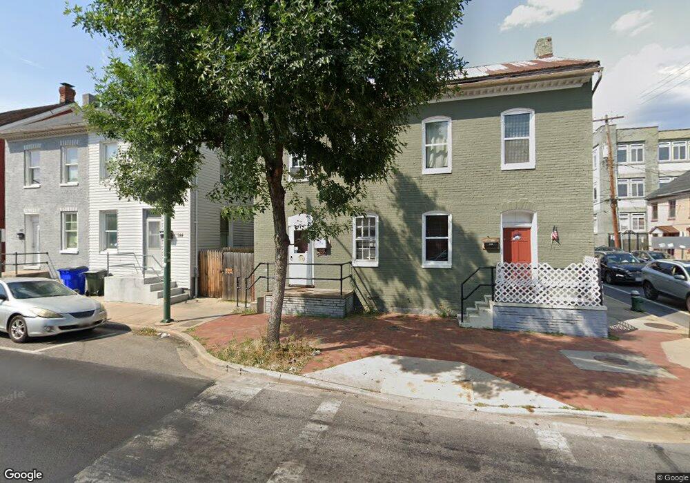
146 E Washington St Hagerstown, MD 21740
Central NeighborhoodEstimated Value: $217,203 - $264,000
--
Bed
1
Bath
1,444
Sq Ft
$163/Sq Ft
Est. Value
About This Home
This home is located at 146 E Washington St, Hagerstown, MD 21740 and is currently estimated at $235,801, approximately $163 per square foot. 146 E Washington St is a home located in Washington County with nearby schools including Ruth Ann Monroe Primary School, Eastern Elementary School, and E. Russell Hicks Middle School.
Ownership History
Date
Name
Owned For
Owner Type
Purchase Details
Closed on
Jun 26, 2020
Sold by
Azizi Abdul Muneer
Bought by
Cannon Street Land Trusts and Hager City Rehabilitation Llc
Current Estimated Value
Purchase Details
Closed on
Sep 21, 2018
Sold by
Mumin Properties Llc
Bought by
Azizi Abdul Muneer
Purchase Details
Closed on
Dec 19, 2016
Sold by
Chaney Oscar Milton
Bought by
Mumin Properties Llc
Create a Home Valuation Report for This Property
The Home Valuation Report is an in-depth analysis detailing your home's value as well as a comparison with similar homes in the area
Home Values in the Area
Average Home Value in this Area
Purchase History
| Date | Buyer | Sale Price | Title Company |
|---|---|---|---|
| Cannon Street Land Trusts | -- | Accommodation | |
| Azizi Abdul Muneer | $45,000 | Premier Settlements & Title | |
| Mumin Properties Llc | $67,500 | Premier Settlements & Title |
Source: Public Records
Tax History Compared to Growth
Tax History
| Year | Tax Paid | Tax Assessment Tax Assessment Total Assessment is a certain percentage of the fair market value that is determined by local assessors to be the total taxable value of land and additions on the property. | Land | Improvement |
|---|---|---|---|---|
| 2025 | $1,526 | $188,400 | $35,000 | $153,400 |
| 2024 | $1,526 | $167,533 | $0 | $0 |
| 2023 | $1,336 | $146,667 | $0 | $0 |
| 2022 | $1,146 | $125,800 | $35,000 | $90,800 |
| 2021 | $1,222 | $121,933 | $0 | $0 |
| 2020 | $1,099 | $118,067 | $0 | $0 |
| 2019 | $1,068 | $114,200 | $35,000 | $79,200 |
| 2018 | $1,144 | $114,133 | $0 | $0 |
| 2017 | $1,066 | $114,067 | $0 | $0 |
| 2016 | -- | $114,000 | $0 | $0 |
| 2015 | $2,644 | $114,100 | $0 | $0 |
| 2014 | $2,644 | $114,100 | $0 | $0 |
Source: Public Records
Map
Nearby Homes
- 16 S Mulberry St
- 15 S Cannon Ave
- 228 E Washington St
- 200 E Antietam St
- 30 S Cannon Ave
- 51 N Cannon Ave
- 112 E Antietam St
- 200 E Franklin St
- 25 S Locust St
- 112 S Cannon Ave
- 145 King St
- 312 E Franklin St
- 123 1/2 S Locust St
- 329 Antietam E
- 136 N Cannon Ave
- 115 East Ave
- 142 East Ave
- 207 N Mulberry St
- 338 Liberty St
- 351 Liberty St
- 144 E Washington St
- 5 N Mulberry St
- 142 E Washington St
- 140 E Washington St
- 138 E Washington St
- 11 N Mulberry St
- 136 E Washington St
- 22 N Mulberry St
- 210 E Washington St
- 209 E Washington St
- 21 N Mulberry St
- 212 E Washington St
- 126 E Washington St
- 12 S Mulberry St
- 8 S Mulberry St
- 214 E Washington St
- 15 S Mulberry St
- 216 E Washington St
- 10 S Mulberry St
- 218 E Washington St