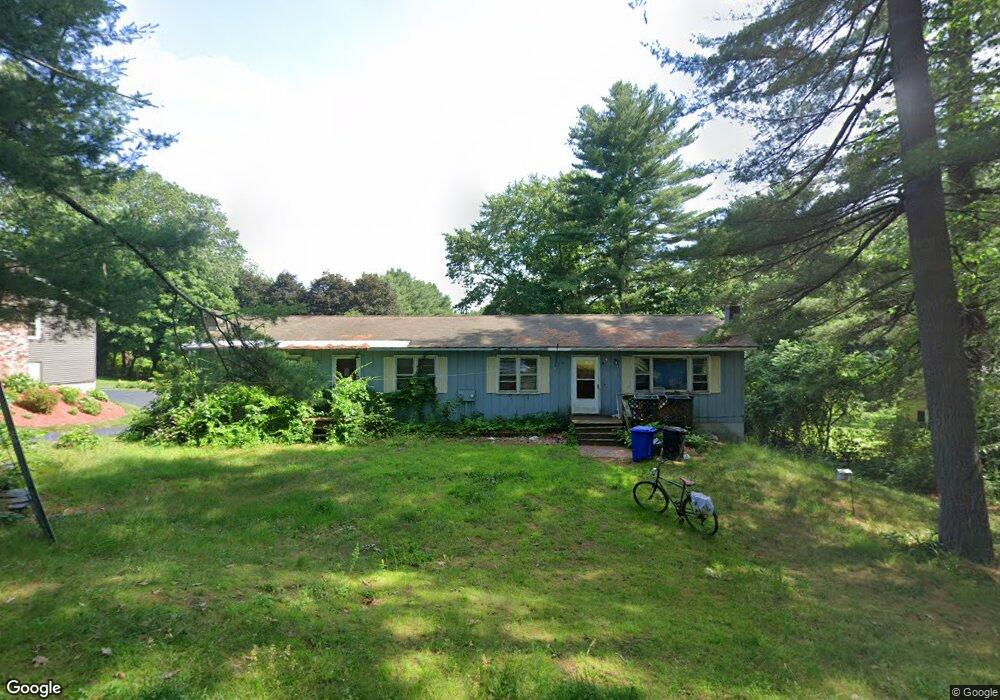
146 Log Plain Rd Unit 148 Greenfield, MA 01301
Estimated Value: $256,000 - $372,000
5
Beds
3
Baths
3,072
Sq Ft
$101/Sq Ft
Est. Value
About This Home
This home is located at 146 Log Plain Rd Unit 148, Greenfield, MA 01301 and is currently estimated at $310,188, approximately $100 per square foot. 146 Log Plain Rd Unit 148 is a home located in Franklin County with nearby schools including Greenfield Center School, Cornerstone Christian School, and Stoneleigh-Burnham School.
Ownership History
Date
Name
Owned For
Owner Type
Purchase Details
Closed on
Sep 22, 2022
Sold by
Adams Joya and Adams Andrew
Bought by
146-148 Log Plain Rd Llc
Current Estimated Value
Purchase Details
Closed on
Apr 11, 2016
Sold by
Adams Joya and Adams Andrew A
Bought by
Adams Rt and Adams
Purchase Details
Closed on
Mar 29, 2011
Sold by
Pfeffer Donna and Adams Joya
Bought by
Pfeffer Donna and Adams Joya
Purchase Details
Closed on
Mar 1, 1979
Bought by
Adams Rt
Create a Home Valuation Report for This Property
The Home Valuation Report is an in-depth analysis detailing your home's value as well as a comparison with similar homes in the area
Home Values in the Area
Average Home Value in this Area
Purchase History
| Date | Buyer | Sale Price | Title Company |
|---|---|---|---|
| 146-148 Log Plain Rd Llc | -- | None Available | |
| 146-148 Log Plain Rd Llc | -- | None Available | |
| Adams Raymond L | -- | None Available | |
| Adams Raymond L | -- | None Available | |
| Adams Joya | -- | None Available | |
| Adams Joya | -- | None Available | |
| Adams Rt | -- | -- | |
| Adams Rt | -- | -- | |
| Pfeffer Donna | -- | -- | |
| Pfeffer Donna | -- | -- | |
| Adams Rt | $47,500 | -- |
Source: Public Records
Tax History Compared to Growth
Tax History
| Year | Tax Paid | Tax Assessment Tax Assessment Total Assessment is a certain percentage of the fair market value that is determined by local assessors to be the total taxable value of land and additions on the property. | Land | Improvement |
|---|---|---|---|---|
| 2025 | $3,724 | $190,400 | $75,900 | $114,500 |
| 2024 | $3,733 | $183,100 | $64,600 | $118,500 |
| 2023 | $3,423 | $174,200 | $64,600 | $109,600 |
| 2022 | $3,698 | $165,700 | $64,700 | $101,000 |
| 2021 | $3,680 | $158,500 | $68,400 | $90,100 |
| 2020 | $3,673 | $160,200 | $68,400 | $91,800 |
| 2019 | $3,423 | $153,100 | $59,500 | $93,600 |
| 2018 | $3,436 | $153,200 | $58,400 | $94,800 |
| 2017 | $3,329 | $153,200 | $58,400 | $94,800 |
| 2016 | $3,411 | $156,400 | $58,400 | $98,000 |
| 2015 | $3,534 | $157,000 | $59,900 | $97,100 |
| 2014 | $3,225 | $157,100 | $59,900 | $97,200 |
Source: Public Records
Map
Nearby Homes
- 31 Lovers Ln
- 83 Eden Trail Branch
- 34 Brookside Ave
- 001 Adams Rd
- 72 Meadowood Dr
- 696 Bernardston Rd
- 47 Cross St
- 75 South St Unit 3
- 59 River St
- 79 Burnham Rd
- 539 Fox Hill Rd
- 23 Industrial Dr
- 1 Northfield Rd
- 218 Greenfield Rd
- 4 Pickett Ln
- 27 Lunt Dr
- 0 Pickett Ln
- 544 Fox Hill Rd (Vacant Land)
- 104 Leyden Rd
- 319 Greenfield Rd
- 142 Log Plain Rd
- 143 Log Plain Rd
- 150 Log Plain Rd Unit 152
- 139 Log Plain Rd
- 136 Log Plain Rd
- 135 Log Plain Rd
- 132 Log Plain Rd
- 131 Log Plain Rd
- 158 Log Plain Rd
- 12 Oak Ridge Rd
- 157 Log Plain Rd
- 49 Severance St
- 164 Log Plain Rd
- 123 Log Plain Rd
- 43 Severance St
- 17 Oak Ridge Rd
- 167 Log Plain Rd
- 37 Severance St
- 95 Newell Pond Rd
- 176 Log Plain Rd