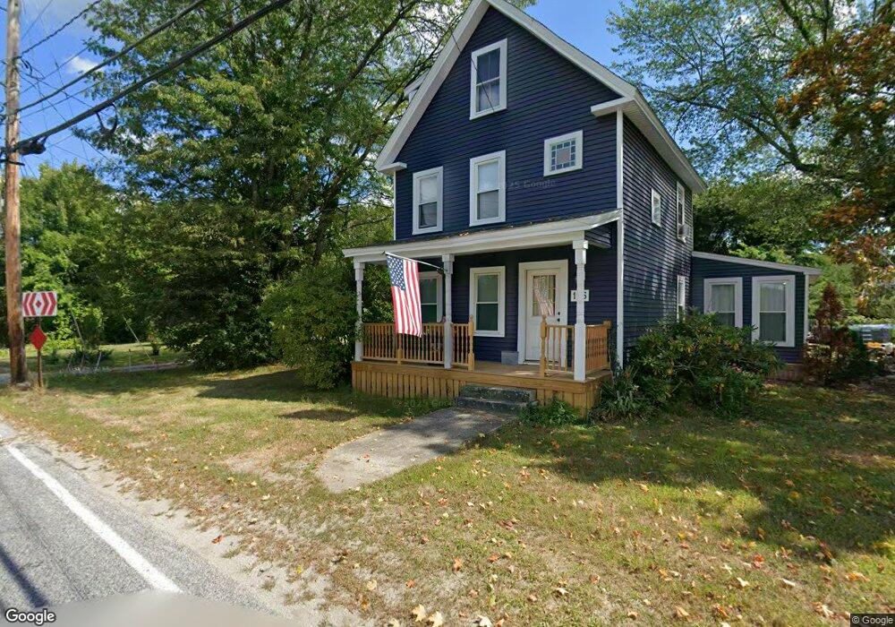
146 Osgood Rd Milford, NH 03055
Estimated Value: $460,445 - $530,000
3
Beds
3
Baths
1,936
Sq Ft
$260/Sq Ft
Est. Value
About This Home
This home is located at 146 Osgood Rd, Milford, NH 03055 and is currently estimated at $502,861, approximately $259 per square foot. 146 Osgood Rd is a home with nearby schools including Jacques Memorial Elementary School, Heron Pond Elementary School, and Milford Middle School.
Ownership History
Date
Name
Owned For
Owner Type
Purchase Details
Closed on
Nov 8, 2006
Sold by
Johnson Lucille J
Bought by
Johnson Dana H and Johnson Lisa A
Current Estimated Value
Home Financials for this Owner
Home Financials are based on the most recent Mortgage that was taken out on this home.
Original Mortgage
$210,400
Interest Rate
6.31%
Mortgage Type
Purchase Money Mortgage
Create a Home Valuation Report for This Property
The Home Valuation Report is an in-depth analysis detailing your home's value as well as a comparison with similar homes in the area
Home Values in the Area
Average Home Value in this Area
Purchase History
| Date | Buyer | Sale Price | Title Company |
|---|---|---|---|
| Johnson Dana H | $263,000 | -- |
Source: Public Records
Mortgage History
| Date | Status | Borrower | Loan Amount |
|---|---|---|---|
| Open | Johnson Dana H | $218,000 | |
| Closed | Johnson Dana H | $218,000 | |
| Closed | Johnson Dana H | $55,000 | |
| Closed | Johnson Dana H | $210,400 |
Source: Public Records
Tax History Compared to Growth
Tax History
| Year | Tax Paid | Tax Assessment Tax Assessment Total Assessment is a certain percentage of the fair market value that is determined by local assessors to be the total taxable value of land and additions on the property. | Land | Improvement |
|---|---|---|---|---|
| 2024 | $6,490 | $274,200 | $102,900 | $171,300 |
| 2023 | $6,079 | $274,200 | $102,900 | $171,300 |
| 2022 | $5,701 | $274,200 | $102,900 | $171,300 |
| 2021 | $5,525 | $274,200 | $102,900 | $171,300 |
| 2020 | $9,307 | $226,300 | $73,300 | $153,000 |
| 2019 | $5,877 | $226,300 | $73,300 | $153,000 |
| 2018 | $5,755 | $196,900 | $73,300 | $123,600 |
| 2017 | $5,787 | $196,900 | $73,300 | $123,600 |
| 2016 | $5,702 | $196,900 | $73,300 | $123,600 |
| 2015 | $5,472 | $191,600 | $73,300 | $118,300 |
| 2014 | $5,231 | $191,600 | $73,300 | $118,300 |
| 2013 | $5,167 | $191,600 | $73,300 | $118,300 |
Source: Public Records
Map
Nearby Homes
- 26 Melendy Rd Unit 97
- 112 Union St
- 24 Spaulding St
- 88 Noons Quarry Rd
- 0 Briar Cliff Dr
- 28 Christine Dr
- 32 Larch Rd
- 254 Nashua St
- 339 Nashua St
- 20 Riversedge Dr
- 377 Nashua St
- 160 Bridge St
- 30 Perkins St Unit 1
- 18 Souhegan St
- 0 Ball Hill Rd
- 18 Adams St
- 00 Ruonala Rd
- 47 Cadran Crossing
- 14 Reserve Way
- 14 North St
- 144 Osgood Rd
- 148 Osgood Rd
- 7 Mason Rd
- 0 Melendy Rd Unit 52-4-3 4702678
- 0 Melendy Rd Unit 52-4-2
- 0 Melendy Rd Unit 2783833
- 0 Melendy Rd Unit 52-4-2 4702644
- 17 Mason Rd
- 190 Armory Rd
- 186 Armory Rd
- 117 Osgood Rd
- 24 Mason Rd
- 176 Osgood Rd
- 175 Osgood Rd
- 30 Mason Rd
- 106 Osgood Rd
- 100 Osgood Rd
- 186 Osgood Rd
- 185 Osgood Rd
- 99 Osgood Rd