Estimated Value: $1,604,000 - $2,099,000
3
Beds
2
Baths
1,248
Sq Ft
$1,506/Sq Ft
Est. Value
About This Home
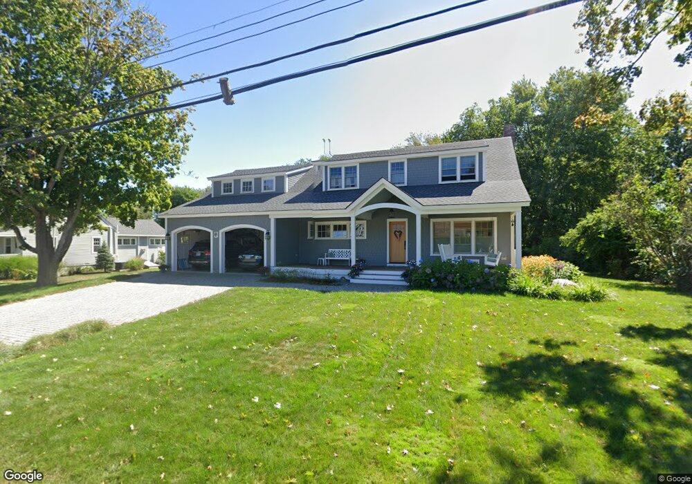
This home is located at 146 Perkins Rd, Rye, NH 03870 and is currently estimated at $1,879,255, approximately $1,505 per square foot. 146 Perkins Rd is a home located in Rockingham County with nearby schools including Rye Elementary School, Rye Junior High School, and Rye Country Day School.
Ownership History
Date
Name
Owned For
Owner Type
Purchase Details
Closed on
Jun 2, 2006
Sold by
Wood Dale S and Wood Kristine
Bought by
Wahl Joseph M and Wahl Jane S
Current Estimated Value
Home Financials for this Owner
Home Financials are based on the most recent Mortgage that was taken out on this home.
Original Mortgage
$325,000
Interest Rate
6.71%
Mortgage Type
Unknown
Purchase Details
Closed on
Jul 15, 2002
Sold by
Hicks-Grogan Grace
Bought by
Wood Dale S and Wood Kristine
Purchase Details
Closed on
Apr 27, 1999
Sold by
Murray Steven F and Murray Roberta L
Bought by
Hicks-Grogan Grace
Create a Home Valuation Report for This Property
The Home Valuation Report is an in-depth analysis detailing your home's value as well as a comparison with similar homes in the area
Home Values in the Area
Average Home Value in this Area
Purchase History
| Date | Buyer | Sale Price | Title Company |
|---|---|---|---|
| Wahl Joseph M | $478,000 | -- | |
| Wood Dale S | $350,000 | -- | |
| Hicks-Grogan Grace | $216,000 | -- |
Source: Public Records
Mortgage History
| Date | Status | Borrower | Loan Amount |
|---|---|---|---|
| Open | Hicks-Grogan Grace | $312,000 | |
| Closed | Hicks-Grogan Grace | $320,000 | |
| Closed | Hicks-Grogan Grace | $325,000 | |
| Closed | Hicks-Grogan Grace | $325,000 |
Source: Public Records
Tax History Compared to Growth
Tax History
| Year | Tax Paid | Tax Assessment Tax Assessment Total Assessment is a certain percentage of the fair market value that is determined by local assessors to be the total taxable value of land and additions on the property. | Land | Improvement |
|---|---|---|---|---|
| 2024 | $9,989 | $1,153,500 | $480,400 | $673,100 |
| 2023 | $9,263 | $1,153,500 | $480,400 | $673,100 |
| 2022 | $8,051 | $1,153,500 | $480,400 | $673,100 |
| 2021 | $8,379 | $819,900 | $418,000 | $401,900 |
| 2020 | $6,034 | $590,400 | $418,000 | $172,400 |
| 2019 | $5,722 | $559,900 | $418,000 | $141,900 |
| 2018 | $5,647 | $558,600 | $418,000 | $140,600 |
| 2017 | $5,647 | $558,600 | $418,000 | $140,600 |
| 2016 | $4,381 | $410,200 | $270,000 | $140,200 |
| 2013 | $4,446 | $405,300 | $270,000 | $135,300 |
Source: Public Records
Map
Nearby Homes
- 16 Richard Rd
- 433 Central Rd
- 32 Cable Rd Unit 6
- 32 Cable Rd Unit 3
- 32 Cable Rd Unit 4
- 1 South Rd
- 78 South Rd
- 20 Causeway Rd
- 6 Wildwood Ln
- 17 Pond Path
- 23 Straws Point
- 495 South Rd
- 850R Washington Rd
- 37 Central Rd
- 21 Mountainview Terrace
- 1643 Ocean Blvd
- 15 Atlantic Ave
- 28 Kasnet Dr
- 34 Kasnet Dr
- 30 Dr
- 160 Perkins Rd
- 150 Perkins Rd
- 130 Perkins Rd
- 136 Perkins Rd
- 135 Perkins Rd
- 129 Perkins Rd
- 2 Mclaughlin Dr
- 4 Mclaughlin Dr
- 125 Perkins Rd
- 120 Perkins Rd
- 149 Perkins Rd
- 6 Mclaughlin Dr
- 156 Perkins Rd
- 153 Perkins Rd
- 8 Mclaughlin Dr
- 3 Mclaughlin Dr
- 2 Foster Ln
- 112 Perkins Rd
- 1 Mclaughlin Dr
- 115 Perkins Rd