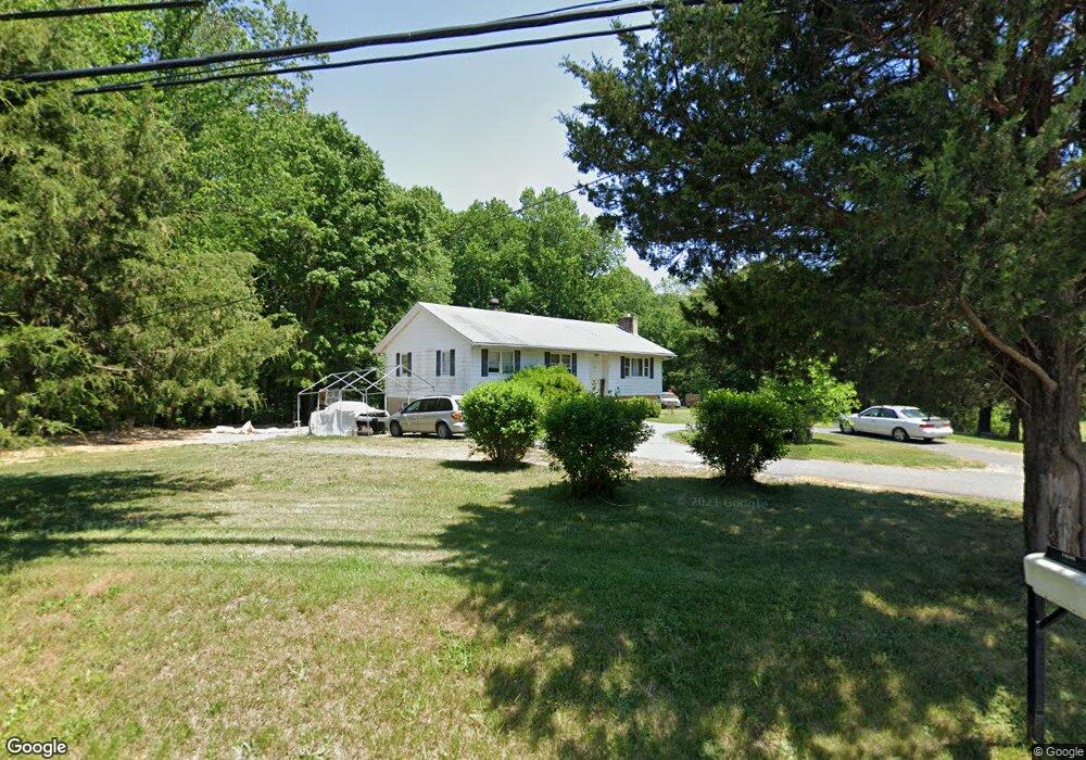
14607 Mount Calvert Rd Upper Marlboro, MD 20772
Croom NeighborhoodEstimated Value: $435,914 - $552,000
Studio
3
Baths
1,654
Sq Ft
$306/Sq Ft
Est. Value
About This Home
This home is located at 14607 Mount Calvert Rd, Upper Marlboro, MD 20772 and is currently estimated at $505,979, approximately $305 per square foot. 14607 Mount Calvert Rd is a home located in Prince George's County with nearby schools including Mattaponi Elementary School, Gwynn Park Middle School, and Frederick Douglass High School.
Ownership History
Date
Name
Owned For
Owner Type
Purchase Details
Closed on
Jul 13, 1999
Sold by
Morris Maryann
Bought by
Morris Maryann and Morris Robert L
Current Estimated Value
Purchase Details
Closed on
Feb 23, 1999
Sold by
Brezinski Michael and Margaret Long
Bought by
Morris Maryann
Purchase Details
Closed on
Feb 14, 1995
Sold by
Thomas Daniel R
Bought by
Brezinski Michael
Create a Home Valuation Report for This Property
The Home Valuation Report is an in-depth analysis detailing your home's value as well as a comparison with similar homes in the area
Home Values in the Area
Average Home Value in this Area
Purchase History
| Date | Buyer | Sale Price | Title Company |
|---|---|---|---|
| Morris Maryann | -- | -- | |
| Morris Maryann | -- | -- | |
| Brezinski Michael | $169,900 | -- |
Source: Public Records
Tax History
| Year | Tax Paid | Tax Assessment Tax Assessment Total Assessment is a certain percentage of the fair market value that is determined by local assessors to be the total taxable value of land and additions on the property. | Land | Improvement |
|---|---|---|---|---|
| 2025 | $4,156 | $453,400 | $96,400 | $357,000 |
| 2024 | $4,156 | $421,333 | -- | -- |
| 2023 | $3,984 | $389,267 | $0 | $0 |
| 2022 | $3,766 | $357,200 | $100,400 | $256,800 |
| 2021 | $3,626 | $350,333 | $0 | $0 |
| 2020 | $3,528 | $343,467 | $0 | $0 |
| 2019 | $3,400 | $336,600 | $100,400 | $236,200 |
| 2018 | $3,254 | $298,033 | $0 | $0 |
| 2017 | $3,139 | $259,467 | $0 | $0 |
| 2016 | -- | $220,900 | $0 | $0 |
| 2015 | $2,641 | $220,900 | $0 | $0 |
| 2014 | $2,641 | $220,900 | $0 | $0 |
Source: Public Records
Map
Nearby Homes
- 8901 Brookridge Dr
- 9316 Croom Rd
- 8100 Croom Rd
- 0 Croom Airport Rd Unit MDPG2148084
- 9608 Croom Rd
- 9905 Croom Rd
- 12900 Sweet Christina Ct
- 12458 Old Colony Dr
- 12800 Center Park Way
- 12921 Trumbull Dr
- 9402 Grandhaven Ave
- 12608 Marlton Center Dr
- 8550 Paragon Ct
- 12802 Carousel Ct
- 9093 Florin Way
- 12824 Town Center Way
- 12736 Wedgedale Ct
- 12713 Midstock Ln
- 13814 W End Farm Rd
- 12618 Monarch Ct
- 14608 Mount Calvert Rd
- 14600 Mount Calvert Rd
- 14611 Mount Calvert Rd
- 8607 Grey Fox Trail
- 14515 Mount Calvert Rd
- 14620 Mount Calvert Rd
- 14601 Mount Calvert Rd
- 14701 Mount Calvert Rd
- 14401 Mount Calvert rd Spur
- 14700 Mount Calvert Rd
- 14501 Mount Calvert Rd
- 8701 Grey Fox Trail
- 14400 Mount Calvert rd Spur
- 8801 Brookridge Dr
- 14706 Mount Calvert Rd
- 14707 Mount Calvert Rd
- 8610 Croom Rd
- 14710 Mount Calvert Rd
- 8800 Brookridge Dr
- 8606 Croom Rd
Your Personal Tour Guide
Ask me questions while you tour the home.