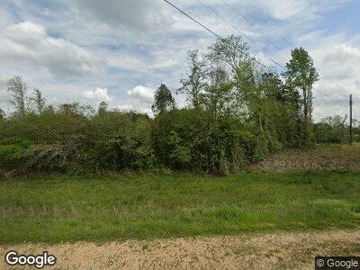
1461 Highway 35 S Foxworth, MS 39483
Estimated Value: $173,000 - $294,481
4
Beds
3
Baths
2,720
Sq Ft
$88/Sq Ft
Est. Value
About This Home
This home is located at 1461 Highway 35 S, Foxworth, MS 39483 and is currently estimated at $239,120, approximately $87 per square foot. 1461 Highway 35 S is a home located in Marion County with nearby schools including West Marion Primary School, West Marion Elementary School, and West Marion High School.
Ownership History
Date
Name
Owned For
Owner Type
Purchase Details
Closed on
Feb 9, 2022
Sold by
Carney Paul B
Bought by
Fortenberry Fields Llc
Current Estimated Value
Purchase Details
Closed on
Jun 24, 2008
Sold by
Martino Deanna F
Bought by
Carney Paul B
Purchase Details
Closed on
Mar 17, 2006
Sold by
Carney Paul B
Bought by
Fortenberry Fields Llc
Purchase Details
Closed on
Jul 25, 2005
Sold by
Fortenberry Melonee J
Bought by
Carney Paul B
Create a Home Valuation Report for This Property
The Home Valuation Report is an in-depth analysis detailing your home's value as well as a comparison with similar homes in the area
Home Values in the Area
Average Home Value in this Area
Purchase History
| Date | Buyer | Sale Price | Title Company |
|---|---|---|---|
| Fortenberry Fields Llc | -- | None Listed On Document | |
| Carney Paul B | -- | -- | |
| Fortenberry Fields Llc | -- | -- | |
| Carney Paul B | -- | -- |
Source: Public Records
Mortgage History
| Date | Status | Borrower | Loan Amount |
|---|---|---|---|
| Previous Owner | Carney Paul B | $184,000 | |
| Previous Owner | Carney Paul B | $159,200 | |
| Previous Owner | Carney Paul B | $130,500 | |
| Previous Owner | Carney Paul B | $250,000 |
Source: Public Records
Tax History Compared to Growth
Tax History
| Year | Tax Paid | Tax Assessment Tax Assessment Total Assessment is a certain percentage of the fair market value that is determined by local assessors to be the total taxable value of land and additions on the property. | Land | Improvement |
|---|---|---|---|---|
| 2024 | $2,950 | $23,073 | $0 | $0 |
| 2023 | $3,036 | $23,685 | $0 | $0 |
| 2022 | $2,811 | $23,687 | $0 | $0 |
| 2021 | $2,913 | $24,598 | $0 | $0 |
| 2020 | $2,422 | $20,461 | $0 | $0 |
| 2019 | $2,422 | $20,462 | $0 | $0 |
| 2018 | $2,448 | $20,656 | $0 | $0 |
| 2017 | $2,474 | $20,847 | $0 | $0 |
| 2016 | $2,301 | $20,246 | $0 | $0 |
| 2015 | $2,350 | $20,436 | $0 | $0 |
| 2014 | $2,350 | $20,629 | $0 | $0 |
Source: Public Records
Map
Nearby Homes
- 211 Highway 35 S
- 0 S Highway 35 Unit 142217
- 0 Military and Tynes Rd
- TBD Mount Carmel Church Rd
- 16 Old Hwy 35 S
- TBD Mt Carmel Church
- . Pickwick Rd
- 112 Old Sandy Hook Rd
- 1289 Mississippi 43
- 0 New Hope Rd
- 1271 Highway 43
- 0 10 Mile Creek Rd
- 0 Son Thompson Rd
- 84 ac Hattie Ln
- Lot #4 Jessie Stogner Rd
- 0 Military and Tynes Roads
- Lot #6 Jessie Stogner Rd
- Lot #3 Jessie Stogner Rd
- Lot #5 Jessie Stogner Rd
- 0 E State Line Rd
