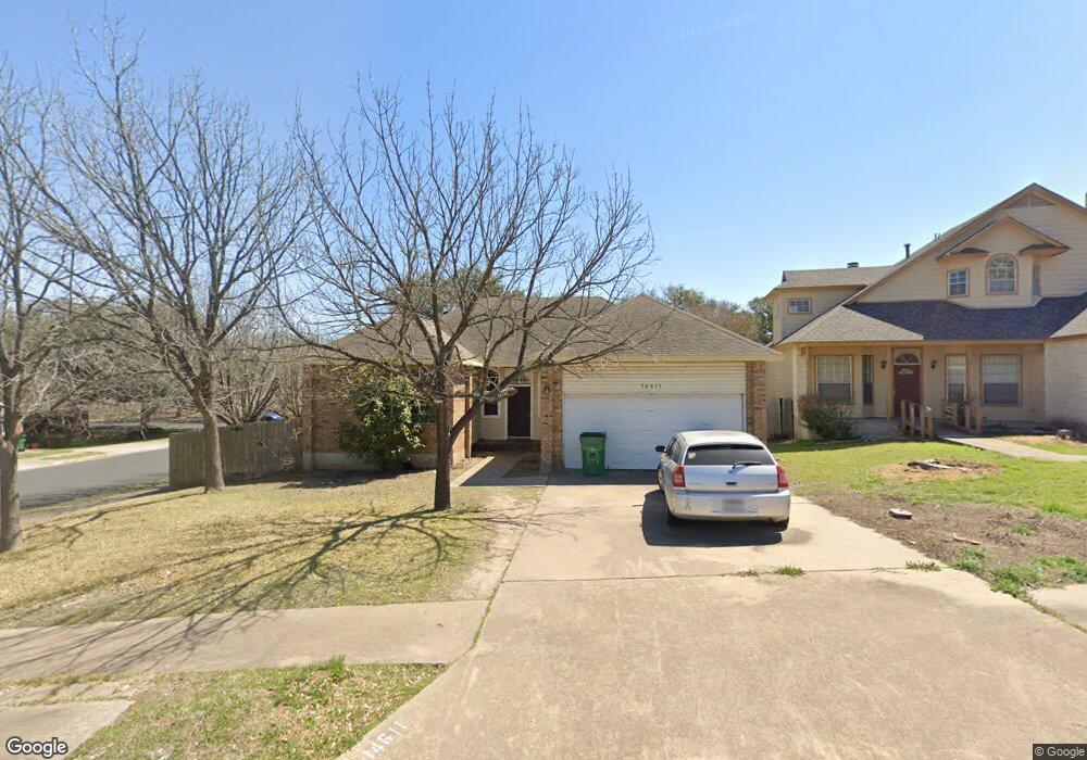
14611 Sandy Side Dr Unit Dr Austin, TX 78728
Wells Branch NeighborhoodEstimated Value: $395,000 - $457,000
Studio
2
Baths
1,662
Sq Ft
$256/Sq Ft
Est. Value
About This Home
This home is located at 14611 Sandy Side Dr Unit Dr, Austin, TX 78728 and is currently estimated at $425,298, approximately $255 per square foot. 14611 Sandy Side Dr Unit Dr is a home located in Travis County with nearby schools including Northwest Elementary School, Westview Middle School, and John B Connally High School.
Ownership History
Date
Name
Owned For
Owner Type
Purchase Details
Closed on
Nov 19, 2010
Sold by
Scruggs Stewart R W and Scruggs Abigail Anne
Bought by
Vega Suzanna
Current Estimated Value
Home Financials for this Owner
Home Financials are based on the most recent Mortgage that was taken out on this home.
Original Mortgage
$160,719
Outstanding Balance
$105,498
Interest Rate
4.17%
Mortgage Type
FHA
Estimated Equity
$319,800
Purchase Details
Closed on
May 30, 1995
Sold by
Milburn Investments Inc
Bought by
Scruggs Stewart R W and Scruggs Abigail Anne
Home Financials for this Owner
Home Financials are based on the most recent Mortgage that was taken out on this home.
Original Mortgage
$106,851
Interest Rate
8.18%
Mortgage Type
FHA
Create a Home Valuation Report for This Property
The Home Valuation Report is an in-depth analysis detailing your home's value as well as a comparison with similar homes in the area
Home Values in the Area
Average Home Value in this Area
Purchase History
| Date | Buyer | Sale Price | Title Company |
|---|---|---|---|
| Vega Suzanna | -- | Itc | |
| Scruggs Stewart R W | -- | Travis Title Co |
Source: Public Records
Mortgage History
| Date | Status | Borrower | Loan Amount |
|---|---|---|---|
| Open | Vega Suzanna | $160,719 | |
| Previous Owner | Scruggs Stewart R W | $106,851 |
Source: Public Records
Tax History
| Year | Tax Paid | Tax Assessment Tax Assessment Total Assessment is a certain percentage of the fair market value that is determined by local assessors to be the total taxable value of land and additions on the property. | Land | Improvement |
|---|---|---|---|---|
| 2025 | $5,889 | $409,335 | -- | -- |
| 2023 | $5,561 | $338,294 | -- | -- |
| 2022 | $6,363 | $307,540 | $0 | $0 |
| 2021 | $6,562 | $279,582 | $75,000 | $221,361 |
| 2020 | $6,095 | $254,165 | $75,000 | $179,165 |
| 2018 | $6,114 | $244,956 | $75,000 | $173,988 |
| 2017 | $5,615 | $222,687 | $75,000 | $154,685 |
| 2016 | $5,105 | $202,443 | $40,000 | $164,420 |
| 2015 | $3,865 | $184,039 | $40,000 | $148,526 |
| 2014 | $3,865 | $167,308 | $40,000 | $127,308 |
Source: Public Records
Map
Nearby Homes
- 14506 Crystal Ct
- 2010 Cervin Blvd
- 2113 Cervin Blvd
- 1910 Margalene Way
- 2109 Haas Ln
- 1717 Fleischer Dr
- 1915 Margalene Way
- 2314 Klattenhoff Dr
- 15203 Wallaby Way
- 1924 Tasmanian Tiger Trace
- 2506 Charla Cir
- 2107 Fuzz Fairway
- 9041 Babbling Brook Dr
- 9053 Babbling Brook Dr
- 9031 Babbling Brook Dr
- 2307 Daisy Dr
- 2214 Gardenia Dr
- 9014 Babbling Brook Dr
- 15501 Connie St
- 14712 Lake Victor Dr
- 14611 Sandy Side Dr
- 14609 Sandy Side Dr Unit Dr
- 14609 Sandy Side Dr
- 14607 Sandy Side Dr
- 14607 Sandy Side Dr Unit Dr
- 1900 Crystal Shore Dr
- 1902 Crystal Shore Dr
- 14606 Sandy Side Dr
- 1904 Crystal Shore Dr
- 14604 Sandy Side Dr Unit Dr
- 14604 Sandy Side Dr
- 14605 Sandy Side Dr
- 1601 Gaylord Dr
- 1906 Crystal Shore Dr
- 14603 Sandy Side Dr
- 14602 Sandy Side Dr Unit Dr
- 14602 Sandy Side Dr
- 1605 Gaylord Dr
- 1908 Crystal Shore Dr
- 1911 Crystal Shore Dr
Your Personal Tour Guide
Ask me questions while you tour the home.