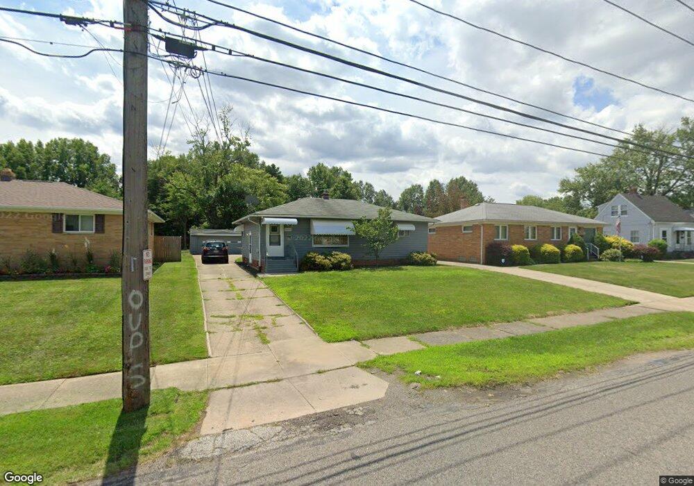
14652 Pease Rd Maple Heights, OH 44137
Estimated Value: $57,000 - $142,000
3
Beds
2
Baths
1,053
Sq Ft
$100/Sq Ft
Est. Value
About This Home
This home is located at 14652 Pease Rd, Maple Heights, OH 44137 and is currently estimated at $105,147, approximately $99 per square foot. 14652 Pease Rd is a home located in Cuyahoga County with nearby schools including Abraham Lincoln Elementary School, Rockside/ J.F. Kennedy School, and Barack Obama School.
Ownership History
Date
Name
Owned For
Owner Type
Purchase Details
Closed on
Jun 5, 2025
Sold by
Cale Dolores J and Cale Frederick
Bought by
Isaac Lake Properties Llc
Current Estimated Value
Purchase Details
Closed on
Jun 20, 1986
Sold by
Cale Dolores
Bought by
Eget Margaret
Purchase Details
Closed on
Mar 22, 1984
Sold by
Eget Margaret
Bought by
Cale Dolores
Purchase Details
Closed on
Mar 6, 1984
Sold by
Eget Andrew
Bought by
Eget Margaret
Purchase Details
Closed on
Oct 13, 1983
Sold by
Eget Andrew and Eget Margaret
Bought by
Eget Andrew
Purchase Details
Closed on
Jan 1, 1975
Bought by
Eget Andrew and Eget Margaret
Create a Home Valuation Report for This Property
The Home Valuation Report is an in-depth analysis detailing your home's value as well as a comparison with similar homes in the area
Home Values in the Area
Average Home Value in this Area
Purchase History
| Date | Buyer | Sale Price | Title Company |
|---|---|---|---|
| Isaac Lake Properties Llc | $53,000 | None Listed On Document | |
| Eget Margaret | -- | -- | |
| Cale Dolores | -- | -- | |
| Eget Margaret | -- | -- | |
| Eget Andrew | -- | -- | |
| Eget Andrew | -- | -- |
Source: Public Records
Tax History
| Year | Tax Paid | Tax Assessment Tax Assessment Total Assessment is a certain percentage of the fair market value that is determined by local assessors to be the total taxable value of land and additions on the property. | Land | Improvement |
|---|---|---|---|---|
| 2025 | $3,400 | $37,555 | $11,375 | $26,180 |
| 2024 | $3,890 | $37,555 | $11,375 | $26,180 |
| 2023 | $3,149 | $24,330 | $6,020 | $18,310 |
| 2022 | $2,617 | $24,325 | $6,020 | $18,305 |
| 2021 | $2,787 | $24,330 | $6,020 | $18,310 |
| 2020 | $2,383 | $18,410 | $4,550 | $13,860 |
| 2019 | $2,367 | $52,600 | $13,000 | $39,600 |
| 2018 | $2,437 | $18,410 | $4,550 | $13,860 |
| 2017 | $2,711 | $21,290 | $5,710 | $15,580 |
| 2016 | $2,619 | $21,290 | $5,710 | $15,580 |
| 2015 | $6,858 | $21,290 | $5,710 | $15,580 |
| 2014 | $6,858 | $21,950 | $5,880 | $16,070 |
Source: Public Records
Map
Nearby Homes
- 14512 Granger Rd
- 14510 Granger Rd
- 13801 Bangor Ave
- 15264 Broadway Ave
- 5408 Roland Dr
- 5197 Milo Ave
- 13600 Royal Blvd
- 14413 Krems Ave
- 15313 Fernway Dr
- 5137 Miller Ave
- 14112 Krems Ave
- 5270 E 135th St
- 13616 Oakview Blvd
- 14203 Tabor Ave
- 13905 Thraves Ave
- 16029 Friend Ave
- 13206 Shady Oak Blvd
- 14214 Tabor Ave
- 13116 Oak Park Blvd
- 5365 E 131st St
- 14644 Pease Rd
- 14660 Pease Rd
- 14638 Pease Rd
- 14677 Pease Rd
- 14796 Pease Rd
- 14636 Pease Rd
- 14800 Pease Rd
- 14724 Granger Rd
- 14725 Pease Rd
- 14800 Granger Rd
- 14665 Pease Rd
- 14653 Pease Rd
- 14810 Pease Rd
- 14629 Pease Rd
- 14720 Granger Rd
- 14621 Pease Rd
- 14716 Granger Rd
- 14570 Pease Rd
- 14832 Pease Rd
- 14591 Pease Rd
Your Personal Tour Guide
Ask me questions while you tour the home.