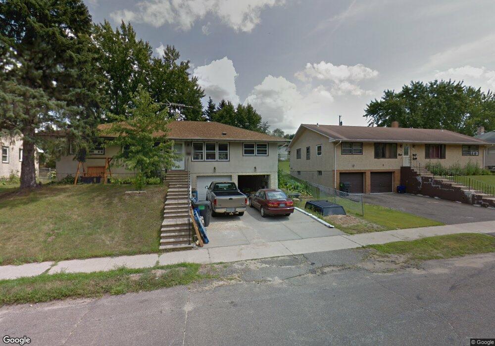
1466 & 146 Mcafee St Saint Paul, MN 55106
Estimated Value: $315,768 - $399,000
5
Beds
2
Baths
1,664
Sq Ft
$224/Sq Ft
Est. Value
About This Home
This home is located at 1466 & 146 Mcafee St, Saint Paul, MN 55106 and is currently estimated at $373,192, approximately $224 per square foot. 1466 & 146 Mcafee St is a home located in Ramsey County with nearby schools including Frost Lake Elementary School, Txuj Ci HMong Language and Culture Upper Campus, and Johnson Senior High School.
Ownership History
Date
Name
Owned For
Owner Type
Purchase Details
Closed on
Apr 13, 2023
Sold by
Kuhn Matthew and Rebholz Michelle
Bought by
Jones Talia
Current Estimated Value
Home Financials for this Owner
Home Financials are based on the most recent Mortgage that was taken out on this home.
Original Mortgage
$342,950
Outstanding Balance
$333,505
Interest Rate
6.65%
Mortgage Type
New Conventional
Estimated Equity
$39,687
Purchase Details
Closed on
Jun 26, 1997
Sold by
Stewart Frances W
Bought by
Burke Karen D and Ricehill Christine R
Purchase Details
Closed on
Jul 12, 1996
Sold by
Belisle James R and Belisle Helga
Bought by
Wickham Rebecca L
Purchase Details
Closed on
Jun 26, 1996
Sold by
Conway Dennis Patrick and Conway Teresa
Bought by
Belisle James R and Belisle Helga
Create a Home Valuation Report for This Property
The Home Valuation Report is an in-depth analysis detailing your home's value as well as a comparison with similar homes in the area
Home Values in the Area
Average Home Value in this Area
Purchase History
| Date | Buyer | Sale Price | Title Company |
|---|---|---|---|
| Jones Talia | $361,000 | -- | |
| Burke Karen D | $116,900 | -- | |
| Stewart Frances W | $100,000 | -- | |
| Wickham Rebecca L | $100,000 | -- | |
| Belisle James R | $84,825 | -- |
Source: Public Records
Mortgage History
| Date | Status | Borrower | Loan Amount |
|---|---|---|---|
| Open | Jones Talia | $342,950 | |
| Closed | Wickham Rebecca L | -- |
Source: Public Records
Tax History Compared to Growth
Tax History
| Year | Tax Paid | Tax Assessment Tax Assessment Total Assessment is a certain percentage of the fair market value that is determined by local assessors to be the total taxable value of land and additions on the property. | Land | Improvement |
|---|---|---|---|---|
| 2025 | $4,286 | $344,200 | $30,000 | $314,200 |
| 2023 | $4,286 | $273,800 | $25,000 | $248,800 |
| 2022 | $3,550 | $262,900 | $25,000 | $237,900 |
| 2021 | $3,452 | $226,000 | $25,000 | $201,000 |
| 2020 | $3,280 | $227,300 | $19,100 | $208,200 |
| 2019 | $2,616 | $204,200 | $19,100 | $185,100 |
| 2018 | $2,154 | $164,800 | $19,100 | $145,700 |
| 2017 | $2,152 | $143,300 | $19,100 | $124,200 |
| 2016 | $1,910 | $0 | $0 | $0 |
| 2015 | $1,826 | $131,300 | $19,100 | $112,200 |
| 2014 | $1,544 | $0 | $0 | $0 |
Source: Public Records
Map
Nearby Homes
- 1377 Clarence St
- 1450 Arlington Ave E
- 1357 Birmingham St
- 1567 Atlantic St
- 1639 Clarence St
- 866 Clear Ave E
- 1229 Clarence St
- 1672 Manton St
- 1583 Nevada Ave E
- 1221 Clarence St
- 1343 Maryland Ave E
- 1435 Price Ave
- 1562 Ivy Ave E
- 1714 Duluth St
- 1532 Larpenteur Ave E
- 1730 Atlantic St
- 1751 Clarence St
- 1635 Maryland Ave E
- 1607 Hoyt Ave E
- 1186 Duluth St
- 1466 Mcafee St
- 1466 Mcafee St
- 1460 Mcafee St
- 1482 Mcafee St
- 1450 Mcafee St
- 1454 Mcafee St
- 1465 Clarence St
- 1457 Clarence St
- 1471 Clarence St
- 1486 Mcafee St
- 1486 1486 McAfee-street-
- 1479 Clarence St
- 1469 Mcafee St
- 1492 Mcafee St
- 1475 Mcafee St
- 1457 Mcafee St
- 1457 1457 McAfee-street-
- 1479 1479 McAfee-street-
- 1339 Arlington Ave E
- 1449 Clarence St