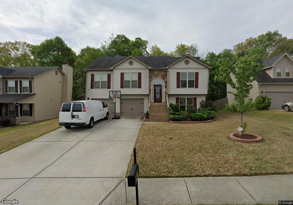
1467 Dillard Heights Dr Bethlehem, GA 30620
Estimated Value: $355,000 - $380,000
5
Beds
3
Baths
2,469
Sq Ft
$149/Sq Ft
Est. Value
About This Home
This home is located at 1467 Dillard Heights Dr, Bethlehem, GA 30620 and is currently estimated at $368,777, approximately $149 per square foot. 1467 Dillard Heights Dr is a home located in Barrow County with nearby schools including Yargo Elementary School, Haymon-Morris Middle School, and Apalachee High School.
Ownership History
Date
Name
Owned For
Owner Type
Purchase Details
Closed on
Jun 2, 2014
Sold by
Edutson Maxwell D
Bought by
Edutson Maxwell D and Oates Nicole
Current Estimated Value
Home Financials for this Owner
Home Financials are based on the most recent Mortgage that was taken out on this home.
Original Mortgage
$154,057
Outstanding Balance
$116,369
Interest Rate
4.25%
Mortgage Type
FHA
Estimated Equity
$252,408
Purchase Details
Closed on
Sep 13, 2013
Sold by
Res-Ga Montreaux Llc
Bought by
Southfork Homes Llc
Purchase Details
Closed on
Jul 3, 2012
Sold by
Federal Deposit Insurance Corp
Bought by
Res-Ga Montreaux Llc
Purchase Details
Closed on
Dec 30, 2008
Sold by
Damascus Homes Llc
Bought by
Federal Deposit Insurance Corporation
Purchase Details
Closed on
Jan 12, 2007
Sold by
Montana Land Development Inc
Bought by
Damascus Homes Llc
Purchase Details
Closed on
May 10, 2005
Sold by
Montana Development Inc
Bought by
Montana Land Development Inc
Create a Home Valuation Report for This Property
The Home Valuation Report is an in-depth analysis detailing your home's value as well as a comparison with similar homes in the area
Home Values in the Area
Average Home Value in this Area
Purchase History
| Date | Buyer | Sale Price | Title Company |
|---|---|---|---|
| Edutson Maxwell D | -- | -- | |
| Edutsen Maxwell D | $156,900 | -- | |
| Southfork Homes Llc | $10,000 | -- | |
| Res-Ga Montreaux Llc | -- | -- | |
| Federal Deposit Insurance Corporation | -- | -- | |
| Damascus Homes Llc | $2,045,900 | -- | |
| Montana Land Development Inc | $2,192,300 | -- |
Source: Public Records
Mortgage History
| Date | Status | Borrower | Loan Amount |
|---|---|---|---|
| Open | Edutsen Maxwell D | $154,057 | |
| Closed | Edutson Maxwell D | $154,057 |
Source: Public Records
Tax History
| Year | Tax Paid | Tax Assessment Tax Assessment Total Assessment is a certain percentage of the fair market value that is determined by local assessors to be the total taxable value of land and additions on the property. | Land | Improvement |
|---|---|---|---|---|
| 2025 | $3,064 | $131,246 | $26,000 | $105,246 |
| 2024 | $3,126 | $128,177 | $26,000 | $102,177 |
| 2023 | $3,685 | $128,577 | $26,000 | $102,577 |
| 2022 | $3,420 | $118,598 | $26,000 | $92,598 |
| 2021 | $2,696 | $87,549 | $18,000 | $69,549 |
| 2020 | $2,530 | $81,786 | $18,000 | $63,786 |
| 2019 | $2,574 | $81,786 | $18,000 | $63,786 |
| 2018 | $2,402 | $76,905 | $16,000 | $60,905 |
| 2017 | $1,895 | $65,086 | $16,000 | $49,086 |
| 2016 | $1,974 | $63,326 | $16,000 | $47,326 |
| 2015 | $1,967 | $63,326 | $16,000 | $47,326 |
| 2014 | $122 | $2,400 | $2,400 | $0 |
| 2013 | -- | $2,400 | $2,400 | $0 |
Source: Public Records
Map
Nearby Homes
- 209 Angie Way
- 1111 Otis Dr
- 907 Downing Dr
- 1188 Carl-Bethlehem Rd
- 449 Carl Bethlehem Rd SW
- 1256 Loganville Hwy
- 1129 Loganville Hwy
- 923 Downing Dr
- 720 Westbury Ct
- 1202 Benton Ct
- 738 Worth Ct
- 724 Westbury Dr
- 236 Vision St
- 176 Market St
- 14 Smithwood Dr
- 713 Carl Bethlehem Rd
- 106 Carterdale Ct Unit 1
- 1309 Tom Miller Rd
- 29 Padley Dr
- Cosmos Plan at Rivington Walk
- 1469 Dillard Heights Dr
- 1465 Dillard Heights Dr Unit 25
- 1465 Dillard Heights Dr
- 1463 Dillard Heights Dr
- 1471 Dillard Heights Dr
- 1466 Dillard Heights Dr
- 1464 Dillard Heights Dr Unit D5R
- 1464 Dillard Heights Dr
- 184 Cole Cir
- 1468 Dillard Heights Dr
- 1473 Dillard Heights Dr
- 1461 Dillard Heights Dr
- 1470 Dillard Heights Dr
- 186 Cole Cir Unit 1
- 1462 Dillard Heights Dr
- 178 Cole Cir
- 1459 Dillard Heights Dr
- 1475 Dillard Heights Dr
- 1472 Dillard Heights Dr
- 188 Cole Cir
Your Personal Tour Guide
Ask me questions while you tour the home.