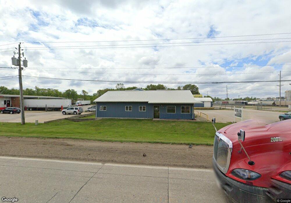
1467 W Airline Hwy Waterloo, IA 50703
Estimated Value: $259,272
--
Bed
--
Bath
7,678
Sq Ft
$34/Sq Ft
Est. Value
About This Home
This home is located at 1467 W Airline Hwy, Waterloo, IA 50703 and is currently estimated at $259,272, approximately $33 per square foot. 1467 W Airline Hwy is a home located in Black Hawk County with nearby schools including Lincoln Elementary School, George Washington Carver Academy, and East High School.
Ownership History
Date
Name
Owned For
Owner Type
Purchase Details
Closed on
Aug 3, 2017
Sold by
East Central Cooperative
Bought by
Overland Transport Llc
Current Estimated Value
Home Financials for this Owner
Home Financials are based on the most recent Mortgage that was taken out on this home.
Original Mortgage
$144,000
Outstanding Balance
$119,869
Interest Rate
3.96%
Mortgage Type
New Conventional
Estimated Equity
$139,403
Create a Home Valuation Report for This Property
The Home Valuation Report is an in-depth analysis detailing your home's value as well as a comparison with similar homes in the area
Home Values in the Area
Average Home Value in this Area
Purchase History
| Date | Buyer | Sale Price | Title Company |
|---|---|---|---|
| Overland Transport Llc | -- | None Available |
Source: Public Records
Mortgage History
| Date | Status | Borrower | Loan Amount |
|---|---|---|---|
| Open | Overland Transport Llc | $144,000 |
Source: Public Records
Tax History Compared to Growth
Tax History
| Year | Tax Paid | Tax Assessment Tax Assessment Total Assessment is a certain percentage of the fair market value that is determined by local assessors to be the total taxable value of land and additions on the property. | Land | Improvement |
|---|---|---|---|---|
| 2025 | $11,982 | $390,730 | $71,500 | $319,230 |
| 2024 | $11,982 | $362,030 | $71,500 | $290,530 |
| 2023 | $6,020 | $362,030 | $71,500 | $290,530 |
| 2022 | $5,078 | $225,360 | $52,000 | $173,360 |
| 2021 | $5,104 | $225,360 | $52,000 | $173,360 |
| 2020 | $8,206 | $225,360 | $52,000 | $173,360 |
| 2019 | $8,206 | $225,360 | $52,000 | $173,360 |
| 2018 | $5,974 | $168,760 | $52,000 | $116,760 |
| 2017 | $5,974 | $257,940 | $52,000 | $205,940 |
| 2016 | $5,880 | $257,940 | $52,000 | $205,940 |
| 2015 | $5,880 | $257,940 | $52,000 | $205,940 |
| 2014 | $7,016 | $257,940 | $52,000 | $205,940 |
Source: Public Records
Map
Nearby Homes
- 231 Mckay Ave Unit 235
- 3355 Logan Ave
- 2556 Logan Ave
- 503 W Dale St
- 2133 Logan Ave Unit 1
- Lot 7 North Crossing
- Lot 6 North Crossing
- Lot 3 North Crossing
- Lot 2 North Crossing
- Lot 9 North Crossing
- Lot 8 North Crossing
- Lot 5 North Crossing
- Lot 4 North Crossing
- Lot 1 North Crossing
- Lot 13 North Crossing
- Lot 10 North Crossing
- Lot 11 North Crossing
- Lot 12 North Crossing
- Lot 3 N Crossing 2nd Addition
- 1309 Grandview Ave
- 1459 W Airline Hwy
- 1420 W Airline Hwy
- 2975 Airline Cir Unit Warehouse
- 2975 Airline Cir Unit Office
- 1340 W Airline Hwy
- 1330 W Airline Hwy
- 1242 W Airline Hwy
- 1166 W Airline Hwy
- 2666 Wcf and N Dr
- 625 Grover Ct
- 1231 Roca Ln
- 613 Grover Ct
- 2642 Wcf and N Dr
- 2636 Wcf and N Dr
- 3133 Burton Ave Unit 3137
- 2920 Janet Dr
- 1201 Roca Ln
- 1058 W Airline Hwy
- 2904 Janet Dr
- 2904 Janet Dr