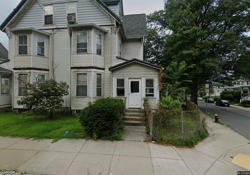
147 Foster St Unit 149 Brighton, MA 02135
Saint Elizabeths NeighborhoodEstimated Value: $1,627,807 - $1,777,000
4
Beds
1
Bath
2,100
Sq Ft
$807/Sq Ft
Est. Value
About This Home
This home is located at 147 Foster St Unit 149, Brighton, MA 02135 and is currently estimated at $1,695,702, approximately $807 per square foot. 147 Foster St Unit 149 is a home located in Suffolk County with nearby schools including Boston Green Academy Horace Mann Charter School, Shaloh House Jewish Day School, and St Columbkille Partnership School.
Ownership History
Date
Name
Owned For
Owner Type
Purchase Details
Closed on
Mar 30, 2000
Sold by
Moran Maureen R and Moran Robert Farrell
Bought by
Mccarthy Joseph A
Current Estimated Value
Create a Home Valuation Report for This Property
The Home Valuation Report is an in-depth analysis detailing your home's value as well as a comparison with similar homes in the area
Home Values in the Area
Average Home Value in this Area
Purchase History
| Date | Buyer | Sale Price | Title Company |
|---|---|---|---|
| Mccarthy Joseph A | $457,500 | -- |
Source: Public Records
Mortgage History
| Date | Status | Borrower | Loan Amount |
|---|---|---|---|
| Open | Mccarthy Joseph A | $510,400 | |
| Closed | Mccarthy Joseph A | $75,000 | |
| Closed | Mccarthy Joseph A | $388,500 |
Source: Public Records
Tax History Compared to Growth
Tax History
| Year | Tax Paid | Tax Assessment Tax Assessment Total Assessment is a certain percentage of the fair market value that is determined by local assessors to be the total taxable value of land and additions on the property. | Land | Improvement |
|---|---|---|---|---|
| 2025 | $14,133 | $1,220,500 | $574,000 | $646,500 |
| 2024 | $12,877 | $1,181,400 | $378,800 | $802,600 |
| 2023 | $12,688 | $1,181,400 | $378,800 | $802,600 |
| 2022 | $12,013 | $1,104,100 | $354,000 | $750,100 |
| 2021 | $11,781 | $1,104,100 | $354,000 | $750,100 |
| 2020 | $11,201 | $1,060,700 | $329,200 | $731,500 |
| 2019 | $10,749 | $1,019,800 | $254,000 | $765,800 |
| 2018 | $9,898 | $944,500 | $254,000 | $690,500 |
| 2017 | $9,707 | $916,600 | $254,000 | $662,600 |
| 2016 | $9,002 | $818,400 | $254,000 | $564,400 |
| 2015 | $9,160 | $756,360 | $231,480 | $524,880 |
| 2014 | $8,242 | $655,200 | $231,480 | $423,720 |
Source: Public Records
Map
Nearby Homes
- 21 Glenmont Rd
- 461 Washington St Unit 301
- 12 Mina Way
- 10 Mina Way
- 30 Dighton St Unit 3
- 30 Dighton St
- 2 Westminster Terrace
- 83-85 Surrey St
- 2021 Commonwealth Ave Unit B
- 10 Waldo Terrace
- 25 South St Unit B1
- 39 South St Unit B
- 33 Shannon St Unit 1
- 33 Shannon St Unit 3
- 51 Wallingford Rd Unit 53
- 129 Chiswick Rd Unit 6
- 77 Bennett St Unit 2
- 34 Larch St Unit 34
- 32 Larch St Unit 34
- 32-34 Larch St
- 8-10 Glenmont Road (Rear Lot K)
- 153 Foster St
- 153 Foster St Unit 4
- 153 Foster St Unit 153 Foster St.
- 153 Foster St Unit Foster St
- 153 Foster St Unit 153 Foster Street 1
- 153 Foster St Unit 153 Foster, 3, Bost
- 153 Foster St
- 153 Foster St Unit 5
- 153 Foster St Unit 3D
- 153 Foster St Unit 2
- 10 Glenmont Rd Unit 1
- 10 Glenmont Rd
- 10 Glenmont Rd
- 10 Glenmont Rd Unit 2
- 10 Glenmont Rd Unit 4
- 10 Glenmont Rd Unit N/A
- 143 Foster St
- 8 Glenmont Rd
- 8 Glenmont Rd