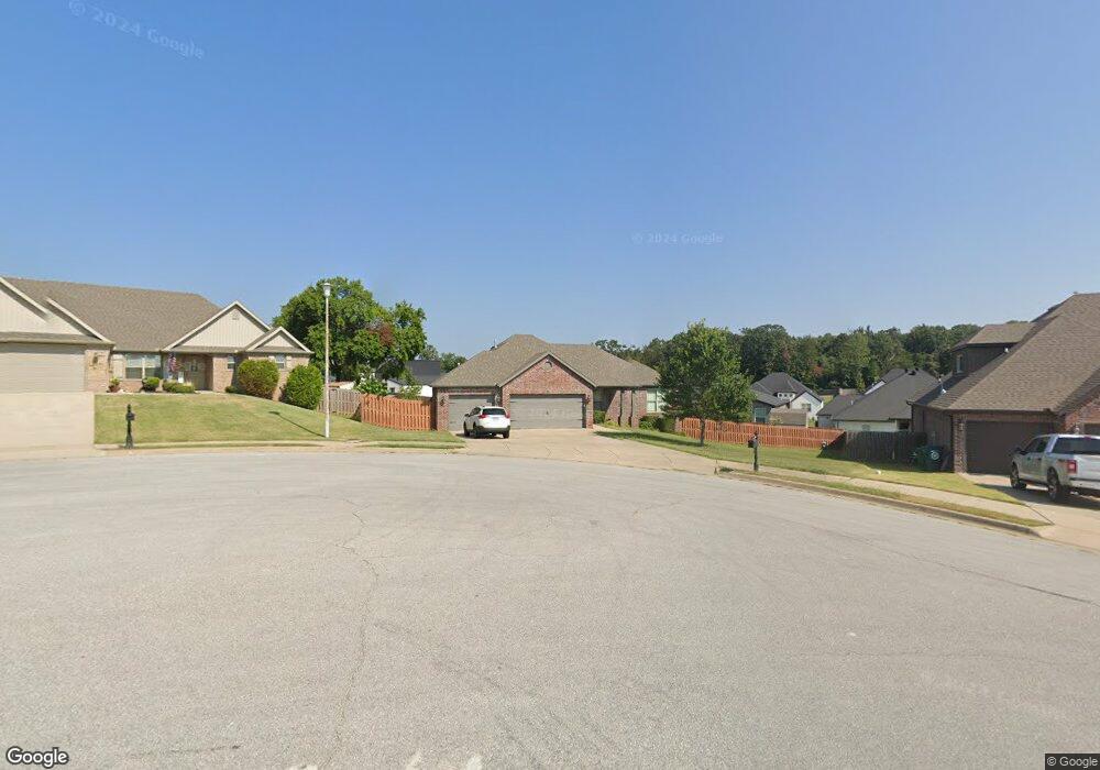
1470 Yorkshire Dr Centerton, AR 72719
Estimated Value: $363,000 - $408,000
--
Bed
--
Bath
1,827
Sq Ft
$209/Sq Ft
Est. Value
About This Home
This home is located at 1470 Yorkshire Dr, Centerton, AR 72719 and is currently estimated at $382,747, approximately $209 per square foot. 1470 Yorkshire Dr is a home with nearby schools including Grimsley Junior High School, Creekside Middle School, and Bentonville West High School.
Ownership History
Date
Name
Owned For
Owner Type
Purchase Details
Closed on
Nov 6, 2015
Sold by
Oakwood Development Group Llc
Bought by
Thach Dat Lap and Thach Binh Thuch
Current Estimated Value
Purchase Details
Closed on
Jun 29, 2015
Sold by
Brown Elvin D and Brown Mary A
Bought by
Oakwood Development Group Llc
Home Financials for this Owner
Home Financials are based on the most recent Mortgage that was taken out on this home.
Original Mortgage
$135,000
Interest Rate
3.91%
Mortgage Type
Construction
Purchase Details
Closed on
Jan 16, 2013
Sold by
Commissioner Of State Lands
Bought by
First Community Bank Of Crawford County
Create a Home Valuation Report for This Property
The Home Valuation Report is an in-depth analysis detailing your home's value as well as a comparison with similar homes in the area
Home Values in the Area
Average Home Value in this Area
Purchase History
| Date | Buyer | Sale Price | Title Company |
|---|---|---|---|
| Thach Dat Lap | $190,550 | Attorney | |
| Oakwood Development Group Llc | $18,000 | City Title | |
| First Community Bank Of Crawford County | $804 | None Available |
Source: Public Records
Mortgage History
| Date | Status | Borrower | Loan Amount |
|---|---|---|---|
| Previous Owner | Oakwood Development Group Llc | $135,000 |
Source: Public Records
Tax History Compared to Growth
Tax History
| Year | Tax Paid | Tax Assessment Tax Assessment Total Assessment is a certain percentage of the fair market value that is determined by local assessors to be the total taxable value of land and additions on the property. | Land | Improvement |
|---|---|---|---|---|
| 2025 | $2,372 | $68,271 | $19,600 | $48,671 |
| 2024 | $2,396 | $68,271 | $19,600 | $48,671 |
| 2023 | $2,396 | $48,500 | $11,000 | $37,500 |
| 2022 | $2,080 | $48,500 | $11,000 | $37,500 |
| 2021 | $2,059 | $48,500 | $11,000 | $37,500 |
| 2020 | $2,095 | $38,840 | $4,800 | $34,040 |
| 2019 | $2,095 | $38,840 | $4,800 | $34,040 |
| 2018 | $2,120 | $38,840 | $4,800 | $34,040 |
| 2017 | $2,035 | $38,840 | $4,800 | $34,040 |
| 2016 | $2,035 | $38,840 | $4,800 | $34,040 |
| 2015 | $222 | $3,600 | $3,600 | $0 |
| 2014 | $222 | $3,600 | $3,600 | $0 |
Source: Public Records
Map
Nearby Homes
- 1511 Westridge Ln
- 256 Graystone Cir
- 1440 Amber Way
- 12698 Bush Rd
- 232 & 234 Graystone Cir
- 1511 Aniston Rd
- 1228 Bradley St
- 2.036 Acres W Centerton Blvd
- Magnolia Plan at Silver Leaf Estates
- Birch Plan at Silver Leaf Estates
- Redwood Plan at Silver Leaf Estates
- Cedar Plan at Silver Leaf Estates
- Aspen Plan at Silver Leaf Estates
- Pine Plan at Silver Leaf Estates
- Cypress Plan at Silver Leaf Estates
- Maple Plan at Silver Leaf Estates
- Silver Oaks Plan at Silver Leaf Estates
- 1218 Bradley St
- 1811 Bluestem Dr
- 751 Tamarron Dr
- 1460 Yorkshire Dr
- 500 Lancaster Rd
- 0 Lot 274 Lancaster Rd Unit 1006520
- 1450 Yorkshire Dr
- 510 Lancaster Rd
- 1441 Westridge Ln
- 1451 Westridge Ln
- 511 Lancaster Rd
- 1431 Westridge Ln
- 1501 Bristol Ln
- 1440 Yorkshire Dr
- 521 Lancaster Rd
- 1421 Westridge Ln
- 1501 Westridge Ln
- 510 Keswick Dr
- 1510 Bristol Ln
- 1511 Bristol Ln
- 1500 Newcastle Ct
- 1430 Yorkshire Dr
- 530 Lancaster Rd